Not a local late afternoon Dundee delicacy …..but
….. two rivers linked photographically by an error in which, about 15 years ago, the same roll of 35 mm slide film was exposed twice, first by the Tay, in the docks and warehouses of Dundee before they were done up, and then on the Mekong around the golden triangle.
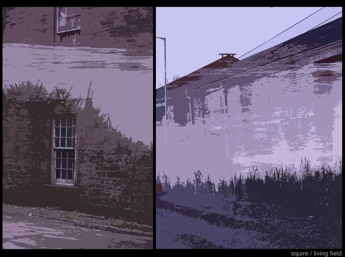
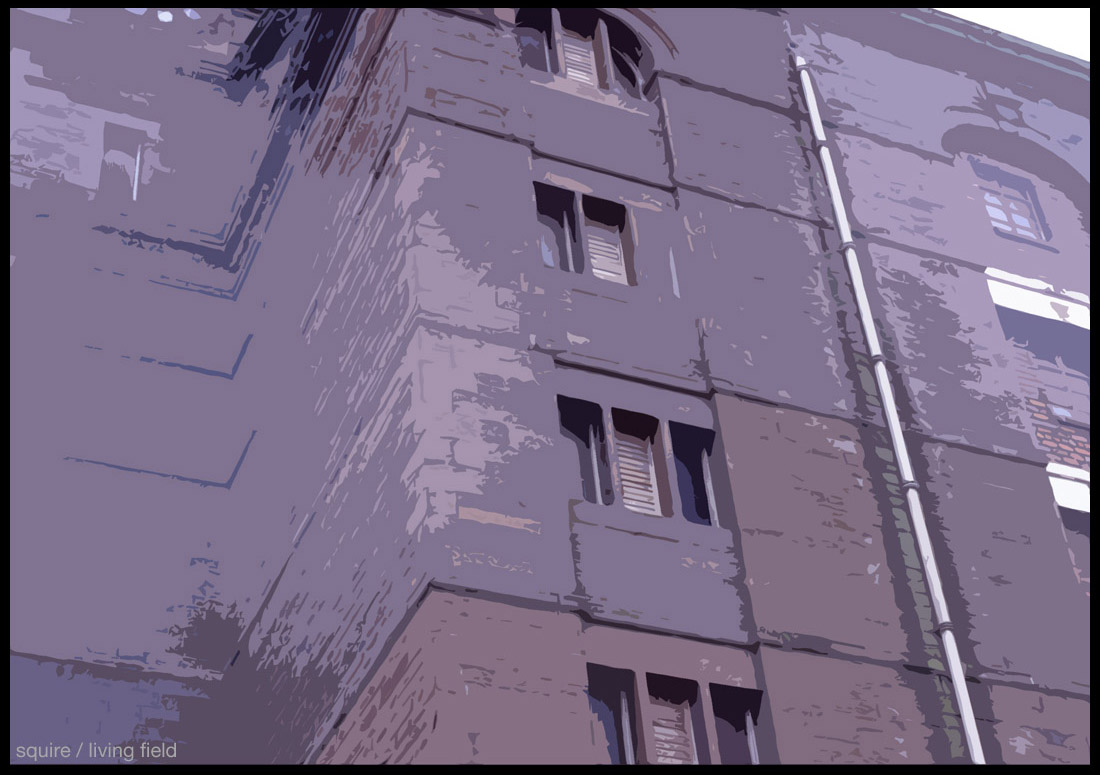
A little editing of the scanned slides gives some artless effects – the banks and water of the Mekong imposed on old, decayed industrial buildings (above); walls and windows of the Clocktower decorated with leafy branches of forest trees (below).
And the 24-paned sash windows of the old dock buildings, appear through the leafiness of a banana grove in the image below.
The Mekong
So it was back to the Mekong a couple of years later, and then again after that, to take in the views, meet the people and find out more about the plants … and to take some more photographs.
The river is still a major route for transport and trade in Asia. Starting high in Tibet, it runs variously through or between Yunnan, Burma (Myanmar), Laos, Thailand, Cambodia, finally spilling in out in a vast delta at the southern coast of Vietnam. Its catchment is 175,000 square kilometres, the size of which becomes apparent when compared with the Tay below.
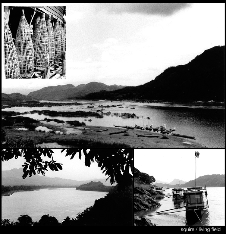
The images above (scanned black and white prints) show the river and assorted craft from a part of Laos. Inset: fish traps made of local plant material (probably bamboo or rattan).
A deep and familiar knowledge of plants occurs throughout: locally grown, woven and dyed fabrics, an array of vegetables and fruits, medicinals and building materials, all abound whether in households, markets or up-market craft shops – botanicals more diverse and commonplace than anywhere in Europe.
[in progress]
The Tay
With a catchment about 150 times smaller than the Mekong’s, the Tay has still the largest outflow of any UK river system. Starting in central Scotland it flows east, then south to Perth, then east again, widening past the Institute’s farm, the Living Field garden and Dundee into a single wide outflow discharging into the North Sea.
There is less diversity of useful plants here and much less local knowledge of their properties. All the crops were domesticated in other lands. Agriculture, as in much of northern Europe, is dominated by a few cereals and roots.
This was not always the case – even as recently as the middle 1800s, there were attempts to document and exploit those plants, both local and foreign, that could grow here and be made use of. And today there is something of a resurgence, through micro-brewing, specialist oils and wild harvesting for natural products.
[in progress]
Renovation of Dundee Waterfront
The renovation of these derelict buildings, together with the new flats and offices nearby brought new life to the Dundee waterfront. ‘Before’ and ‘after’ images of one of the massive doorways on Camperdown St are shown below. In the left-hand one, the stone rybats, brickwork and metal bollard were all painted white, the door itself, tongue and groove wood with horizontal metal braces, painted bright red, and all overlaid with grasses and other plants.
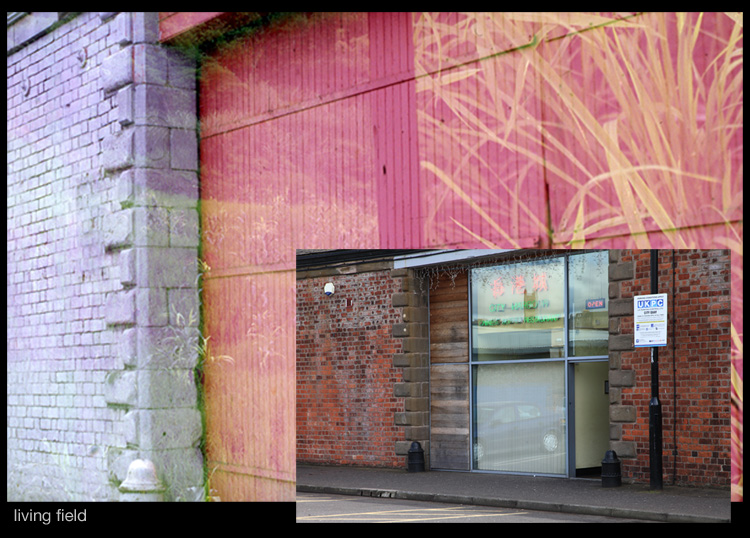
The inset shows the stone- and brickwork cleaned, the bollards black and the wood-and-glass entrance to a restaurant.
Eastwards of these sheds, towards the mouth of the Tay, is the working port, but access is open down Camperdown St from the end of which the clock tower and some original warehouses (as yet unrevovated) are seen looking west across the water.
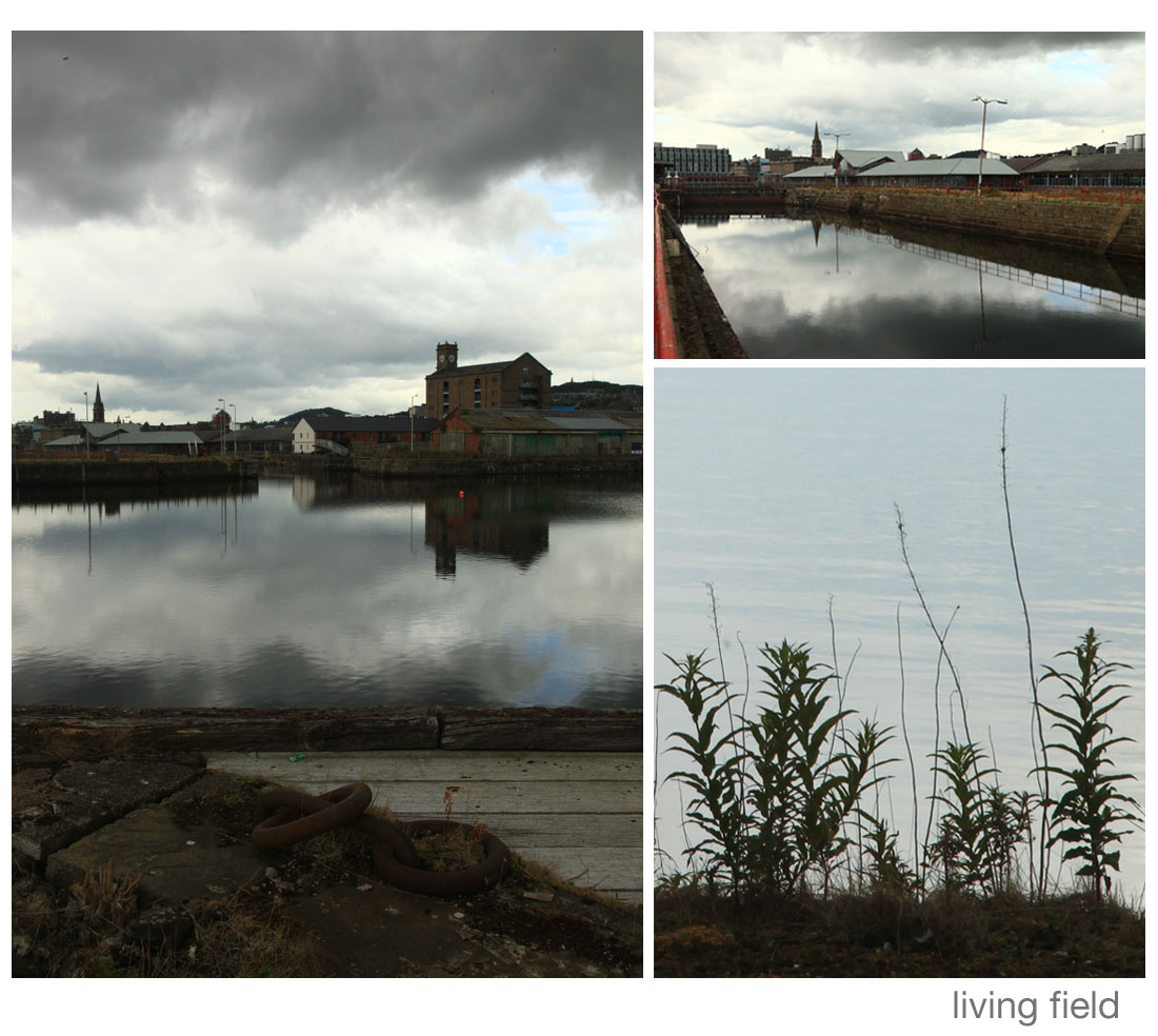
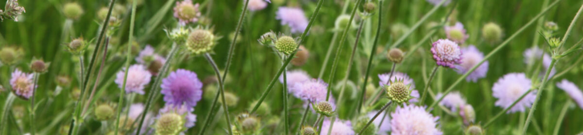
The docks, looking west towards the clock tower, and rosebay willowherb by the estuary, a grey day in July 2015 (Living Field)
Of plants here are dyers weld Reseda luteola and flixweed Descurainia sophia, but blanket herbicide periodically removes all but the rosebay willowherb Chamerion angustifolium.
The original slides?
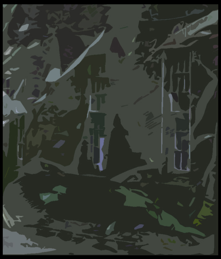
The space between one and the next exposure left an image of only the first exposure in the middle of the frame, then different double exposures either side. Here are some examples of the originals. Below is the vista down Camperdown St with bollards and warehouses, the old gas canister to the distant left and the clocktower to the right; all covered in rice plants right the way up to the sky.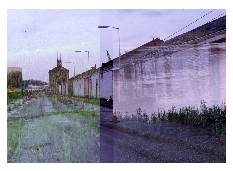
Rice fields and riverside vegetation on Camperdown St Dundee (Squire)
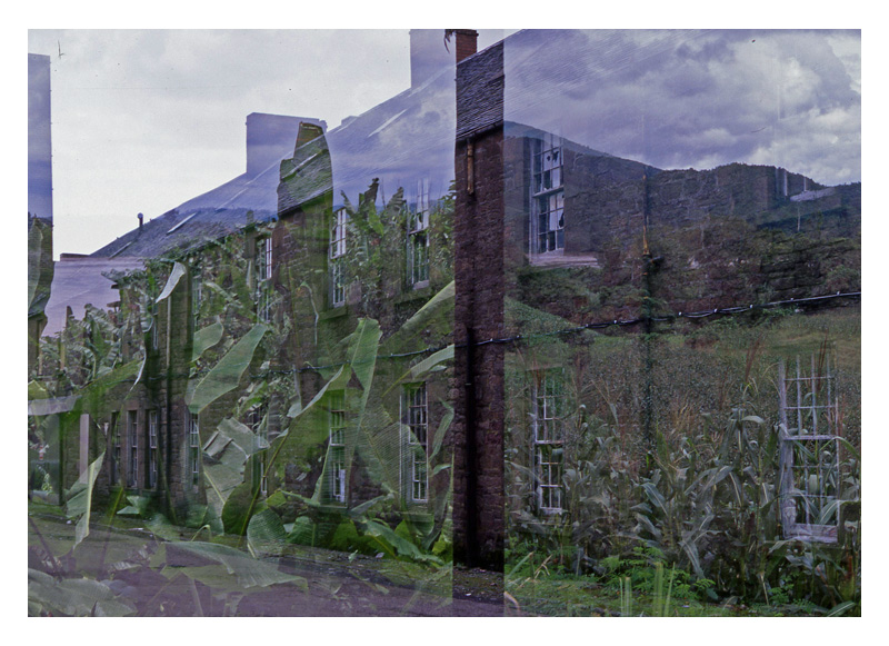
On the right are the old warehouses, white painted brick exterior, washed by the flow of the Mekong, bankside grasses in the foreground. And below to the left is some sort of banana grove superposed on stone walled, sash windowed and slate roofed dereliction, and to the right a maize field (lower) with hills above the old power cables. Could be a recent Dr Who set?
Sources and further reading
Jackson, G, Kinnear K. 1991. The trade and shipping of Dundee 1780 to 1850. Abertay Historical Society, Publication No 31, Dundee. Available second hand but also online at http://www.fdca.org.uk/Abertay_Publications.html
Scotland’s Places. Dundee, Camperdown Street, Victoria Dock, Harbour Warehouse.The Royal Commission on the Ancient and Historical Monuments of Scotland. Canmore web site for photographs and images.
http://canmore.rcahms.gov.uk/en/site/237997/details/dundee+camperdown+street+victoria+dock+harbour+warehouse/
Turner, Louise. 2010. Dundee Central Waterfront: historic building recording. Data structure report. Rathmell Archaeology Ltd. A report on archaeological investigations around the docks at Dundee, giving history, old maps including maps of the various land reclamations and harbour improvements. Check this Canmore/RCAHMS site http://canmore.rcahms.gov.uk/en/event/633583/ or do a web search on the title.
Discover Dundee Waterfront http://www.dundeewaterfront.com/