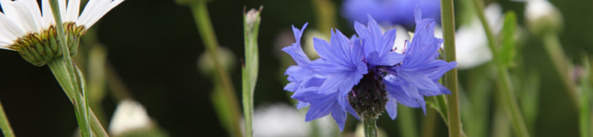
Kirstin Buchholz & Michael Munson (photographer) visited Iceland in February 2015. Here are some of their impressions and images of the places on the route.
In Vatnajökull National Park, Iceland (Michael Munson/Kirsten Buchholz)
Their visit took place during the Holuhraun volcanic eruption (click link for events in February 2015) which began on 31 August 2014. to the north of Vatnajökull glacier.
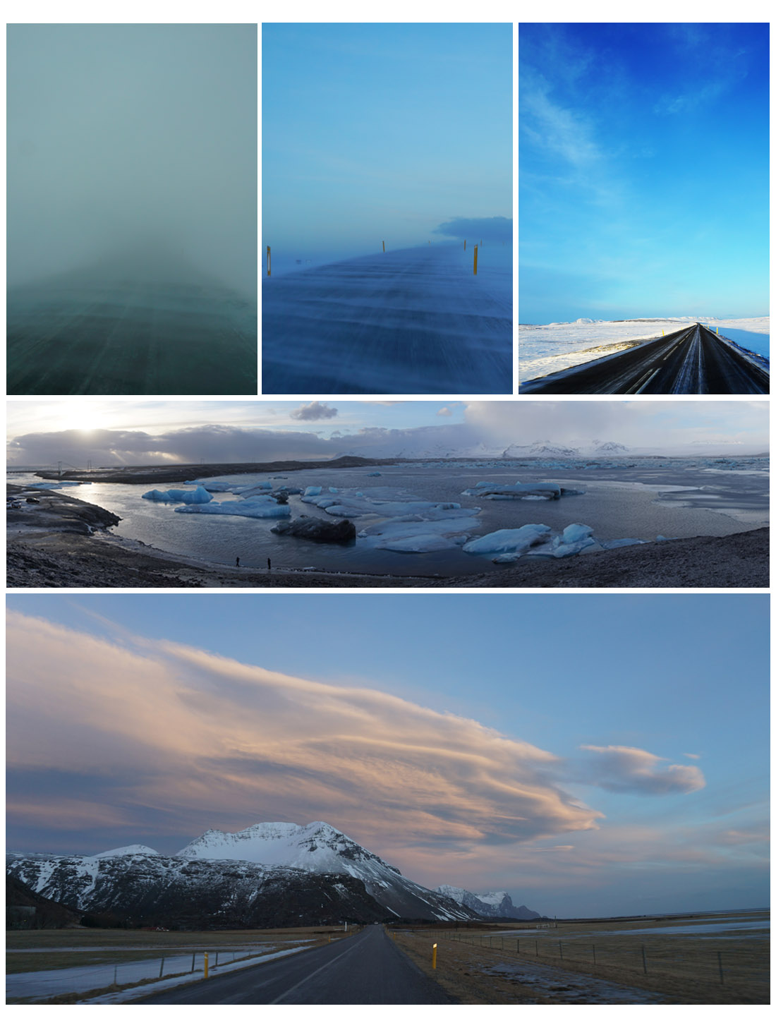
Kirsten writes: “When we started off in Reykjavik, it was chilly with 4°C and clear sky. When we reached the Golden Circle, it got colder, windier and we even had snow. Down south, it was about 0°C, windier and lots of broken icebergs from the glacier Vatnajökull in Jokulsarlon. The south and east coast of Iceland reminded us about Scotland’s west coast. The rocks, the maritime climate, the wind, the rain, the seagulls and the snow covered hills, apart from the black sand beach in Vik! …….. “
On the road in Iceland, February 2015 (Michael Munson/Kirsten Buchholz)
“The canyon Jokulsargljufur on our way north to Iceland was impressive – also the weather changed dramatically. The temperature dropped down to -10°C with snow, sleet, hail and rain and very high wind – sometimes all simultaneously! The cloud cover changed by the minute so the chances of seeing the Northern Lights were slim. There were loads of farms, cattle and horses around the south, east and north of Iceland. There are also reindeer, mostly on the east coast.”
Vatnajökull
The Vatnajökull glacier and its surrounds is a National Park, the largest in Europe, notable for its sub-glacial lakes and volcanos concealed under the ice cap. The last eruption was in 1996. It broke through the surface of the ice, emitting an ash cloud 10 km high. The subsequent spectacular release of meltwater caused great damage but increased the land area of the country by 7 square kilometres. There’s more on Vatnajökull at Iceland on the Web.
At Vatnajökull (Michael Munson / Kirsten Buchholz)
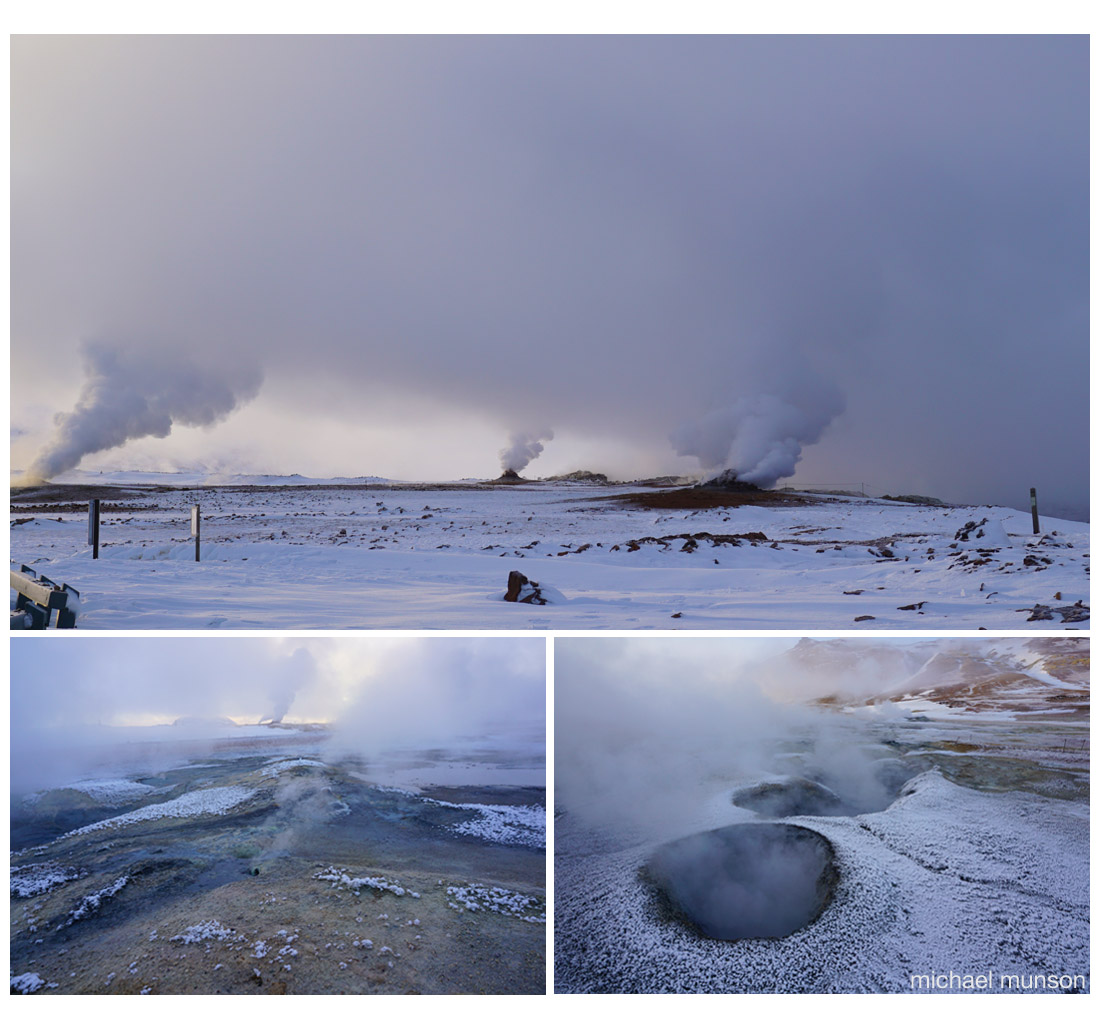
Mývatn
… the name of a lake in northern Iceland, which like Scotland was covered in ice during the last glaciation. The region experienced several major volcanic eruptions in recent millennia. One that happened 2300 years ago – that’s the middle of the Iron Age in Britain and the founding of Ancient Messene in Greece – led to the formation of the lake.
The area around the lake is still geothermally active, the images below showing smoke and fumes rising from small craters and holes in the ground.
Geothermal landscape near Lake Mývatn (Michael Munson / Kirsten Buchholz)
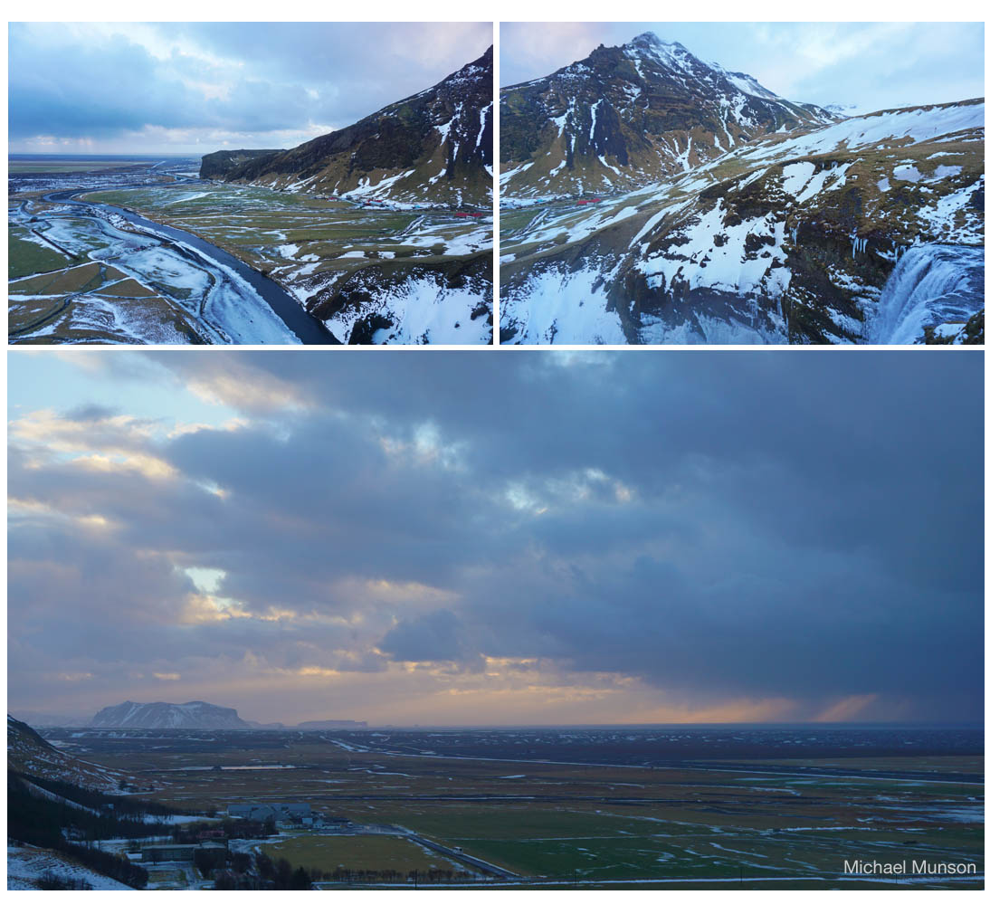
Skógafoss and the southern agricultural plain
The farmland of Iceland experiences a form of the ‘northern cool summer’ effect in which the solar income is spread over the long days, encouraging crops and grass to produce a high output. The main farming activity is stock raising.
The southern agricultural plain from Skogafoss (Michael Munson / Kirsten Buckholz)
The waterfall, Skógafoss, is a major attraction of the southern region of Iceland. The fall is seen to the lower right of the top right image above. Note the red roofs in the left centre of that image – they are seen again at the right centre of the image to the left, which then shows the river flowing from the waterfall through pasture continuing down to the sea in the distance. The lower image taken from Skógafoss shows the strip of coastal grazing land, between hills and sea.
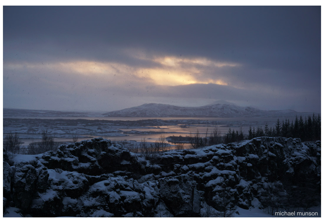
Þingvellir
And we end with this scene in fading light from Þingvellir. The Þingvellir (or Thingvellir) National Park was designated by law in 1928 and protected as a national shrine.
Þingvellir (Michael Munson / Kirsten Buchholz)
A general assembly (parliament?) began here about 930 and continued until 1798.
Thingvellir is one of the partner sites in the Thing Project – a move to coordinate the documentation and history of viking or norse ‘assembly’ sites – Thing sites – in North West Europe. Partners in Britain include organisations and sites in Shetland, Orkney and Highland Region at Dingwall.
Notes, credits
All images copyright of Michael Munson and Kirsten Buchholz. Additional material by GS.
The Icelandic Met Office give a month-by-month account of the Holuhraun eruption at en.vedur.is. The eruption was declared to have ended in early March 2015.
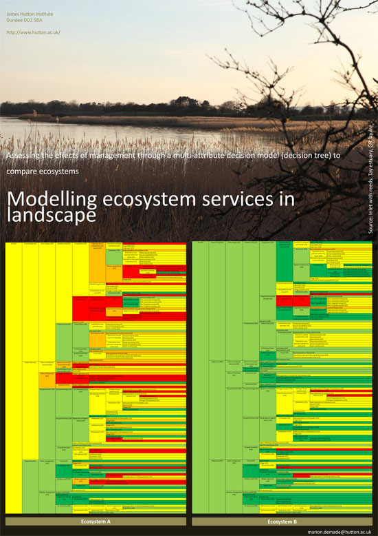
Tay Estuary Forum’s Annual Conference, this year on Sustainable Coasts, is held in Dundee on 23 April 2015. The small poster above draws attention to work showing the way different forms of land management may affect the estuary (Marion Demade, James Hutton Institute)
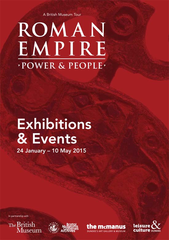
Thoughts on a visit to the exhibition Roman Empire – Power and People McManus Dundee, on 14 March 2015.
This fine, informative display gave evidence of the Roman presence north of the Antonine Wall (between Forth and Clyde) around 2000 years ago. They set up marching camps and lines of communication, patrolled a long and complicated frontier, built great fortresses, then retreated. Yet few things remain to tell of their everyday life.
One was scale armour, known as lorica squamata [1], fragments found at the site of the fort at Carpow, near the junction of the rivers Tay and Earn in Perthshire. These small samples, linen cloth as backing, sown with 1-2 cm wide sheet-bronze scales, are stated to be the best preserved of this type of army gear in north-west Roman europe. They are rare intact because the linen cloth usually rots and disappears. Someone might have worn this armour to help protect them from a thrown stone or spear or a body blow from wood or metal. It is not known whether the fibre plant flax Linum usitatissimum used to make the linen was grown locally or even whether the cloth was made here [2]. There was a trade in linen throughout the empire.
Another was an amphora (a clay pot), reconstructed from pieces found at Carlungie, Angus, lying in one of the dwellings adjoining an earth-house or souterrain, used as an underground storage chamber. Amphora such as this were used to move wine, oil and other essentials round the empire. A note by the exhibit told the amphora was from Gaul (France) and contained French wine. Who brought it here is not known, but you can imagine the party.
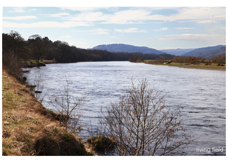
The Tay from the bank opposite the site of the Roman legionary fortress of Inchtuthil looking west, a landscape probably little changed (Squire/Living Field)
Forts and fortresses along the northern frontier
These exhibits were some of the few fragments remaining in this area from the massive resourcing of the empire’s northern frontier. The Romans made Britain a province in 43 AD and by the 70s AD had established fortified lines and supply routes through (what are now) Perthshire, Angus, Aberdeenshire and Moray. They patrolled well north of the Antonine Wall, which itself is more than an hour’s car-drive north of Hadrian’s Wall in northern England.
They built and manned forts close to transport routes by land and water from the south and east, as at Carpow, and camps and signal towers along the Gask line that ran north of Stirling and continued north east along fertile Strathmore as far as the east coast near Stracathro, and from there, dog-legging north and north west across Aberdeenshire to Moray. A long way to march. A long way from home.
Surprising is the size of some of the garrisons. The one at Carpow, close to the Tay estuary and not far from the North Sea, and thought to be occupied between 180 and 220, was designed to hold 2000-3000 people. The massive base at Inchtuthil – a legionary fortress – by the Tay river west of Meigle (image above), commanded the way north from Perth and was estimated from its dimensions and excavated buildings to house 20,000 to 50,000. A small town! To do its job today, it would need to be sited a few miles farther west to command the A9 and railway from Perth to Inverness.
Roman Inchtuthil existed only for a few years in the AD 80s before it was purposely abandoned. Even if not fully occupied, these garrisons must have held thousands to tens of thousands of people, many of whom were soldiers with big appetites.
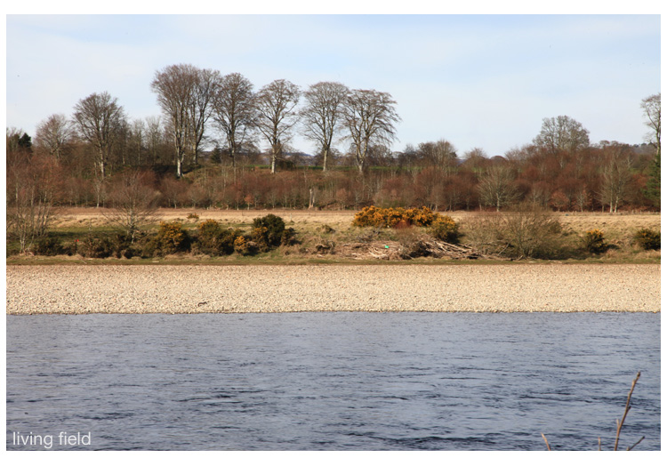
Across the Tay to the site of the Roman legionary fortress at Inchtuthil on the raised ground beyond the tall trees (Squire/Living Field)
How to feed thousands of soldiers
They all had to be fed. They would have brought and tended some of their own livestock and perhaps grown some crops and vegetables nearby, but the staple food would have been grain – wheat, barley or oat. (There was no maize, potato or turnips then.) Just think how many packets of porridge oats would be needed to feed all those men every morning [3], and that grain would have had to be transported over long distances from the south or else stolen or coerced as tribute, or tax, from local people.
The SCRAN entry states: “The Roman army was adept at self-sufficiency. At Inchtuthil the legionaries exploited local resources of wood, stone, gravel, and clay to build their fortress. They manufactured their own lime, bricks, and pottery on the spot. Food and other raw materials such as leather would have been obtained from the natives, probably in the form of tax. The massive granaries at Inchtuthil hint at the scale of such levies.” And these granaries, or grain stores, were big, as shown by the diagrams and aerial images made during archaeological digs (online references below).
The exhibition says that when the Romans came the area was populated by farming communities of native tribes, scattered and based around fortified hill tops. This was the late Iron Age, so agriculture would have been widespread, but even so it would have been very hard pressed to support tens of thousands of soldiers in addition to the existing people. Imagine working hard all year to grow crops and then when they were harvested, you had to give away a lot of the grain for the privilege of having the Romans living nearby. The invaders can’t have been popular and presumably that is why they had to build these lines of communication and massive fortresses.
Coppiced birch, last cut 20-30 years ago, near the site of a Roman signal tower in Strathmore (Squire/Living Field)
In conclusion
The Romans did not stay long. They arrived (in what is now Scotland) in the 70s (AD), which is about one thousand nine hundred and fifty years ago, but they were gone in less than 150 years. Their leaving is said to be the result of things happening elsewhere in the empire. Rome was too stretched – but (you have to ask) – was it the midge!
The iron age skills of growing crops and tending stock continued to the present time. So did working hard all year and giving away the harvest to those wealthier or more powerful. The Romans had no monopoly on oppression. It became endemic to northern agriculture.
Notes
[1] Squamata is the scientific name now given to reptiles that have scaly skin, the lizards and snakes.
[2] Flax is one of the oldest fibres plants, grown in Britain for several thousand years, see the Living Field’s page on Fibres.
[3] A packet of porridge oats weighing one kilogram contains 25 servings. To make 1000 servings would take 40 packets, and 10,000 servings 400 packets; and that would be just for one breakfast.
Ploughed land, line of trees through to stubble fields, near the site of the Roman fort of Cardean, Strathmore (Living Field)
On at the McManus Gallery & Museum until 10 May 2015, an exhibition of antiquities, from the British Museum and local collections. See the earthenware pot (amphora) found near an Angus earth-house, said to have held French wine, and the linen-backed, bronze scale armour from Carpow where Tay and Earn meet. Web link: Roman Empire: Power and People – a British Museum Tour.