On the edge

Remote, extensive rig system (lazy beds), north Lewis; historical records of crops from 1690s; bere and barley; subsistence farming on the atlantic edge.

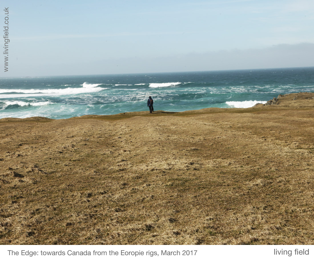
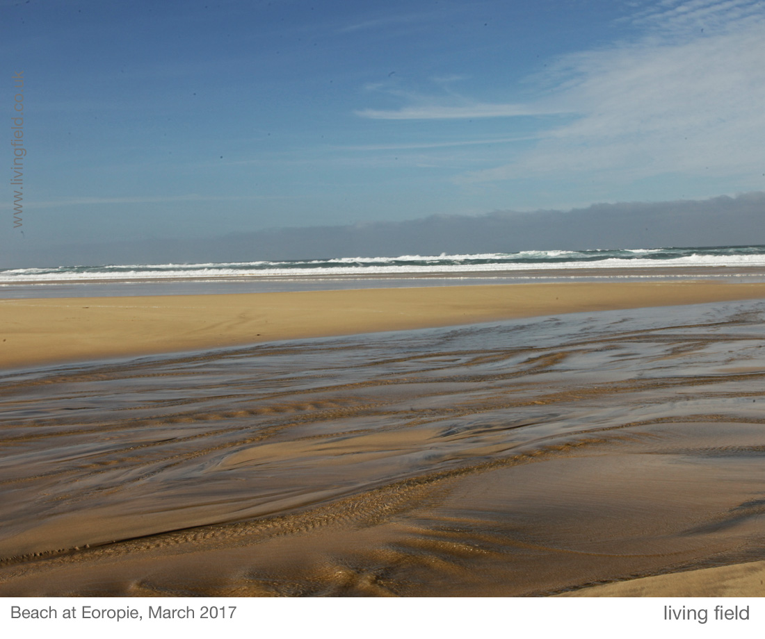
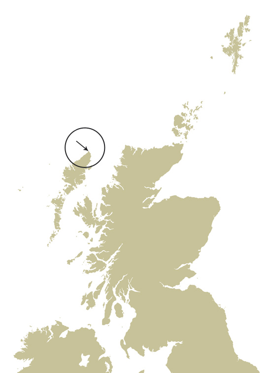
One of the remotest field systems in Europe lies near Eoropaidh (Eoropie) on the north-west coast of the Island of Lewis, facing the Atlantic at 58 N.  Continue round that parallel and you’ll cross Quebec in Canada, the Gulf of Alaska and Russia’s Kamchatka Peninsula.

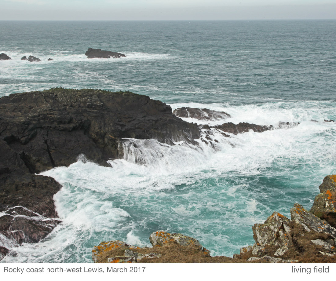
The Butt of Lewis lighthouse [1] lies at the northern tip of the Island. As you walk south west from there, the soil and grassy vegetation  appear to be slipping towards the cliffs and into the sea.

lf_ntsmgs_dgfmg_rsnbttlws_gk_1100

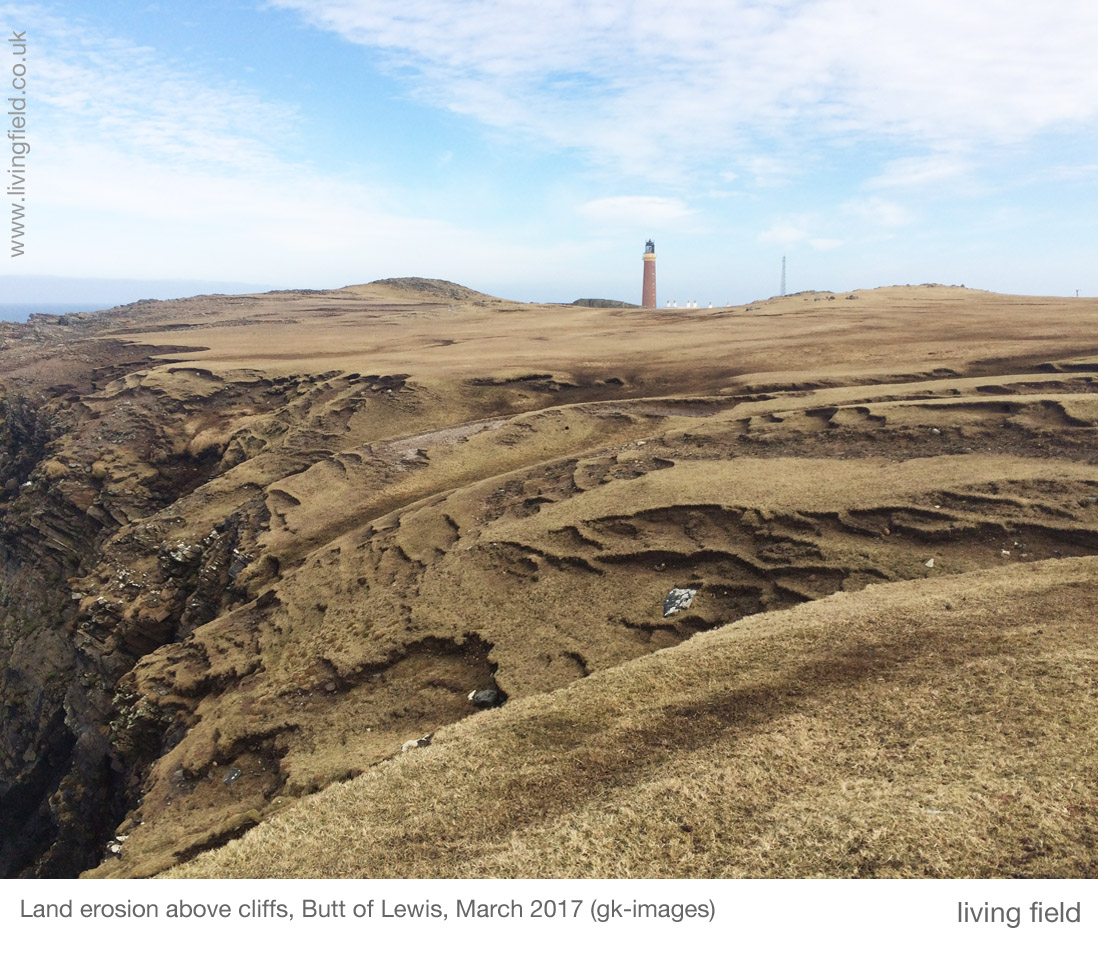
A little farther south, and the cliffs descend to a rocky shore where the rigs or lazy beds were cultivated close to the tide. It’s a stunning position – go west and there’s no more land until north America. And what Atlantic storms there must be. Yet corn and other crops were grown here.

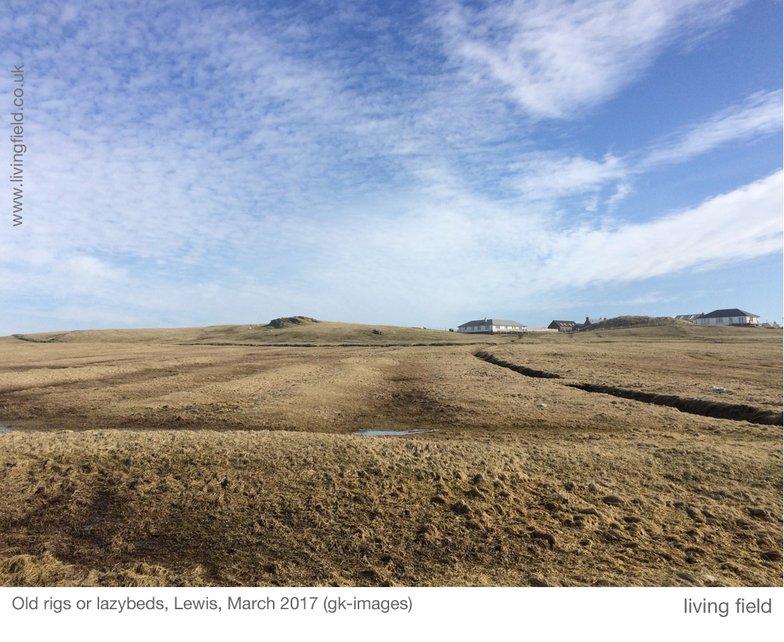
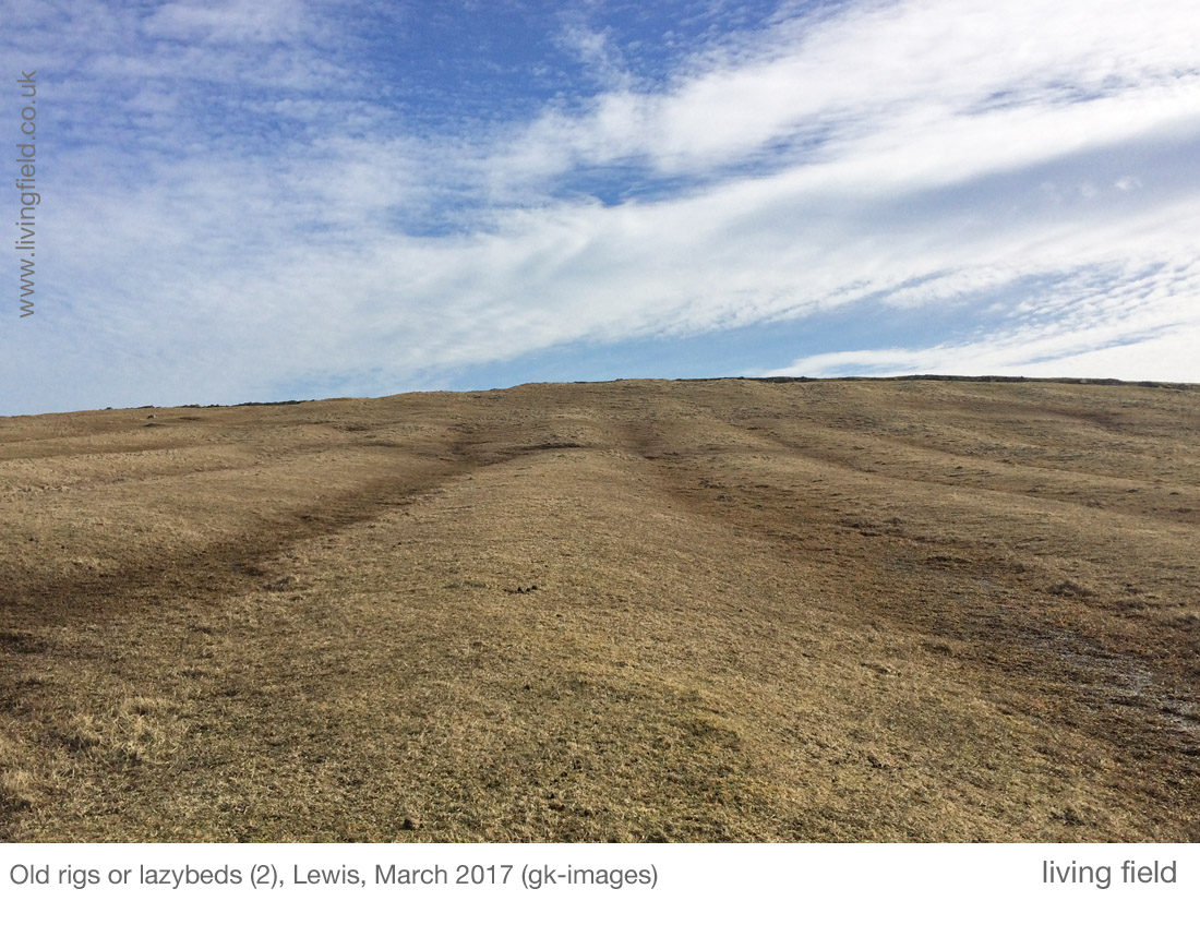
As testament, the rigs remain as long, grass-covered mounds 5 to 6 m between the furrows, some at more or less right angles to the coastline, others parallel to it. Earth was dug and piled from both sides into the centre and seaweed carried from the beaches and heaped on as fertiliser. Excess water ran down the furrows.

lf_ntsmgs_dglws_lkngwst_gs_1100Extensive field systems

The rigs in the images are one of several field systems around Eoropaidh and Butt of Lewis. The Canmore web site [2] describes the field system in the photographs here, which lies south west of the lighthouse and facing west, and several others (round the ‘top’) to the south east of the lighthouse. All are abandoned.

They are considered to be post-mediaeval but period uncertain.

Aerial photographs are given for each location on the Canmore site [2] and other pages on that site tell more of the history of the area [3].

lf_ntsmgs_dgfrmnglws_lzbd1_gk_1100
Looking inland towards Eoropie, one bed running across, and the others up and down, March 2017 (gk-images)

Lazy Hardly. Lazy beds in various parts of Scotland and Ireland were constructed to different designs. They are of various widths and heights. One explanation of the word is that they are made, not by digging up and completely turning sods of earth and grass, but rather cutting the sod on three sides, then flipping it over the uncut side to form  a double layer – soil, vegetation, vegetation, soil. The method is shown in some recent videos [4].

But the most likely meaning is indicated by Fenton [4] as ‘from an obsolete sense of the English word (lazy), meaning uncultivated’, and refers to the fact that the raised bed is made on top of a strip of uncultivated ground.

Maintaining fertile rigs of the extent seen today around Eoropaidh was a major undertaking, needing the work of (according to Martin below) probably hundreds of people each year.

The method by which this land was managed is known as runrig, ‘a system of joint landholding by which each tenant had several detached rigs allocated in rotation by lot each year, so that each would have a share in turn of the more fertile land’ [5].

Fenton and Veitch (2011) give explanations and many references to the runrig system in different parts of Scotland.

lf_ntsmgs_dgfrmnglws_lzbd2_gk_1100
Looking uphill from the shore, the central rig about 5 m wide (gk-images)

Historical records

Several accounts of the area  were made from the 1690s onwards, but they make no mention of the field systems and give little information on the crops and methods of husbandry.

Why this omission? The extensive rigs must have been there during one or more of these accounts, The landforms look impressive to us today, the result of decades, centuries, of hard work, and continued upkeep.

Martin Martin’s visit in the 1690s

Martin Martin, from Skye, visited Lewis in the 1690s and reported his findings in the Description of the Western Isles of Scotland, published 1703 [7].  On soil cultivation, he reported that the people turned the ground with spades; and with wooden harrows for breaking and smoothing the earth, drawn by a man ‘having a strong rope of horse hair across his breast’.

He writes ‘the island was reputed very fruitful in corn, until the late years of scarcity and bad seasons. The corn sown here is barley, oats and rye; and they have also flax and hemp.’ [8] He continues to relate that the main fertiliser is sea-ware but that soot is also used, reportedly causing jaundice in those who eat bread from corn grown on land so treated.

However, there is no mention in his chapter on Lewis of rigs, lazybeds or any means of land-sharing.

Potato is often associated with rig systems but it was not grown in Scotland until several decades after Martin Martin wrote his journal, so it would not have been on the Island when he visited.

lf_ntsmgs_nthdglws_rckcst_gs_1100
Coastal rocks, resting place of seabirds, south-west of the Butt of Lewis, looking west (Squire/Living Field)

A note of caution is due – Martin is not always credible. What a pity when reliable records from that time are so needed! At various places, he related what we would today consider fabulous or supernatural occurrences, without question, as if they happened.

He was knowledgeable about many things, so was he tempting readers with fake news, or did he not check his sources?

Old Statistical Account, 1797

The Rev Donald Macdonald wrote ‘not a single tree, or even any brushwood, to be seen in the whole parish’. The crops were black oats, bear and potatoes, sown April and May, reaped in September and October. (Ed: black oat is Avena strigosa and bere a landrace of barley, Hordeum vulgare).

He confirms the use of soot as fertiliser as reported by Martin a century earlier. He writes that the roof of each house is thatched with stubble and heather ropes (stubble presumably being cereal stems) which become covered in soot due to the burning of peat within. He writes that in the latter end of May when the barley blade (first leaf) appears, the people take the soot and stubble and strew it over the crops as fertiliser.

Many domestic animals were reported – horses, sheep and black cattle, all small in stature. The region was very isolated, things had to be carried to and from Stornoway.

Potato came to the area between Martin’s visit and this account, but there is no mention of rigs or lazybeds. Just that many crude ploughs are found in the parish, consisting of a small piece of crooked wood, guided by a side handle held by a man walking alongside, and pulled by four small horses.

lf_ntsmgs_gdelws_bchsndstm_gs_1000
On the beach, Eoropie – wide stream in the foreground, flowing across the beach from inland; hazy light due to sand from the dry part of the beach blown inland (Squire/Living Field)
New Statistical Account, 1836

The Rev William Macrae notes also the absence of wood or tree, but  that roots and trunk of fir, oak and hazel (with nuts) are ‘imbedded in a great depth of moss, such that wooded land must ‘at some remote period, have undergone some sweeping and desolating revolution’.

He mentions that people eat oat and barley meal, potatoes and milk, but laments the state of farming: that people have not attempted draining or trenching because they were just too hard up, while short tenancies of 6-12 years did not making it worthwhile. It was a subsistence economy with no exports and in no season was produce more than ‘barely sufficient, and sometimes not adequate, to supply the necessities of the tenantry’.

There is no mention of field systems or rigs, and the comment on the absence of drainage is not consistent with what we see today, but he may have been generalising to the whole of Barvas parish rather than these rig systems.

The Rev Macrae commented on many other aspects of life. His account is entertaining, but you feel his mind sometimes strays: he is patient to note among the statistics of population, produce, and adherence to the faith, that ‘The women are modest, comely and many of them good-looking.’

Modern field strips

Visitors today will see the agricultural land in crofting townships on Lewis divided into long thin strips, usually separated by fences. The OS 1:25,000 maps show these bundles of linear features covering much land near the coast.

lf_ntsmgs_frmgdg_crftlws_gs_1100
Draining and de-stoning croft land (upper); sheep on long strips of grazing land demarked by post and wire fences (lower): both north-west Lewis (images by Squire/Living Field)

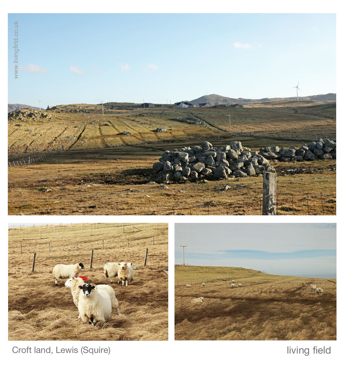
One of the stated characteristics of linear farming of the type shown above is that, provided the strips run perpendicular to the main gradient in slope or soil, no one strip gets the best land and no one gets the worst.

This sharing of good and bad appears to be one of the reasons why crops, especially in the tropics, are sometimes mixed in a field, not in clumps but in long straight lines [11].

A note on bere and barley

The Living Field has a biding interest in when bere and barley were noted as being different things, e.g. that bere was a primitive landrace of barley. The story unfolds on this site at Bere line – rhymes with hairline.

There is nothing definitive in any of these historical accounts as to whether bere and barley were considered different. In the Old Statistical Account of Barvas parish [9], as noted above, both names are used for the barley crop but neither is defined.

lf_ntsmgs_dglws_br_gs_1100
Landraces of bere (barley) from Eday and North Uist grown in the Living Field garden in 2015 (Living Field)

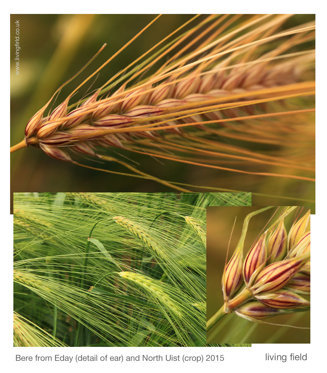
In 2015, the Living Field team grew a range of old barley varieties in the garden, including some bere landraces  originating from various parts of the north.

We had none from Lewis, but shown above are bere from North Uist in the Outer Hebrides and from Eday in Orkney. Barley grown in the lazy beds around Eoropie would have looked like this.

An achievement

The land was farmed in this way for centuries, in isolation from much of the rest of the world. Given the location,  the rig systems in north Lewis and elsewhere should be seen as a major achievement rather than something to be dismissed as backward (as some travellers did).

Crop production was limited by plant nutrients – nitrogen, phosphate, potash and the many minor elements. Legumes that provided much needed nitrogen by fixation from the air were not mentioned in the historical accounts, and were unlikely to have been planted as crops here as they were during the Improvements era after 1700 in the lowlands.

Apart from seaweed and soot, and probably animal dung, there was no other source of nutrients. To have survived for so long on so little was the achievement.

Author and contact for this article: geoff.squire@hutton.ac.uk. Thanks to gk-images for allowing us to use some of their photographs.

[Began late March, edited in April and May 2017]

Sources

[1] Northern Lighthouse Board: Butt of Lewis Lighthouse.

[2] Field systems of lazy beds around Eoropie and the Butt of Lewis on the Canmore web site: the one shown in the photographs here is west of Eoropie, Canmore ID 129505. Others include ID 270561, ID 270560 and Dun Eistean ID 4417.

lf_dglws_mp1_gs_350[3] More on the history of the area at the Canmore pages for Eoropie, Teampull Mholuaidh (St Moluag’s).

[4] Lazy beds: Guthan nan Eilean short video on making lazy beds in Uist (in Gaelic and English versions). A article from Ireland: Lazy beds in the Cooley Mountains. From the Louth Field Names project. The origin of the word lazy, from ‘uncultivated’, is explained by Fenton A, Ch 27, p 673 in Fenton & Veitch 2011 [6].

[5] Definition of runrig in the Concise Scots Dictionary. Ed. Mairi Robinson. 1985. Aberdeen University Press. Also: The runrig system of land tenure, fromThe Angus Macleod Archive via Hebridean Connections.

[6] Fenton A & Veitch K (eds). Farming and the Land. 2011. Publ: John Donald & European Ethnological research Centre. This multi-authored book has many references to runrig and lazybeds, including photograph of lazybeds at Eoropie (p 125); and a note that the runrig system in north Lewis may have been managed by small groups of people, rather than individuals.

[7] Martin Martin, 1703. A description of the Western Islands of Scotland. Printed in London. Available online: search Google Books for the author and title; also the Undiscovered Scotland web site offers the book online (with adverts). Undiscovered Scotland web pages: biography of Martin Martin, died 1719.

[8] Martin is probably referring to the Ill Years, the 1690s when a run of very bad weather caused repeated crop failure and consequently hardship and famine through the north of Britain.

[9] Old Statistical Account of Scotland, 1791-99: Vol XIX dated 1797 for the Parish of Barvas. Online at Old Statistical Account.

[10] New Statistical Account of Scotland, 1834-45: Vol XII for the Parish of Barvas. Online at New Statistical Account and also at Google Books.

[11] As argued in the editor’s account of Mixed cropping in Burma (Myanmar).

And if you are anywhere near latitude 58 N, make a point of visiting the famous –

eoropiedunesparklogo

Information at eoropiedunespark.co.uk


Fibres in design

West Ward Works, in Dundee, previously used for printing books and magazines, was the site of the first Dundee Design Festival, 25-28 May 2016. The Works is now a disused factory, vast space, tubes, wiring and old instructions on the walls.

The Works was one of those many places in Dundee and its surrounds that processed masses of natural product – flax and jute are other examples – usually extracted or grown elsewhere, but given greater value through manufacture and sale.

lf_poim_ddssgnfst1_gs_1100


Silk, husk and glass

Several of the exhibits used natural fibre or other natural products.  ‘Firth of Tay’ (shown among the images above) is a length of handwoven silk by Cally Booker.  The notes say ‘Each block of pattern corresponds to (the) population profile in a local city, village or town’. It looks as if the patterns are based on a set of statistical distributions, e.g. perhaps number of people by age.  (The subtlety of the colours is not well reproduced in the cellphone snaps above – her web site shows the original, link below).

Elsewhere, Barley waste from local brewing has been compressed and formed into a piece of furniture (a bar) by Beer52 with Design in Action and Aymeric Renoud.

And – though not using natural fibres in this invention – the firm Scot & Fyfe, establishd 1864 in Tayport to manufacture linen from flax, offered Alphashield – ‘A seamless glass textile ‘sock’ … fed into defective pipes deep underground and set in place with resin to repair the damage and create a new strong pipeline’. (But how do they get it to stick to the sides of the pipe?)

Further

Dundee Design Festival 2016 introduction and programme

Canmore report headed Dundee, Guthrie Street, West Ward Works

DC Thompson: West Ward Works to host first Dundee Design Festival

UNESCO Creative Cities Network

Exhibitors referred to above: Cally Booker, Aymeric RenoudScot & Fyfe.

On this site: Living Field web pages on Fibres, and Fiberoptic 1, 2 , 3 and 4.

Contact: geoff.squire@hutton.ac.uk

Restored High Mill at Verdant Works

The High Mill, derelict for some decades, has been restored at Verdant Works and is open to the public as part of the Verdant Works Museum, Dundee. This magnificent restoration reveals the skills in engineering, architecture and construction that arose with the industrial revolution. The restored ironwork is a superb sight while the roof timbers reflect the colour of jute fibre. See for yourself.

lf_5_fbr_vrdnthm_gs_1100

The name Verdant arises from the flax fields that used to grow in the area of the Mill, yet the flax disappeared many years ago. The museum tells of the changes in the textile industry from its beginning as a distributed home-based craft, cultivating flax and making yarn and linen cloth.

Local cultivation gave way to imported raw material. Then local production gave way to steam power and to industrial manufacture. Even this was out-competed in the 1800s as the industry turned to jute grown in India and Bangladesh. The main museum presents the story of jute.

The spaces created at High Mill are intended for exhibitions and education ….  but they make you wonder, both at the engineering skills that created the building and the industry it served, and the often appalling conditions and treatment of the people who worked there.

Further

Background to the restoration and intended uses highmillproject.com/project

Before the transformation www.buildingsatrisk.org.uk/ref_no_3738

Dundee stv news update with photographs, drawings and images dundee/stv/tv

Visiting the Mill: Verdant Works Dundee

The Living Field’s web pages on Fibres, part of the 5000 Years – Plants project –  describe local and global production of fibre plants, including flax and jute.

Feeding the Romans

Thoughts on a visit to the exhibition Roman Empire – Power and People McManus Dundee, on 14 March 2015.

This fine, informative display gave evidence of the Roman presence north of the Antonine Wall (between Forth and Clyde) around 2000 years ago. They set up marching camps and lines of communication, patrolled a long and complicated frontier, built great fortresses, then retreated. Yet few things remain to tell of their everyday life.

One was scale armour, known as lorica squamata [1], fragments found at the site of the fort at Carpow, near the junction of the rivers Tay and Earn in Perthshire. These small samples, linen cloth as backing, sown with 1-2 cm wide sheet-bronze scales, are stated to be the best preserved of this type of army gear in north-west Roman europe. They are rare intact because the linen cloth usually rots and disappears. Someone might have worn this armour to help protect them from a thrown stone or spear or a body blow from wood or metal. It is not known whether the fibre plant flax Linum usitatissimum used to make the linen was grown locally or even whether the cloth was made here [2]. There was a trade in linen throughout the empire.

Another was an amphora (a clay pot), reconstructed from pieces found at Carlungie, Angus, lying in one of the dwellings adjoining an earth-house or souterrain, used as an underground storage chamber. Amphora such as this were used to move wine, oil and other essentials round the empire. A note by the exhibit told the amphora was from Gaul (France) and contained French wine. Who brought it here is not known, but you can imagine the party.

The Tay from the bank opposite the site of the Roman legionary fortress of Inchtuthil looking west, a landscape probably little changed (Squire/Living Field)

Forts and fortresses along the northern frontier

These exhibits were some of the few fragments remaining in this area from the massive resourcing of the empire’s northern frontier. The Romans made Britain a province in 43 AD and by the 70s AD had established fortified lines and supply routes through (what are now) Perthshire, Angus, Aberdeenshire and Moray. They patrolled well north of the Antonine Wall, which itself is more than an hour’s car-drive north of Hadrian’s Wall in northern England.

They built and manned forts close to transport routes by land and water from the south and east, as at Carpow, and camps and signal towers along the Gask line that ran north of Stirling and continued north east along fertile Strathmore as far as the east coast near Stracathro, and from there, dog-legging north and north west across Aberdeenshire to Moray. A long way to march. A long way from home.

Surprising is the size of some of the garrisons. The one at Carpow, close to the Tay estuary and not far from the North Sea, and thought to be occupied between 180 and 220, was designed to hold 2000-3000 people. The massive base at Inchtuthil – a legionary fortress – by the Tay river west of Meigle (image above), commanded the way north from Perth and was estimated from its dimensions and excavated buildings to house 20,000 to 50,000. A small town! To do its job today, it would need to be sited a few miles farther west to command the A9 and railway from Perth to Inverness.

Roman Inchtuthil existed only for a few years in the AD 80s before it was purposely abandoned. Even if not fully occupied, these garrisons must have held thousands to tens of thousands of people, many of whom were soldiers with big appetites.

Across the Tay to the site of the Roman legionary fortress at Inchtuthil on the raised ground beyond the tall trees (Squire/Living Field)

How to feed thousands of soldiers

They all had to be fed. They would have brought and tended some of their own livestock and perhaps grown some crops and vegetables nearby, but the staple food would have been grain – wheat, barley or oat. (There was no maize, potato or turnips then.) Just think how many packets of porridge oats would be needed to feed all those men every morning [3], and that grain would have had to be transported over long distances from the south or else stolen or coerced as tribute, or tax, from local people.

The SCRAN entry states: “The Roman army was adept at self-sufficiency. At Inchtuthil the legionaries exploited local resources of wood, stone, gravel, and clay to build their fortress. They manufactured their own lime, bricks, and pottery on the spot. Food and other raw materials such as leather would have been obtained from the natives, probably in the form of tax. The massive granaries at Inchtuthil hint at the scale of such levies.” And these granaries, or grain stores, were big, as shown by the diagrams and aerial images made during archaeological digs (online references below).

The exhibition says that when the Romans came the area was populated by farming communities of native tribes, scattered and based around fortified hill tops. This was the late Iron Age, so agriculture would have been widespread, but even so it would have been very hard pressed to support tens of thousands of soldiers in addition to the existing people. Imagine working hard all year to grow crops and then when they were harvested, you had to give away a lot of the grain for the privilege of having the Romans living nearby. The invaders can’t have been popular and presumably that is why they had to build these lines of communication and massive fortresses.

Coppiced birch, last cut 20-30 years ago, near the site of a Roman signal tower in Strathmore (Squire/Living Field)

In conclusion

The Romans did not stay long. They arrived (in what is now Scotland) in the 70s (AD), which is about one thousand nine hundred and fifty years ago, but they were gone in less than 150 years. Their leaving is said to be the result of things happening elsewhere in the empire. Rome was too stretched – but (you have to ask) – was it the midge!

The iron age skills of growing crops and tending stock continued to the present time. So did working hard all year and giving away the harvest to those wealthier or more powerful. The Romans had no monopoly on oppression. It became endemic to northern agriculture.

Notes

[1] Squamata is the scientific name now given to reptiles that have scaly skin, the lizards and snakes.

[2] Flax is one of the oldest fibres plants, grown in Britain for several thousand years, see the Living Field’s page on Fibres.

[3] A packet of porridge oats weighing one kilogram contains 25 servings. To make 1000 servings would take 40 packets, and 10,000 servings 400 packets; and that would be just for one breakfast.

Ploughed land, line of trees through to stubble fields, near the site of the Roman fort of Cardean, Strathmore (Living Field)

Sources and references

Introduction including material for schools

BBC Primary History http://www.bbc.co.uk/schools/primaryhistory/romans/romans_in_scotland/

SCRAN Trust: information on the fortress at Inchtuthil and on   grain stores http://www.scran.ac.uk/packs/exhibitions/learning_materials/webs/56/Inch.htm http://www.scran.ac.uk/packs/exhibitions/learning_materials/webs/56/Garrison.htm#granary

See also links to SCRAN for Carpow and Gask Frontier from the above pages.

Looking south-east across arable and grazing land from the site of a Roman signal tower, Strathmore (Squire/Living Field)
Books and articles

Jones, RH. 2012. Roman camps in Britain. Amberley Publishing, Stroud, Gloucestershire, UK. Available as ebook via Google Books.

Hoffmann, B. 2013.The Roman invasion of Britain – archaeology versus history. Pen and Sword Archaeology, Barnsley, UK.

Wolliscroft DJ, Hoffman B. 2006. Rome’s first frontier: the Flavian occupation of Northern Scotland. Tempus publishing.

Archaeological investigations and records (RCAHMS)

Carpow: http://canmore.rcahms.gov.uk/en/site/30081/details/carpow/

Inchtuthil: http://canmore.rcahms.gov.uk/en/site/28592/details/inchtuthil/

Contact

geoff.squire@hutton.ac.uk

Photographs on this page taken early April 2015.

Towards the site of a Roman signal tower, now occupied by planted Scots Pine, bulb field in the foreground (Squire/Living Field)