Crop diversification

The Living Field has been studying and promoting the diversity of crops and cropping methods since its beginning over 15 years ago. The Garden displays the different crops grown since the first farmers arrived here thousands of years ago.

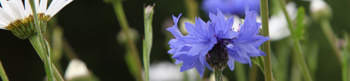
The Garden’s habitats also harbour and attract a range of wild plants that have themselves been nurtured and harvested in the wider landscape.

Why diversification? Many of our crops have been lost in the march to uniformity and many wild plants are threatened by loss of habitat. Plant diversity in the croplands has decreased in the last 150 years.

Yet there is a drive to reclaim this heritage, to diversify agricultural fields and landscapes for the betterment of the environment and human nutrition.

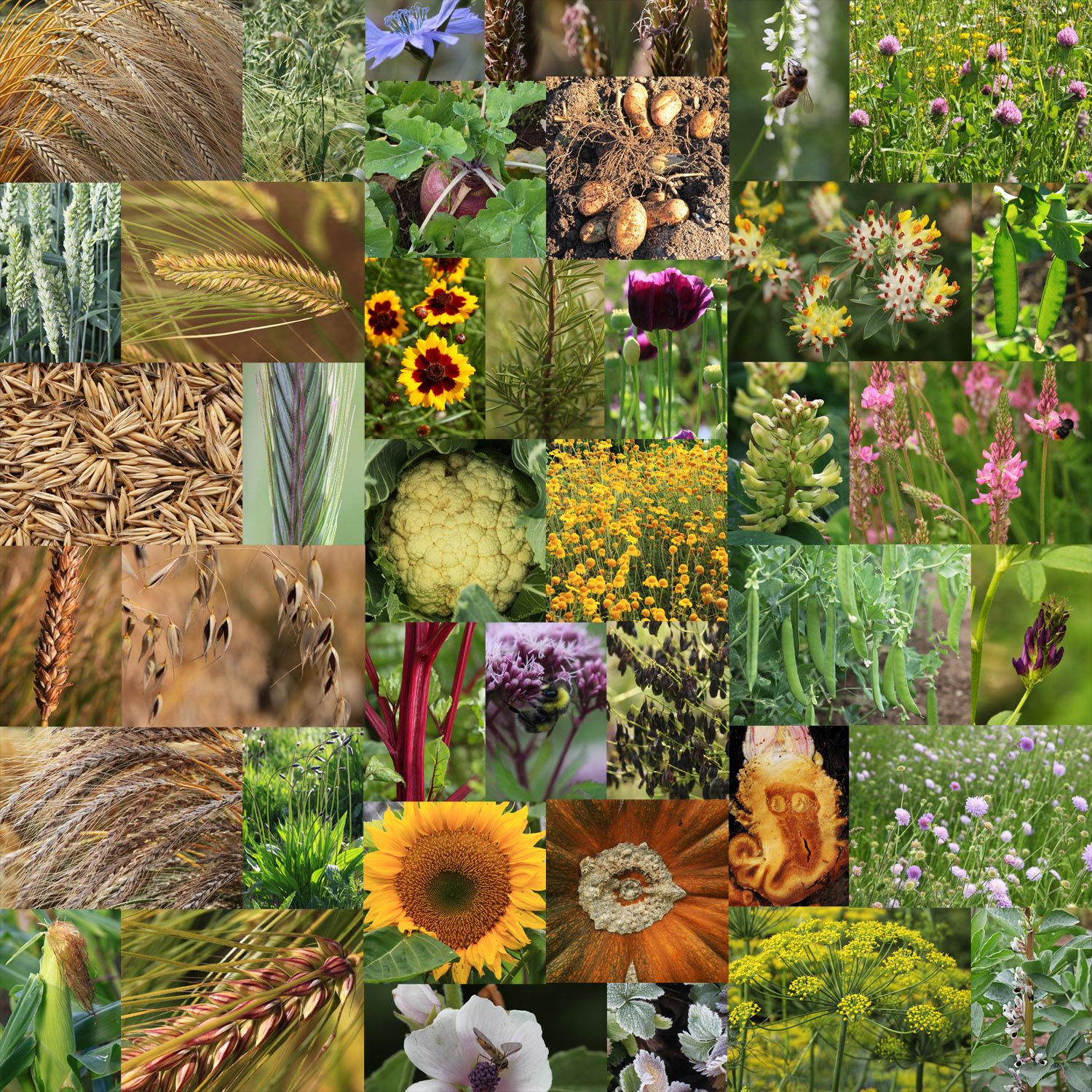
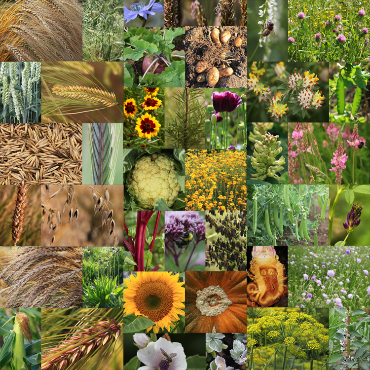
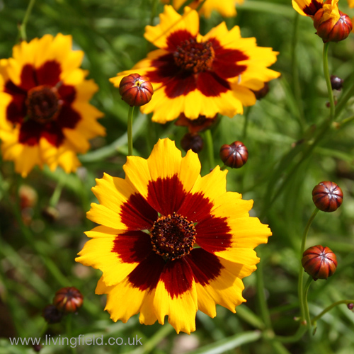
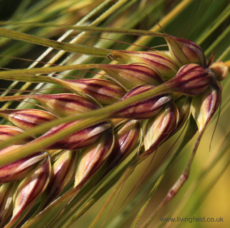
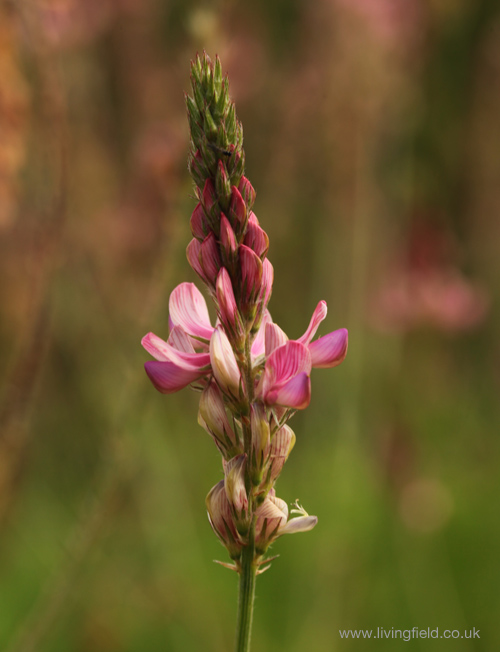
The collage above shows some of the crops and other useful plants grown  in the Living Field garden in recent years. The cereals are towards the left and the legumes to the right, while the centre holds dyes, medicinals, vegetables and ‘root’ crops. [Click on the image and a larger copy will appear in a new tab.]

What does crop diversity do?

Each type of plant uses the resources of sunlight, water and nutrients to form its body, including the things we take off it as yield – grain, leaf, root and so on. Each type takes up, uses and passes on these resources in slightly different ways. They open or close channels through which the resources flow – some to us in the form of nutritious food, some to the soil and some to food webs and wildlife.

A single type of plant can open only a small number of channels – it blocks the others off.  Therefore many types need to be grown together to ensure that all the channels necessary for the ecological wellbeing of the land are open and working.

Therefore as plant diversity declines, channels are closed and the ecosystem malfunctions. An example is the decline of legume crops and wild plants such as peas, beans, vetches and clovers. They fix their own nitrogen (an essential plant nutrient) and so do not need to be given mineral nitrogen fertiliser (which, apart from helping plants to grow, can be a damaging pollutant).

Is crop diversity declining?

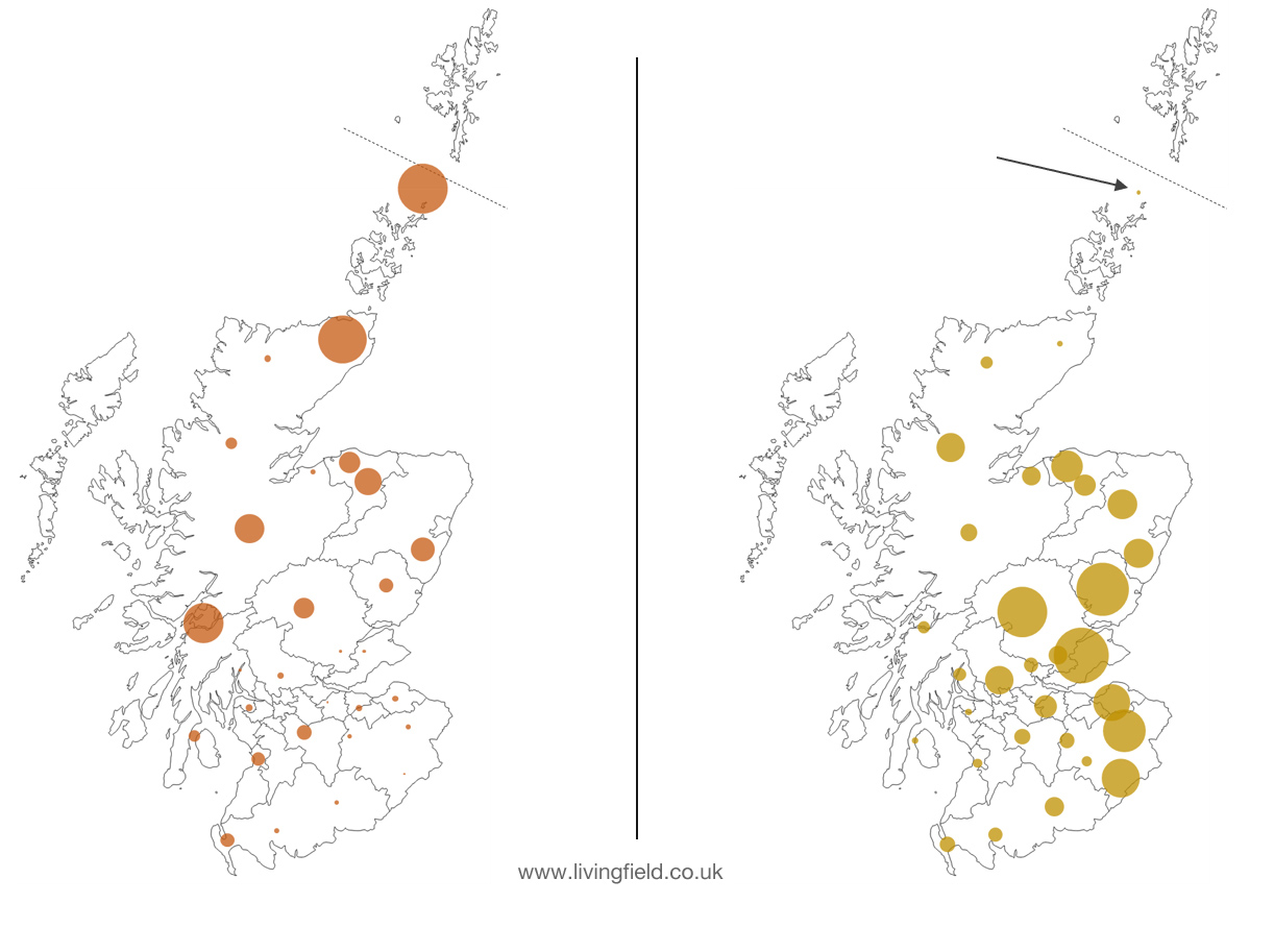
There has been a trend in the last 150 years to reduce the diversity in crops and grass which have together sustained people here since the neolithic age 5000-6000 years ago. The changes have not been abrupt, but they accelerated after the 1950s due to the higher yields that were achievable using mineral fertiliser and pesticide.

Barley is now dominant, whereas many other types have declined or disappeared. The tuber crops such as turnips, swedes and potatoes, the legumes such as peas, beans and vetches, and the dyes and fibres have all declined in area in the last 150 years. Some such as the fibre crop, flax,  or the dye plant, woad, are no longer grown.

Along with increasing use of pesticide, these changes have limited the channels through which natural resources flow to sustain the ecosystem. They have reduced farmland wildlife and in some cases endangered the capacity of soil to sustain life.

But while food security was assured in the 1960s, perhaps for the first time ever, agriculture then became geared to the manufacture of drink and animal feed, while the people living here came to rely on imports for food.

The croplands are out of balance!

Can diversity be restored?

There are increasing and welcome pressures to re-diversify agricultural land for the benefit of all forms of life that rely on it. The pressure certainly comes from many small enterprises and businesses involved in creating a sustainable and healthier food system, but pressure also comes through European Union influence.

Notably,  funding from the EU has enabled researchers at the Hutton to  collaborate and share knowledge and practice of diversification with scientists and  innovators throughout Europe.

A series of short articles is therefore planned for the Living Field web site, covering:

  • the origins and decline of diversity in crops and their associated plants and animals;
  • the ‘channels’ by which crops and their management regulate the flows of energy and matter through the ecosystem;
  • the methods that can be used to restore and maintain diversity in the field and landscape.

Putting knowledge into practice on the farm

The James Hutton Institute’s farms and science have been re-diversifying agriculture for some years. There’s a range of projects on mixed cropping including undersowings, practices to conserve and build soil and landscape ‘engineering’ to improve the habitats and encourage movement of wildlife.

The Living Field garden will continue to grow and display many of the crops and useful wild plants that sustained people here since the last ice.

Author/contact: geoff.squire@hutton.ac.uk

Bere country

A note in the Bere-line – a survey of bere barley, an old corn landrace. Distribution of bere and barley in the 1850s: bere to the north and west, barley to the east and centre. Loss of bere and many other crops from the late 1800s. Declines in crop diversity. 

Previous notes in the bere-line compared bere barley and the improved two-row barleys in several collections and census records from the 1800s. By the 1850s, bere was still recognised and catalogued in terms of several variants [1] but most named types of barley were of the two-row form.

In the crop census of 1854 [2, 3], itself a milestone in the description of agriculture, bere occupied about 10% of the area of barley, but was still recorded throughout the country.

Distribution of bere in the 1850s

The census of 1854 was based on the pre-1890s counties, administrative areas that had been in existence, though not unaltered, for many hundreds of years [4, 5]. A map of the counties is shown at Sources below.

The areas sown with bere and barley in 1854 are shown in Fig. 1. The centre of each circle is positioned near the centre of one of the old counties. The map is partitioned into present administrative areas [6].

The area of each circle represents the relative area of crop in each county. The largest circle in the bere map is about 3000 acres (1,200 hectares) while the largest on the barley map is 28,000 acres (11,300 hectares). The map appears to show no or little bere or barley was grown in the western islands, but they were part of mainland counties at that time, so the crops grown there were included within circles  located on the mainland.

Fig. 1 Distribution of bere (left) and barley (right) from the 1854 census, each circle representing the area of crop in one of the pre-1890s counties. The largest bere circle is about ten times smaller than the largest barley. The dashed line near the top indicates Shetland is displaced downwards in this depiction. Orkney and Shetland formed one area in the census: bere on the left represented by the large circle just above Orkney; the arrow on the right pointing to the small area grown with barley. Click on the map to see a larger image. Original map outline from [6]. Source of data [3].

The distribution of bere confirms it was grown country-wide, from the Borders to Orkney and Shetland. Yet the areas sown to bere were very small in counties to the east and south east. It seems to have almost faded out in these places but remained strong in the north in Caithness, in the south-west in Argyll and in the northern islands, Orkney and Shetland. Bere was therefore grown in colder, wetter climates and poorer soils than could be profitably grown with the two-row types.

At this time, barley was the preferred crop in the east central and south east, which are now the typical, high-yielding grain producing regions of the country. Barley was not the major cereal in the 1800s. Oat was still grown over a much greater area. But the regions occupied by barley in the 1850s are those in which it rose to dominance in the period 1940-1960 to become by far the most widely grown cereal.

Bere’s decline

One of the main difficulties with charting the fall of bere is the absence of reliable records before and in the early 1800s.  Even its decline into the early 1900s is obscure because barley and bere were combined in the annual census of area and yield [7]. 

The reasons for bere’s later decline to near extinction are uncertain and would have differed between regions. The improving two-rowed barleys were probably easier to manage and more reliable yielders than bere in most parts of the country. There were regional variations – in Shetland, for example [10] the barleys as a whole declined fourfold from 1890 to 1930 and then continued to fall due to a rise in rotational grass and sheep.

Many changes occurred in the 150 years from the 1854 census, including major reductions of other crops – other than grass – grown for animal feed, including turnips and swedes, forage (leaf ) brassicas, grain legumes and mashlum, a traditional crop mix of oats and beans [8]. The loss of bere was part of that change. 

Yet bere did not die out. This traditional landrace is still grown and finding high-value uses in food and drink [9, 10]. There’s hope still – buy some bere meal and get cooking!

Author/contact: geoff.squire@hutton.ac.uk. Gladys Wright and Jackie Thompson grow the bere and barley crops in the Living Field Garden.

Sources, references, links

[1] Lawson and Sons synopsis of the vegetable products of Scotand: Bere in Lawsons synopsis of 1852.

[2] Highland and Agricultural Society of Scotland. For history and archives: https://archive.rhass.org.uk://archive.rhass.org.uk

[3] Thorburn T. 1855. Diagrams, Agricultural Statistics of Scotland for 1854. London: Effingham Wilson. More at this Living Field article on Thorburn’s Diagrams. Original available in part through the web. 

[4] The Historic Counties Trust and the Historic Counties Borders project: http://www.county-borders.co.uk/historiccountiestrust/index.html. See also Great Britain and Ireland – interactive county map at https://wikishire.co.uk/map/ 

[5] Shires of Scotland (Scotland historic counties before 1890) https://en.wikipedia.org/wiki/Shires_of_Scotland gives the history of the counties and map. The map opposite showing counties by number, except Orkney and Zetland (as it was then named) is from Undiscovered Scotland at Scottish Counties until 1890.

[6] Scotland map, outline with modern administrative regions: www.d-maps.com, free map, edited by the author.

[7] Agricultural Statistics 1912. Acreage and live stock returns of Scotland. Board of Agriculture for Scotland. HMSO. A useful starting point since it gives crop-areas back to 1902.

[8] Bean-oat or pea-oat mixed crop – an article on the Living field web site at Mashlum – a traditional mix of oats and beans.

[9] See Barony Mills’s web site  for preparation and uses of bere meal:  http://www.birsay.org.uk/baronymill.htm. The Living Field web site offers several of Grannie Kate’s recipes for bere meal, usually mixed with other cereals: seeded oatcakes with beremeal, bere bannocks, bere shortbread and bere scones.

[10] For a summary of cereal growing on Shetland, its decline and potential: Martin, P. 2015. Review of cereal growing in Shetland. Agronomy Institute, Orkney College. To find the PDF online, search for ‘cereal shetland agronomy institute 2015″.

Links to other Living Field articles on bere

The bere line – rhymes with hairline : summary of all links to bere on this site.

Landrace 1 – bere : notes on the barley landrace and crops on Orkney.

The horizontal water mills at Huxter: Shetland’s horizontal water mills.