The Mill at Atholl

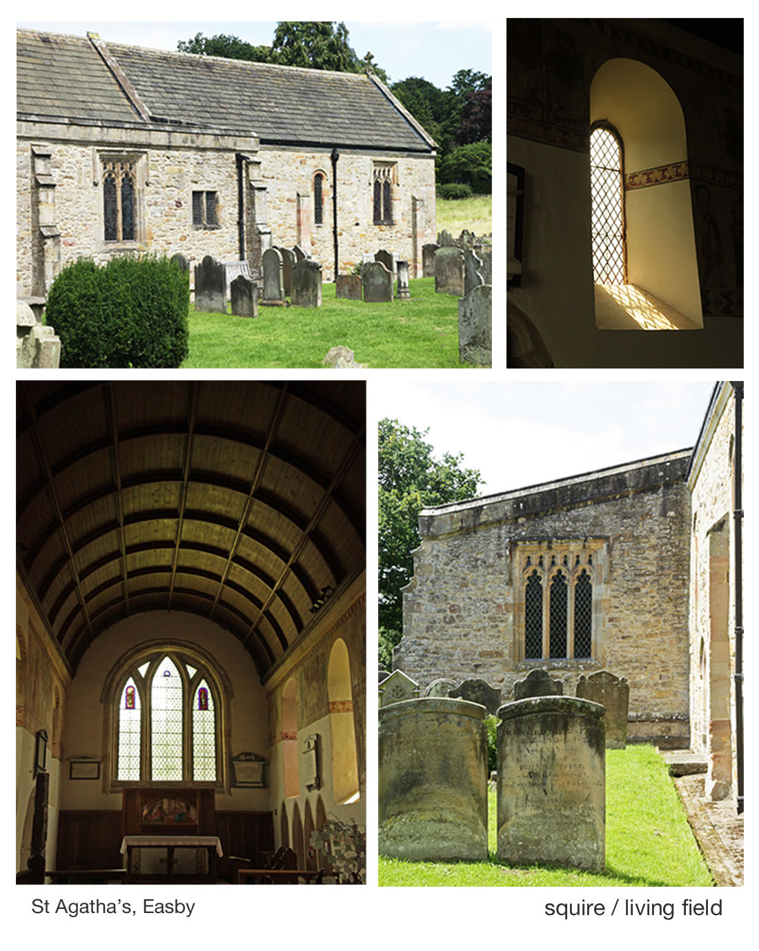
The historic watermill at Blair Atholl. Absence of corn growing in the surrounding area today. Extensive field systems and enclosed land in the mid 1700s. Andrew Wights 1780s descriptions of innovation, enterprise and crop diversification. Part of a Living Field series on old corn mills.

The watermill at Atholl [1] offers a welcoming break to journeys along the A9 road, offering – in addition to the working mill – coffee and freshly baked bread from a variety of grains. In 2017, the mill and its bakers gained some deserved exposure on a BBC2 television programme, Nadiya’s British Food Adventure, presented by Nadiya Hussain [1].

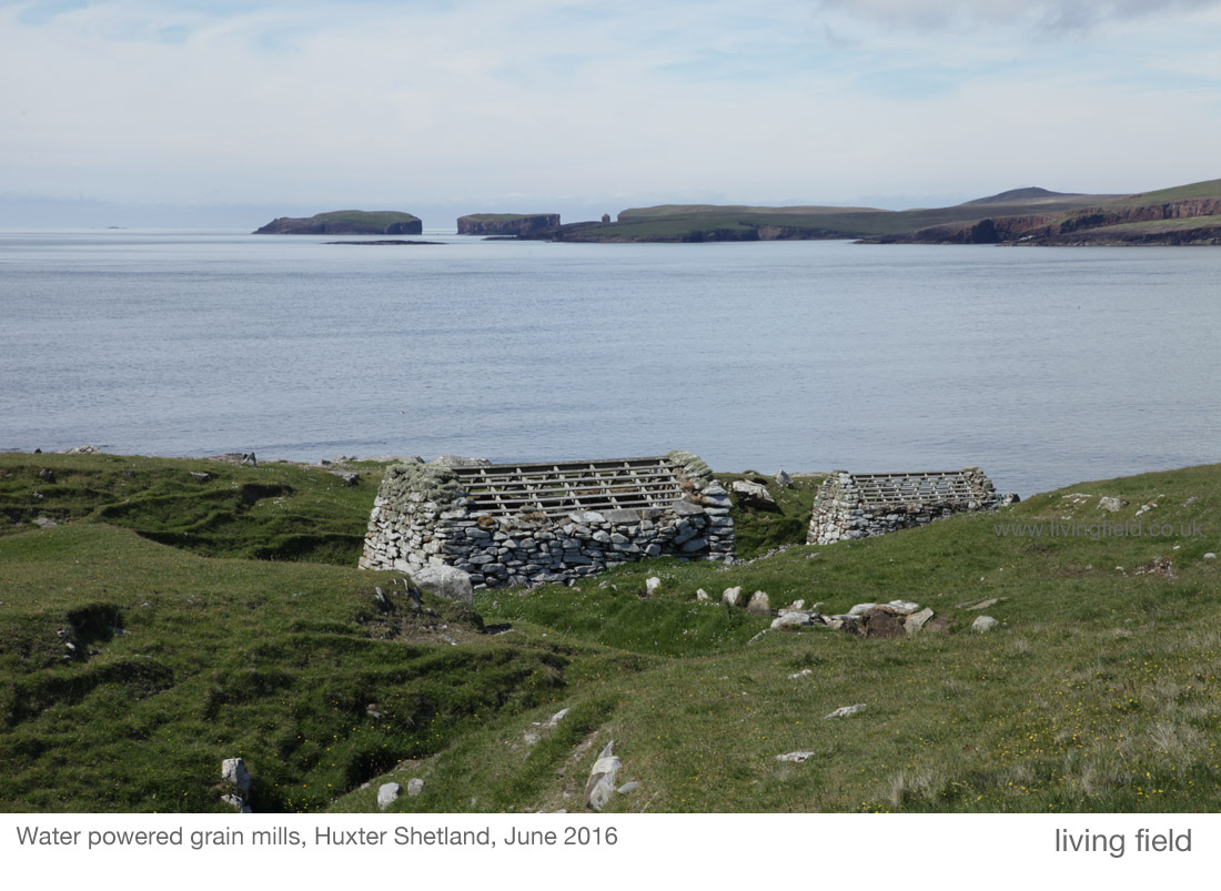
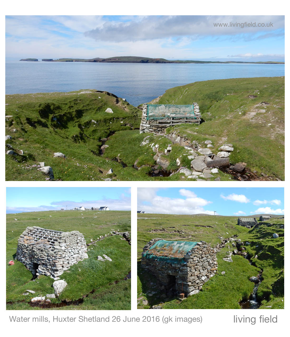
The remaining corn mills in the north of Britain tell much about the phasing in and out of local corn production over the last few centuries. The Living Field’s interest in this case lies in the mill’s history and location, being a substantial building but presently in an area that has no local corn production. In this, it differs from Barony Mills in Orkney which lies within an area of barley cultivation that still supplies the mill [2].

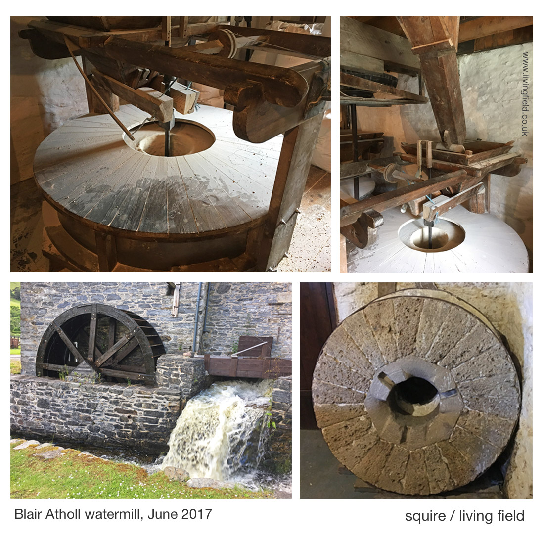
The images above show the water wheel fed by a lode that runs from the river Tilt to the north, the main grinding wheel (covered, top l), hoppers feeding the wheel and an old mill wheel. The watermill’s web site [1] and the explanation boards in the mill itself describe the history of the building and workings of the machinery.

The Atholl watermill was a substantial investment, but what strikes today is the absence of corn-growing (arable) land in the area. When visited in 2017, very few fields were cultivated.

What do the historical maps tell us?

The information inside the mill states that it was present at the time of Timothy Pont’s map of the 1590s [3]. It is there on his map, just south of ‘Blair Castel’. But Roy’s Military Survey [4] of the mid-1700s gives the best indication of the possible extent of cropped land in the area. Features on the Roy map (copied below) include ‘Blair Kirk’ (church) which still stands at what is now known as Old Blair and ‘Tilt Bridge’ on the road that ran north of the Garry; then areas of enclosed land or parkland, bounded by tree lines; and the Mill, shown within the white circle in the upper map, with its lode clearly leaving the River Tilt to the north and flowing past the mill to enter the River Garry upstream of where the Tilt joins it.

The Roy Map shows what appear be clusters of field systems on both sides of the Garry, depicted by short parallel lines suggesting rigs, some indicated by white arrows on the upper map. The lower map has been displaced to show more field systems around Aldclune.

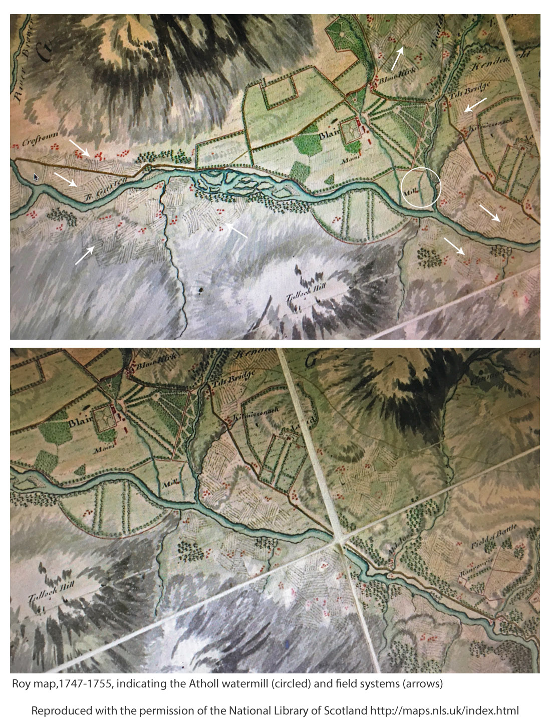
Later, on the first edition of the Ordnance Survey 1843-1882, the village of ‘Blair Athole’ has started to take shape, the corn mill is marked being fed by a Mill Lead originating at a sluice off the River Tilt. Later still, the Land Utilisation Survey 1931-1935 shows arable land remaining, consistent with the location of many of the field systems on Roy’s map.

Therefore crops, and they must have included corn, whether oat or barley, were grown in the region and presumably fed the mill, but more information on what was grown was reported by Andrew Wight, travelling 30 years or so after Roy.

Andrew Wight’s survey of 1784

Mr Wight’s surveys of agriculture in Scotland in the 1770s and 1780s again provide rare and sometimes surprising insights. He meets and reports on mainly the improvers, the landowners and their major tenants, less so the householder and small grower. Yet he was there at a crucial time in the development of food production and able to present a unique and consistent account throughout mainland Scotland.

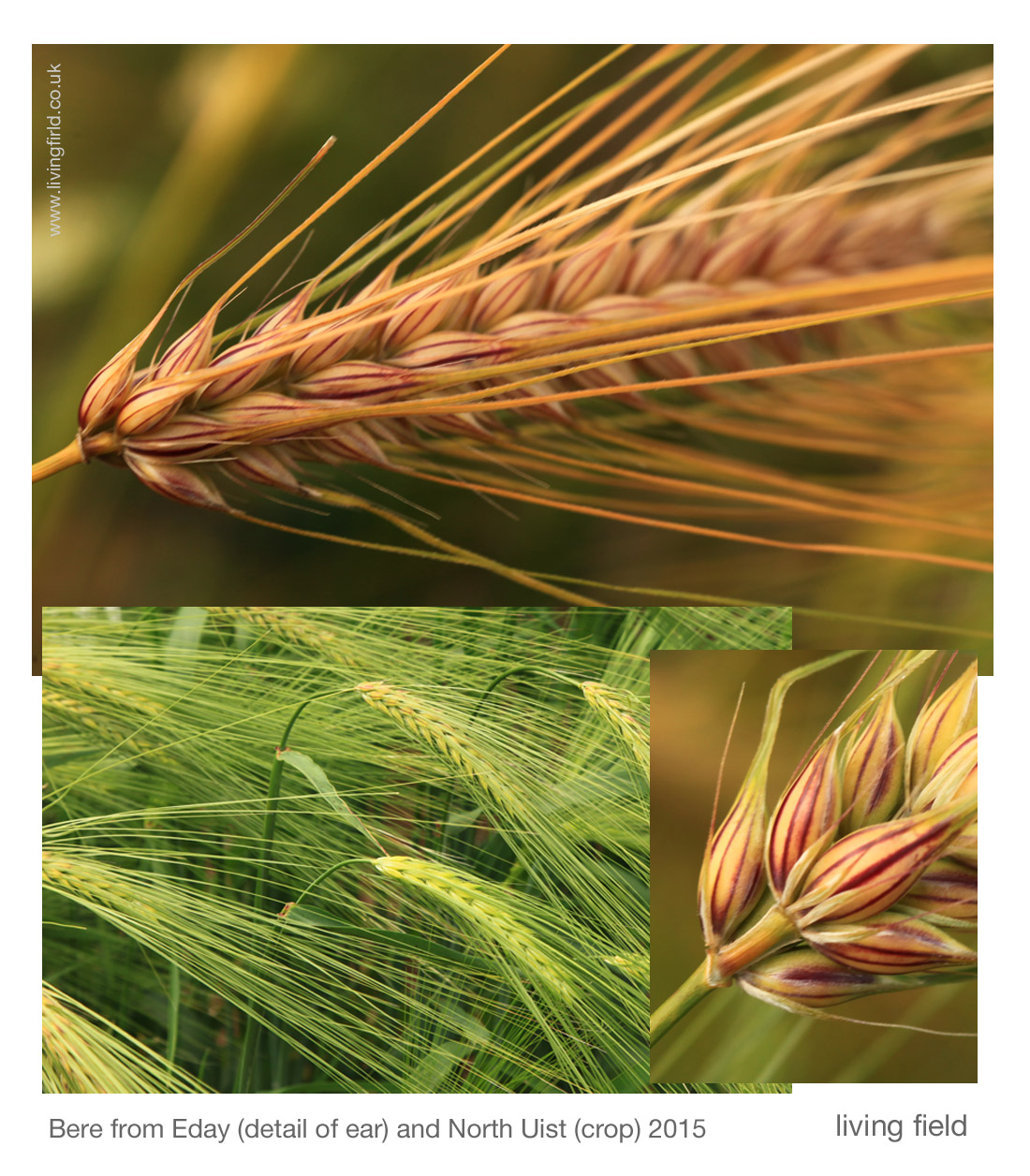
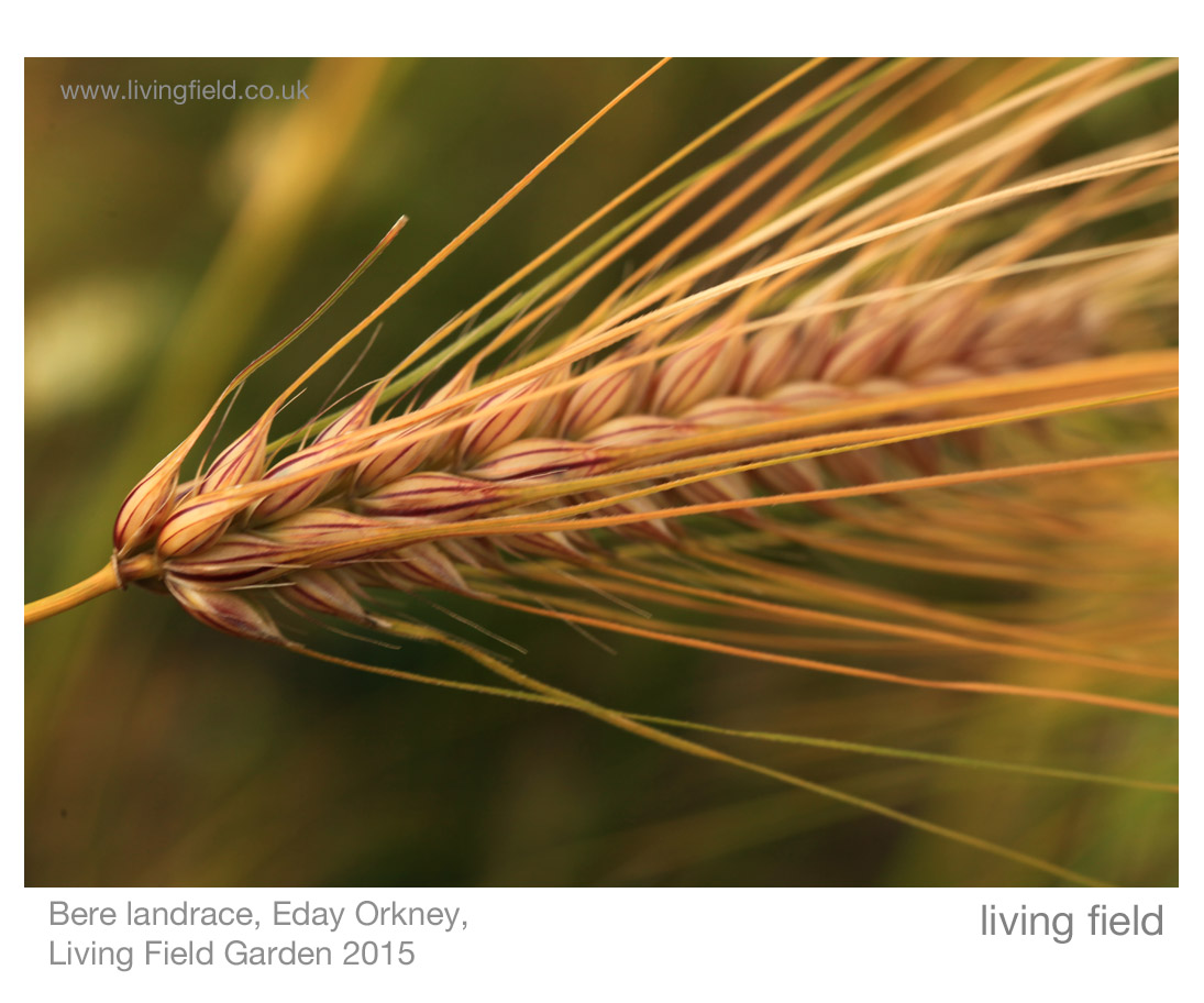
Part way through his fourth survey [6], he spent the night in Dalwhinnie, then on travelling south towards lowland Perthshire, he stopped at Dalnacardoch, commenting that the innkeeper was a ‘spirited and enterprising’ farmer. There he reports a “clover field, dressed to perfection; an extraordinary sight in this barren country” and also “turnips in drills in perfect good order, pease broadcast, bear and oats with grass-seeds”, and notes ‘great crops of potato are raised here’. [Ed: bere is a landrace of barley.]

On ‘Athol House’ (near the mill) he concentrates on the animals, various breeds and hybrids of cattle, and also sheep; but on the tilled land, he writes the “Duke’s farm is about 700 acres arable; of which not more than 120 are in tillage, the rest being hay or pasture.” The rotation is “turnip broadcast, barley, oats and turnip again”. So corn crops – barley and oats – occupied 2/3 of the 120 acres, equivalent to 80 acres or 32 hectares (abbreviated to ha, 1 acre = 0.405 ha). It is uncertain what this land yielded at that time, but assuming it was 1 t/ha or one-fifth of todays typical spring cereal harvest, then that’s 30 tonnes of corn annually. By itself it does not seem enough for such a big mill.

Again, it is unclear whether tenants and crofters are included in the stated area, but they were probably not. For example, later he mentions tenants, including the innkeeper and farmer at ‘Blair of Athol’ who grew corn for his own local consumption. The extent of other corn land cultivated by small tenants, for example, on the field systems shown in the maps above, is not mentioned.

Mr Wight continues in his appreciation of the standards as he moves south, finding after Killicrankie and towards Faskally, an enchantment of orderly farmland. On the road south to Dunkeld, he writes ‘hills on every side, some covered with flocks, some with trees and small plantations, mixed with spots of corn scattered here and there; and beautiful haughs variegated with flax, corn and grass.’

Driving along the A9 road today, the land flanking the Garry seems impoverished and the climate inhospitable for crops, but Wight presents an entirely different view: innovation, improvement, and diversity of plant and animal husbandry. As in many upland areas, the land reverted to poor pasture, in some instances as recently as the 1980s. Why? Higher costs of growing crops, low profit margins, easier alternatives based on better transport connections and ready imports of cereal carbs.

Sources, links

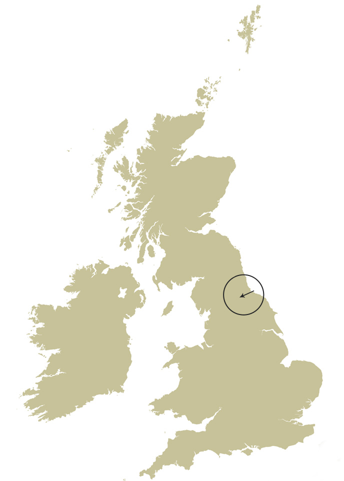
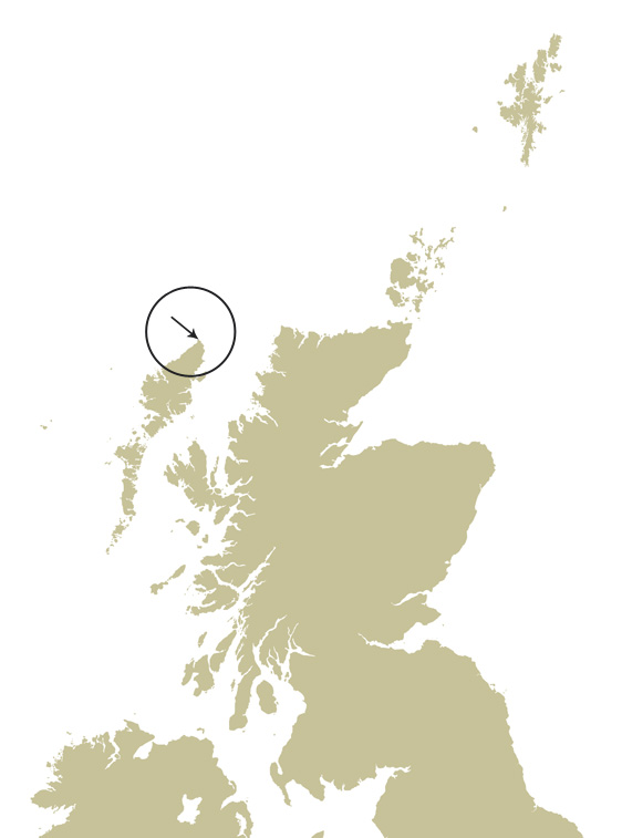
[1] Blair Atholl Watermill and tearoom. Location shown on map, right. http://blairathollwatermill.co.uk (check web site for opening). The mill and its bakers were featured in 2017 on BBC2’s Nadiya’s British Food Adventure.

[2] Living Field articles on water-driven corn mills: 1) Shetland’s horizontal water mills and 2) Landrace 1 – bere (Barony Mills, Orkney).

[3] Pont maps of Scotland ca. 1583-1614, by Timothy Pont http://maps.nls.uk/pont/index.html

[4] Roy Military Survey of Scotland 1747-1755 http://maps.nls.uk/roy/ The web site of the National Library of Scotland (NLS) allows educational and not-for-profit use: acknowledgement given on the map legend.

[5] Land Utilisation Survey Scotland 1931-1935. “The first systematic and comprehensive depiction of the land cover and use in Scotland under the supervision of L. Dudley Stamp” http://maps.nls.uk/series/land-utilisation-survey/ See also
https://digimap.edina.ac.uk/webhelp/environment/data_information/dudleystamp.htm

[6] Wight, Andrew. 1784. Present state of husbandry in Scotland Volume IV, part I. Edinburgh: William Creech. The sights noted above, between Dalwinnie and Dunkeld, are described at pages154-165. [Available online, search for author and title.] Other reports of Mr Wight’s journeys are given on this site at Great quantities of Aquavitae and Great quantities of Aquavitae II.


Labours of the Months

A note to the Living Field’s exploration of The Year. The Labours in Medieval art and craft. Labours in the remaining Easby church murals, Yorkshire, ca 1250. Adam and Eve in the tradition: delving and spanning. The reformer John Ball. Modern Labours and the Crow. 

The ‘Labours of the months’ was an artistic theme that recurred in cathedrals and churches across Europe in the middle ages, typically 1200-1400 AD or 800-600 years ago [1]. The Labours, depicting rural activities through the year, were sometimes paired with the signs of the zodiac. They were crafted in stone, wood and stained glass and occasionally in wall paintings (murals). The great cathedrals of France and Italy display many fine examples.

The Labours  had a role in reinforcing power and privilege. In the Très Riches Heures for example [2] the paintings show well turned out peasants about their seasonal activities, but overlooked and dominated by great palaces and castles. And not all the Labours were about the agricultural year: hunting with hawk and dog would also have been the preserve of the wealthy.

So now to Yorkshire …

The Easby Murals

In the church of St Agatha at Easby [3] Yorkshire, four of what are thought to have been 12  murals remain of these Labours of the Months, dated to around 1250 along with several murals depicting scenes from the Bible. There are apparently very few other wall paintings of ‘The Labours’ from medieval Britain, and none to compare with these. 
lf_ntsmgs_stgthmrls1_gs_1100

These murals were originally painted on dry plaster, but found covered with lime wash, presumably to prevent them being seen and defaced during Henry VIII’s purges of the monasteries in the mid-1500s. They were uncovered in Victorian times and restored again in 1994 [4]. The remaining 8 have not survived.

A notice in the church states that two of the remaining Labours are from spring, sowing and pruning, and the others, digging and hunting, from winter. Those of sowing and pruning are the best preserved.

The church at that time was next to a monastery, Easby Abbey, now a well kept ruin [5], and the resemblance of monks’ hair styles (tonsures) in the labourers depicted suggests that the painter’s models were working canons from the Abbey rather than common people.

lf_ntsmgs_stgth_mrls2_gs_1100

Yet the presence of this ‘Labours’, so close to central Christian themes, and in a humble church, shows the importance of the year’s cycle to the people and the beliefs at that time. As in the great cathedrals, hunting on horseback with a hawk features in one of the four (lower right in the images above). The hawk itself looks more like a crow and not too different from the crow observing the sower.

Who was then the gentleman …?

Another of the murals, not part of the ‘Labours’, but one of a set on early Christian themes, shows Adam digging and Eve sat on a rock or tree stump spinning, symbolic mundane tasks that they would have to do for eternity after their ejection from the Garden in the book of Genesis.

lf_ntsmgs_stgth_dgspn_gs_750These symbols of husbandry and craft have resonated throughout recent history, not least when the preacher for social justice and equality, John Ball [6] wrote in the 1300s not long after the Easby murals were painted:

“When Adam delved and Eve span, who was then the gentleman.”

He was querying why privilege and power should still so dominate and make miserable the lives of working people in what was purportedly a Christian country. That power was uncomfortable with the idea of social justice and John Ball came to a violent end, being cut into pieces and displayed in different parts of the country.

John Ball’s memory has also been kept in writings and songs, notably that by Sydney Carter [6].

In the mural at St Agatha’s, Adam is fully clothed, and Eve not quite, but in the folk tradition they can be without. In the song “Old Adam” – which has a delving and spanning refrain –  is the line “he never paid his tailor’s bills because he wore no clothes” [7].

Modern labours

The Labours of the months was given a new treatment by the writer and artist Clare Leighton in her ‘The Farmers Year’ published in the 1930s [8]. She begins with the Labours of Lambing, Lopping and Threshing, then in the month of April, Sowing; and the time of the engraving is more than 500 years after Easby, yet the farmer is broadcasting by hand, carrying the grain in a basket slung in front of him.

Her sower strikes a similar pose to that in the Easby murals, but with right arm back after flinging the seed. Her sower is more rugged, of the earth, not with smock and tonsure but with weathered face and trousers tied below the knee and having a wife waiting for him at the farm.

lf_ntsmgs_stgth_clswng_750

Though she admits most sowing and other field work was then done with machinery, Clare Leighton chooses to engrave this sower, and writes ” ….. but here and there a farmer remains who still feels some warmth come up to him from the earth as he strides his fields, and to whom the land is a matter of emotion as well of economics.”

The crow?

The presence of the crow, following the Easby sower, recurs throughout the tradition. Crows observe the human condition, taking advantage where they can. In traditional song, two crows find a ready meal in a new-slain knight, deserted by his dog, his hawk and his lady. The crows are thinking aloud about which of them will feast on the eyes.

Of contemporary artists, Alan Stones has a special eye for crows and ravens [9]. In his lithograph – Brother Sun – a crow observes a man, a shepherd, coiling barbed wire. Another crow flies away low over the field. In a charcoal drawing, two crows peck before a gnarled hawthorn tree. His series ‘Divided self’ show crow-type birds standing on sheep and the series ‘Raven’ brings out the unearthly power of the great black birds.

The murals at St Agatha’s, Easby, are part of a European heritage and a continuing tradition [including colouring-in if that’s your fancy 10].

Contact / author: geoff.squire@hutton.ac.uk, visited St Agatha’s on 9 July 2017.

Sources, references, links

[1] Labours of the months: for general background and examples, see the Wikipedia page https://en.wikipedia.org/wiki/Labours_of_the_Months; and The Paradoxplace web site shows Labours and Zodiac in stained glass at Chartres, France c1217

[2] The illuminated manuscript, Très Riches Heures can be viewed at Public Domain Review: https://publicdomainreview.org/collections/labors-of-the-months-from-the-tres-riches-heures/.

[3] Easby Parish Church – a brief guide. Bargate Publications, Richmond, North Yorkshire, www.bargatepublications.co.uk. A notice on one of the walls states that the murals were originally painted on dry plaster and pre-date the Florentine Giotto (c. 1267-1337) and the Sienese Duccio (active 1278-1319). The church contains a replica of the Easby Cross, of sculpted stone, now in the V&A London. The photographer and historian Stiffleaf has a bank of images at http://www.ipernity.com/tag/stiffleaf/keyword/28360/@/page:69:18

[4] The Easby Church guide states: ‘…. they were uncovered during the Victorian restoration and restored again in 1994 by Perry Lithgow (a company specialising in architectural restoration) assisted by a grant from English Heritage.’ More photographs of the murals can be viewed at Wasleys.org.uk.

[5] Easby Abbey was founded in the 1150s for the Premonstratensian Order, itself founded in about 1121 in Prémontré, in France. The Abbey was destroyed in the 1540s in Henry VIII campaigns. Information at English Heritage http://www.english-heritage.org.uk/visit/places/easby-abbey/

[6] John Ball: the Wikipedia entry gives general background. Sydney Carter wrote the song ‘John Ball’ for the 600th anniversary of the Peasant’s Revolt of 1381. Perceptive commentary at ‘Songs that grow like trees: an appreciation of Sydney Carter (1915-2004)’ on the web site Early Music Muse – musings on medieval, renaissance and traditional music by Ian Pittaway. Chris Wood sings ‘John Ball’ on his album Trespasser:  ChrisWoodMusic.

[7]  The traditional song “Old Adam” is performed (2016) by Fay Hield and the Hurricane Party on the CD album Old Adam, 2016, Soundpost Records, www.fayhield.com.

[8] Clare Leighton, 1898-1989, writer, artist and engraver. For examples of works, see clairleighton.com. Source: Leighton, C. 1933. The Farmer’s Year – a calendar of English husbandry. Little Toller Books, Dorset.

[9] Alan Stones at www.alanstones.co.uk.  ‘Brother Sun’ and other early lithographs can be viewed at Lithographs – Farming (1984-1992); crows and ravens at Lithographs (1996-1999).

[10] Institute for Medieval Studies University of Leeds
Downloadable page for colouring, Labours of the Months, January to March https://www.leeds.ac.uk/arts/download/2753/labours_of_the_months

lf_ntsmgs_lbrsyr_stgth_gs_1100

[Edited 17 September 2017]

Bere battered fish

Grannie Kate’s back with a new use of bere meal ….. she writes …

“Fed up of ‘days old’ fish from the supermarket? Try stopping a local fish van to see the beautiful produce on sale!

lf_ntsmgs_brbttr_gk_750

This was what I did last Friday morning at 9.50 a.m. precisely and bought some haddock (landed that morning) from a mobile fish merchant from Anstruther.

The van horn was tooted loudly in the Main Street and behold people silently appeared to purchase from a wide selection of sea food displayed in the back of the refrigerated van. The old word ‘fishmonger’ seems to be out of fashion these days, ‘fish merchant’ now the preferred description

Home made fish and chips then, for tea, using my mother’s recipe for coating the fish before frying in oil. Haddock (and other white fish) tend to break up in the frying pan if they are fried without coating them first.

Fresh haddock from the sea and …… earthy bere meal from Barony Mills!

What to do

  1. Place a large tablespoon of bere barley on a plate and then (if preferred) mix with white flour, e.g. another large tablespoon or less depending on your taste.
  2. Grind sea salt and black pepper into the flour to season it.
  3. Crack a fresh free range egg into a small jug and whisk it until the yolk is well mixed with the white.
  4. Wash the fish ( this is important especially if the fish is not as fresh as you would wish and actually smells; remember, fresh fish does NOT smell!). Cut the fish in half lengthways to give 2 portions. Then cut again diagonally across the portion to give two or three smaller pieces or goujons. You now have about 6 goujons of fresh haddock.
  5. Dip each goujon into the egg, shake off the excess egg wash then place onto your flour, rolling it around until it is covered. Repeat for all the haddock pieces.
  6. Add some light cooking oil into a frying pan and heat – to test the temperature is right add a little bit of flour to the oil and it should start to bubble up immediately.
  7. Add all your goujons to the oil, fry for about two or three minutes on one side, then two or three minutes on the other on a medium heat.
  8. Lift out with a fish slice onto some kitchen towel and blot lightly to remove excess oil.

The goujons should be light brown with a thin crispy coating of bere meal on the outside.

Serve with fresh garden peas and homemade chips. Add salt and vinegar or wedge of lemon and perhaps some tartare sauce!

Delicious………!
Links

The bere meal was sourced from Barony Mills in Orkney. For more on Orkney bere, see: Bere line rhymes with hairline and Landrace 1 Bere.

And for other bere recipes on this site – Bere bannocks and Bere shortbread and Seeded oatcakes with bere meal …..


On the edge

Remote, extensive rig system (lazy beds), north Lewis; historical records of crops from 1690s; bere and barley; subsistence farming on the atlantic edge.

One of the remotest field systems in Europe lies near Eoropaidh (Eoropie) on the north-west coast of the Island of Lewis, facing the Atlantic at 58 N.  Continue round that parallel and you’ll cross Quebec in Canada, the Gulf of Alaska and Russia’s Kamchatka Peninsula.

The Butt of Lewis lighthouse [1] lies at the northern tip of the Island. As you walk south west from there, the soil and grassy vegetation  appear to be slipping towards the cliffs and into the sea.

lf_ntsmgs_dgfmg_rsnbttlws_gk_1100

A little farther south, and the cliffs descend to a rocky shore where the rigs or lazy beds were cultivated close to the tide. It’s a stunning position – go west and there’s no more land until north America. And what Atlantic storms there must be. Yet corn and other crops were grown here.

As testament, the rigs remain as long, grass-covered mounds 5 to 6 m between the furrows, some at more or less right angles to the coastline, others parallel to it. Earth was dug and piled from both sides into the centre and seaweed carried from the beaches and heaped on as fertiliser. Excess water ran down the furrows.

lf_ntsmgs_dglws_lkngwst_gs_1100Extensive field systems

The rigs in the images are one of several field systems around Eoropaidh and Butt of Lewis. The Canmore web site [2] describes the field system in the photographs here, which lies south west of the lighthouse and facing west, and several others (round the ‘top’) to the south east of the lighthouse. All are abandoned.

They are considered to be post-mediaeval but period uncertain.

Aerial photographs are given for each location on the Canmore site [2] and other pages on that site tell more of the history of the area [3].

lf_ntsmgs_dgfrmnglws_lzbd1_gk_1100
Looking inland towards Eoropie, one bed running across, and the others up and down, March 2017 (gk-images)

Lazy Hardly. Lazy beds in various parts of Scotland and Ireland were constructed to different designs. They are of various widths and heights. One explanation of the word is that they are made, not by digging up and completely turning sods of earth and grass, but rather cutting the sod on three sides, then flipping it over the uncut side to form  a double layer – soil, vegetation, vegetation, soil. The method is shown in some recent videos [4].

But the most likely meaning is indicated by Fenton [4] as ‘from an obsolete sense of the English word (lazy), meaning uncultivated’, and refers to the fact that the raised bed is made on top of a strip of uncultivated ground.

Maintaining fertile rigs of the extent seen today around Eoropaidh was a major undertaking, needing the work of (according to Martin below) probably hundreds of people each year.

The method by which this land was managed is known as runrig, ‘a system of joint landholding by which each tenant had several detached rigs allocated in rotation by lot each year, so that each would have a share in turn of the more fertile land’ [5].

Fenton and Veitch (2011) give explanations and many references to the runrig system in different parts of Scotland.

lf_ntsmgs_dgfrmnglws_lzbd2_gk_1100
Looking uphill from the shore, the central rig about 5 m wide (gk-images)

Historical records

Several accounts of the area  were made from the 1690s onwards, but they make no mention of the field systems and give little information on the crops and methods of husbandry.

Why this omission? The extensive rigs must have been there during one or more of these accounts, The landforms look impressive to us today, the result of decades, centuries, of hard work, and continued upkeep.

Martin Martin’s visit in the 1690s

Martin Martin, from Skye, visited Lewis in the 1690s and reported his findings in the Description of the Western Isles of Scotland, published 1703 [7].  On soil cultivation, he reported that the people turned the ground with spades; and with wooden harrows for breaking and smoothing the earth, drawn by a man ‘having a strong rope of horse hair across his breast’.

He writes ‘the island was reputed very fruitful in corn, until the late years of scarcity and bad seasons. The corn sown here is barley, oats and rye; and they have also flax and hemp.’ [8] He continues to relate that the main fertiliser is sea-ware but that soot is also used, reportedly causing jaundice in those who eat bread from corn grown on land so treated.

However, there is no mention in his chapter on Lewis of rigs, lazybeds or any means of land-sharing.

Potato is often associated with rig systems but it was not grown in Scotland until several decades after Martin Martin wrote his journal, so it would not have been on the Island when he visited.

lf_ntsmgs_nthdglws_rckcst_gs_1100
Coastal rocks, resting place of seabirds, south-west of the Butt of Lewis, looking west (Squire/Living Field)

A note of caution is due – Martin is not always credible. What a pity when reliable records from that time are so needed! At various places, he related what we would today consider fabulous or supernatural occurrences, without question, as if they happened.

He was knowledgeable about many things, so was he tempting readers with fake news, or did he not check his sources?

Old Statistical Account, 1797

The Rev Donald Macdonald wrote ‘not a single tree, or even any brushwood, to be seen in the whole parish’. The crops were black oats, bear and potatoes, sown April and May, reaped in September and October. (Ed: black oat is Avena strigosa and bere a landrace of barley, Hordeum vulgare).

He confirms the use of soot as fertiliser as reported by Martin a century earlier. He writes that the roof of each house is thatched with stubble and heather ropes (stubble presumably being cereal stems) which become covered in soot due to the burning of peat within. He writes that in the latter end of May when the barley blade (first leaf) appears, the people take the soot and stubble and strew it over the crops as fertiliser.

Many domestic animals were reported – horses, sheep and black cattle, all small in stature. The region was very isolated, things had to be carried to and from Stornoway.

Potato came to the area between Martin’s visit and this account, but there is no mention of rigs or lazybeds. Just that many crude ploughs are found in the parish, consisting of a small piece of crooked wood, guided by a side handle held by a man walking alongside, and pulled by four small horses.

lf_ntsmgs_gdelws_bchsndstm_gs_1000
On the beach, Eoropie – wide stream in the foreground, flowing across the beach from inland; hazy light due to sand from the dry part of the beach blown inland (Squire/Living Field)
New Statistical Account, 1836

The Rev William Macrae notes also the absence of wood or tree, but  that roots and trunk of fir, oak and hazel (with nuts) are ‘imbedded in a great depth of moss, such that wooded land must ‘at some remote period, have undergone some sweeping and desolating revolution’.

He mentions that people eat oat and barley meal, potatoes and milk, but laments the state of farming: that people have not attempted draining or trenching because they were just too hard up, while short tenancies of 6-12 years did not making it worthwhile. It was a subsistence economy with no exports and in no season was produce more than ‘barely sufficient, and sometimes not adequate, to supply the necessities of the tenantry’.

There is no mention of field systems or rigs, and the comment on the absence of drainage is not consistent with what we see today, but he may have been generalising to the whole of Barvas parish rather than these rig systems.

The Rev Macrae commented on many other aspects of life. His account is entertaining, but you feel his mind sometimes strays: he is patient to note among the statistics of population, produce, and adherence to the faith, that ‘The women are modest, comely and many of them good-looking.’

Modern field strips

Visitors today will see the agricultural land in crofting townships on Lewis divided into long thin strips, usually separated by fences. The OS 1:25,000 maps show these bundles of linear features covering much land near the coast.

lf_ntsmgs_frmgdg_crftlws_gs_1100
Draining and de-stoning croft land (upper); sheep on long strips of grazing land demarked by post and wire fences (lower): both north-west Lewis (images by Squire/Living Field)

One of the stated characteristics of linear farming of the type shown above is that, provided the strips run perpendicular to the main gradient in slope or soil, no one strip gets the best land and no one gets the worst.

This sharing of good and bad appears to be one of the reasons why crops, especially in the tropics, are sometimes mixed in a field, not in clumps but in long straight lines [11].

A note on bere and barley

The Living Field has a biding interest in when bere and barley were noted as being different things, e.g. that bere was a primitive landrace of barley. The story unfolds on this site at Bere line – rhymes with hairline.

There is nothing definitive in any of these historical accounts as to whether bere and barley were considered different. In the Old Statistical Account of Barvas parish [9], as noted above, both names are used for the barley crop but neither is defined.

lf_ntsmgs_dglws_br_gs_1100
Landraces of bere (barley) from Eday and North Uist grown in the Living Field garden in 2015 (Living Field)

In 2015, the Living Field team grew a range of old barley varieties in the garden, including some bere landraces  originating from various parts of the north.

We had none from Lewis, but shown above are bere from North Uist in the Outer Hebrides and from Eday in Orkney. Barley grown in the lazy beds around Eoropie would have looked like this.

An achievement

The land was farmed in this way for centuries, in isolation from much of the rest of the world. Given the location,  the rig systems in north Lewis and elsewhere should be seen as a major achievement rather than something to be dismissed as backward (as some travellers did).

Crop production was limited by plant nutrients – nitrogen, phosphate, potash and the many minor elements. Legumes that provided much needed nitrogen by fixation from the air were not mentioned in the historical accounts, and were unlikely to have been planted as crops here as they were during the Improvements era after 1700 in the lowlands.

Apart from seaweed and soot, and probably animal dung, there was no other source of nutrients. To have survived for so long on so little was the achievement.

Author and contact for this article: geoff.squire@hutton.ac.uk. Thanks to gk-images for allowing us to use some of their photographs.

[Began late March, edited in April and May 2017]

Sources

[1] Northern Lighthouse Board: Butt of Lewis Lighthouse.

[2] Field systems of lazy beds around Eoropie and the Butt of Lewis on the Canmore web site: the one shown in the photographs here is west of Eoropie, Canmore ID 129505. Others include ID 270561, ID 270560 and Dun Eistean ID 4417.

lf_dglws_mp1_gs_350[3] More on the history of the area at the Canmore pages for Eoropie, Teampull Mholuaidh (St Moluag’s).

[4] Lazy beds: Guthan nan Eilean short video on making lazy beds in Uist (in Gaelic and English versions). A article from Ireland: Lazy beds in the Cooley Mountains. From the Louth Field Names project. The origin of the word lazy, from ‘uncultivated’, is explained by Fenton A, Ch 27, p 673 in Fenton & Veitch 2011 [6].

[5] Definition of runrig in the Concise Scots Dictionary. Ed. Mairi Robinson. 1985. Aberdeen University Press. Also: The runrig system of land tenure, fromThe Angus Macleod Archive via Hebridean Connections.

[6] Fenton A & Veitch K (eds). Farming and the Land. 2011. Publ: John Donald & European Ethnological research Centre. This multi-authored book has many references to runrig and lazybeds, including photograph of lazybeds at Eoropie (p 125); and a note that the runrig system in north Lewis may have been managed by small groups of people, rather than individuals.

[7] Martin Martin, 1703. A description of the Western Islands of Scotland. Printed in London. Available online: search Google Books for the author and title; also the Undiscovered Scotland web site offers the book online (with adverts). Undiscovered Scotland web pages: biography of Martin Martin, died 1719.

[8] Martin is probably referring to the Ill Years, the 1690s when a run of very bad weather caused repeated crop failure and consequently hardship and famine through the north of Britain.

[9] Old Statistical Account of Scotland, 1791-99: Vol XIX dated 1797 for the Parish of Barvas. Online at Old Statistical Account.

[10] New Statistical Account of Scotland, 1834-45: Vol XII for the Parish of Barvas. Online at New Statistical Account and also at Google Books.

[11] As argued in the editor’s account of Mixed cropping in Burma (Myanmar).

And if you are anywhere near latitude 58 N, make a point of visiting the famous –

eoropiedunesparklogo

Information at eoropiedunespark.co.uk


Effect on corn yields of the 2016 winter flood

High annual rainfall in recent decades causing problems for cereal production; timing of rainfall more important than yearly total; much greater yield drop caused by the wet harvest of 2012 than the winter floods of 2016. [An article in the series ‘Winter flood’.]

The last few decades have experienced several of the highest rainfall years since reliable records began in 1910. The effects of perhaps too much water on long term trends in crop yield are being examined and will be reported elsewhere.  Yet contrasting years tell us already that problems are not caused by the amount of rainfall in a year, but by the timing of that rainfall.

lf_nm_1701_wntrfldcrs_gs_1100

The image above looks south over the Carse of Gowrie in early January 2016, the green cereal (corn) fields and the brown stubble were completely waterlogged, the landscape immersed in dense cloud, hardly any light for photosynthesis in the middle afternoon. (No attempt to brighten the image – this was how it looked.)

Many autumn-sown corn fields grew yellow with the persistent wet, dead patches within them. Yet the final estimates of yield for the harvest years 2016, released in December 2016, give the first indication that the severe flooding the previous winter caused a much smaller loss of yield than the wet harvest of 2012.

lf_ntsmgs_1701_wntfldyld_gs_750

Fig. 1. Grain yield, average for Scotland, for wheat, spring barley and oilseed rape between 2000 and 2016: the first two standardised to 14% water content, the latter to 9%; horizontal lines show the average.

The trace in yield from 2000 (Fig. 1) shows a drop in 2002 for the two cereal crops, then a period of stability up to 2011 followed by a large fall in 2012. Yield partly recovered in 2013, rose well above the average in 2014 and 2015, then dropped back in 2016.

The same data are shown in Fig. 2 where yield of each crop is expressed as a percentage of the average for the whole period (100% line). The large depression in 2012 and 2013 is shown by all three crops as is the recovery and the later drop in 2016. The 2012 depression caused economic losses, but perhaps more important, the large variation between years shows how sensitive modern arable farming is to these slight variations in the weather.

lf_nm_1701_wntrfldyld_gs_750

Fig. 2. Grain yield from Fig. 1 presented as a percentage of the average for the period, for wheat (red), spring barley (green) and oilseed rape (blue).

It’s not the total rainfall

The annual  rainfall exceeded 1300 mm several times during the period of stable yield between 2003 and 2011, but then the rain generally peaked in the winter. Only about one third of the corn is in the ground at that time (mainly winter wheat, winter barley and winter oat) – the larger area destined for spring-sown barley is still unplanted.

So provided the winter crops are not submerged for more than a few days at a time, they recover and grow to harvest. This happened during the stable phase, for example in 2008 and 2009 when annual rainfall was above 1300 mm.

Why was 2012 yield so poor?

The difference in 2012 and to some degree in 2002 was that rainfall was much higher in summer before and during harvest. In fact, annual rainfall in 2012, at 1287 mm, was lower than that during several years between 2003 and 2011.

It was the wet weather in late summer and autumn of 2012 that caused major loss of yield in the harvest of that year (mostly August to late September). The damage to the ground and to the winter crops just sown or about to be also caused a depression of yield in the next harvest in late summer 2013.

How did 2016 recover?

In contrast, the high rainfall in the winter of 2015/16 set records: in East Scotland December 2015 had the highest rainfall at 272 mm since records began in 1910, then January 2016 also broke all previous records with 266 mm.  The result was prolonged waterlogging of fields and severe flooding of some river floodplains, and as stated above, a yellowing of leaf in many winter cereal fields.

Then conditions changed – the spring and summer months had less than average rain, and more than average sun, allowing soils to dry and crops to bulk, such that they yielded at or not much below the the average in Fig. 2.

lf_nm_1701_wntrfldsl_gs_1100

The image above looks north across the Isla floodplain in Strathmore, in dense cloud just before nightfall, the field in the foreground cultivated, sludging and eroding into the river-water. (No attempt to brighten the image.)

Resilience?

The 2015/16 cropping season was testament to the resilience of the crop varieties and their agronomic management to overcome what was unusual weather by our standards. There’s also evidence that farming adapted, perhaps learning from the 2012 floods to shift its cropping patterns and perhaps the fields in which its most profitable crops were placed.

Winter wheat maintained its area between 2015 and 2016, indicating that few fields already sown with this crop had failed by February 2016 to the extent that they had to be resown in March or April with another crop.

But the surprise was the greater production of oats despite the bad winter. The area sown with oat (mainly spring 2016) increased a little, but the yield per unit area increased from 5.92 to a record 6.44 t/ha (tonnes per hectare) and the total production of oat increased by a factor of 1.32, also to a record for recent decades.

So what was going on? The reasons why oats did so well are not clear at present.

Signs of things to come?

The capacity of grain yield to recover from the late summer rain of 2012 and adapt to the winter floods of 2016 shows the soil and crops have kept a certain resilience during this bout of record rain-years.

But the alarming feature of the traces in Fig. 1 and Fig. 2 is the large variation between years caused by what were – compared to weather patterns elsewhere – fairly small shifts in the distribution of rainfall through the year.

The longer term effects of the present rise in annual rainfall are not yet understood. It will be not easy to distinguish the effects of rainfall from the higher temperatures over the same period – and the lower solar income in cloudy summers

More on this in future articles …

Sources, references

Links on this site

Winter flood – pages on the flooding effect of the high rainfall in recent years.

Winter flood …. continued  – commentary on the 2012 yield depression

The late autumn floods of 2012 – after the bad harvest

Rainfall

Rainfall since 1910 for UK and regions. Annual and monthly totals are available from 1910 at the Met Office pages for UK and Regional Series. At the Download site for UK and regional datasets scroll down to ‘Year ordered statistics’ and click the download link for ‘Scotland E – Rainfall’.

Winter rainfall 2015/2016. The following Met Office web article gives a summary, with maps, videos and data, of the very wet November to January: Further rainfall and flooding across north of the UK. http://www.metoffice.gov.uk/climate/uk/interesting/december2015_further Jan 27 2016

Cereal and oilseed yields

Scottish Government. Final estimate of cereal and oilseed rape harvest 2016. Downloads are available as pdf and excel files. In the excel download, Tables 2 and 3 give cereal and oilseed rape areas, yield per hectare and total production from 1997 to 2016.

Yields, take from government statistics, are given in tonnes per hectare, t/ha, standardised to a water content of 14% for the cereals (corn) and 9% for the oilseed. Standardising is needed because the grain might be a bit drier in some harvests and a bit wetter in others.

Contact: geoff.squire@hutton.ac.uk

Shetland’s horizontal water mills

Corn mills in Shetland, Orkney and the Western Isles; the horizontal water driven mechanism; locally managed and owned; bere and oat;  the similarities of mills in in Europe and Asia.

“The praying machine of Thibet is, I believe, of similar construction.’ (Goudie, 1885-86)

Three small water mills, housed in stone huts, lie one below the other down a small waterway near Huxter in Shetland (HU 172572), west of Sandness and NW of Walls.

lf_yr_ss_wtrmllhxtrshtlnd_gs_1100

They must have been some advance over the saddle quern, which was still in use when Gilbert Goudie investigated Shetland’s horizontal mills in the 1880s. The mills were of a time when each family or group grew its own bere barley and oat and then ground it to meal, to eat.

The mills are small stone buildings constructed along a waterway or burn. They were locally made and owned, sometimes by several families. Goudie cites Evershed (1874): ‘No portion of the material is purchased, except a single clamp of iron”. The millstones are sourced locally.

The water is channeled off the waterway above the mill along a stone-lined lode (visible in the images below) which enters the mill to turn a paddle wheel under the floor. The mills are called ‘horizontal’ because the force of water turns the paddles in a horizontal plane, rather than vertically as in the later water wheels of the type at Birsay in Orkney.

lf_5_innvcrnmll_hxtr_gkimages_1100

The paddles drive a vertical  iron rod, fixed so it turns the upper of two millstones (up to 3 ft diameter) in the room above. After passing through the paddles, the water then runs out to rejoin the waterway and on to the next mill.

There’s no sign of corn crops in this area today – it is all grazing. Yields of corn are uneconomical now and people can import their bread, rice and pasta from other regions, as do most others in the Atlantic croplands.

But what did bere look like? The photograph below shows a bere landrace from Eday, Orkney,  grown in the Living Field garden in 2015.  Bere in Shetland in the 1800s would have looked much like this – very different from today’s two-row types, but not quite a six-row barley.

lf_5_nnvcrnmll_hxtr_edaybr_gs_1100

But in the later 1800s, the people here probably grew mainly oat, as they did all over Scotland. But which oat – a landrace of the nutritious common oat Avena sativa or one of the black oat Avena strigosa?  Those concerned with the industrial archaeology of the late 1800s rarely noted the crops.

Easier than a saddle quern

The mills were reported by Goudie to grind a bushel an hour. Depending on conversion factors, a bushel (volume) is equal to about 22 kg of bere – which is equivalent to about 15 kitchen-sized bags of flour or meal, though the actual yield of pure meal would be less because of all the chaff (husks, awns) that would have to be be discarded. So not a bad yield for an hour’s work!

lf_5_innvcrnmll_hxtr_grzngshp_gs_1100

Horizontal mills in history

Horizontal water mills had been in use for many hundreds of years when Goudie wrote his account. Both Goudy (1885-86) and Wilson (1960) point to the almost global occurrence of these machines, stretching from eastern Europe and Asia to Shetland and the Faroe Islands. Wilson illustrates characteristic types of mill wheel – Shetland, Irish, Alpine, Israel, Balkan – the design transferred in antiquity across the land masses of Europe and Asia, evidence of the connectedness of the northern islands to the wider world.

So how and when did they get to Shetland? These authors note that despite the similarity between mills in Shetland, the Faroe Islands and Norway, suggesting a common ancestry (9th C?), there is no evidence to confirm the direction of travel. Goudie also points to similar constructions in eastern Europe and Asia, and concludes:

“Almost obliterated as it is elsewhere, it is here still to be found in extraordinary numbers” and “… almost in Shetland only, that we find it in active operation …”.

One factor that hastened the loss of these mills was the (not untypical) action of a landowner, who constructed his own big mill, and then dissuaded families to abandon their small enterprises and pay for the use of his.

Certainly, the mills work no longer to grind meal, except as archaeological curiosities. The last one at Dounby in Orkney was taken over by The Office of Works in 1932.

But what a location! Imagine harvesting and milling bere or oat here on a fine day: sheep on coastal grazing, the Island of Papa Stour over the Bay and Vinland over an unbroken stretch of ocean to the west.

lf_5_innvcrnmll_hxtrvw_gs_1100

Sources, references

Main sources are Goudie and Wilson – both give diagrams of the mechanism

Goudie, Gilbert. 1885-1886. On the horizontal water mills of Shetland. Proceedings of the Society of Antiquaries of Scotland 20, 257-97. Available online via the Archaeology Data Service: http://archaeologydataservice.ac.uk/archives/view/psas/volumes.cfm then click on Volume 20 and scroll down to a PDF of the article.

Wilson, Paul N. 1960. Watermills with horizontal wheel. Society for the Protection of Ancient Buildings (London). Titus Wilson & Son ltd, Kendal. Available online: try http://www.fastonline.org/CD3WD_40/JF/430/22-526.pdf

lf_5_hxtr_thrftclffs_gk_550Further diagrams and general information

Cruden SH. 1948. The horizontal water-mill at Dounby, on the mainland of Orkney. Search: Archaeology Data Service / Archives (shows photograph of the Huxter Mills).

http://sihs.co.uk/features-waterwheel.htm

https://canmore.org.uk/site/69376/huxter-norse-mill

Another mill of similar type at Eshaness
http://www.heard.shetland.co.uk/Projects/Project8.htm

Fenton A. 1978. The Northern Isles: Orkney and Shetland. New edition 1997.

Article and images, taken 26 June 2016: Squire / Living Field; except where stated by gk images.

[Last update 15 July 2016]

Corn grain bread bannocks

A Living Field exhibit at Open Farm Sunday this year on 7 June 2015 10 am to 4 pm at the James Hutton Institute, Invergowrie, Dundee.

lf_cer_plntplt1_gs_550

Plant to plate: see and touch corn (cereal) plants, ancient and modern; have a go at threshing; try hand-grinding grain; see bread, biscuits and bannocks made from bere (an old Scottish barley landrace), rye, spelt and oat.

Images above show (top) ripening ‘ears’ of emmer wheat grown in the Living Field garden, a bag of oat grain and the Living Field’s rotary quern for grinding grain into meal

Contact: gillian.banks@hutton.ac.uk.


SoScotchBonnet

Indigenous crops; Scotch Bonnet; wool, woad and indigo; Tam o’Shanter, Burns supper; staple food of the north Atlantic seaboard; tatties, neeps, oat and barley; the grey cat!

In its undying search for the truly indigenous crop, the Living Field investigated the ‘Scotch Bonnet’, to find it was nothing local at all, but a hot little capsicum, now grown in the West Indies and other tropical places and used to give some spicy heat to food.

Why then is it called the Scotch Bonnet? It seems because it looks like one. Unlike many varieties of the chillies, this one bulges and sometimes flops when it leaves the stem: to some, with imagination, it resembles a Scotch Bonnet, on a head.

The Scotch Bonnet

Now the Living Field is well disposed to the headgear named Scotch Bonnet, originally made of local fibre, usually wool, and dyed blue with woad Isatis tinctoria, which was once grown as a crop in these islands, or with the deeper indigo Indigofera tinctoria, which is imported and replaced woad. Such skill and craft go into making this one little hat: you have to rear the sheep and shear them, then wash, spin and weave the fibre, grow and harvest the woad or indigo, extract the dyestuff, dye the cloth, then form it into a shape that would fit on a head – and it was all done before electricity.

But we see the Scotch Bonnet (headgear) is also called the Tam o’Shanter, and this is, it seems, because Tam in the poem by Burns wears a blue bonnet – it’s mentioned only once, but there it is – ‘Tam’s blue bonnet’.

Sheep being sheared of its wool (top right), wool dyed with woad (bottom right) and indigo, and photograph of scene from Gourdie's Tam O'Shanter showing Tam's blue bonnet in hand (Living Field / details of book below)
Sheep being sheared of its wool (top right), wool dyed with woad (bottom right) and indigo, and photograph of scene from Gourdie’s Tam O’Shanter showing Tam’s blue bonnet in hand (Living Field / details of book below)

Tam o’Shanter

Now these three words do not define what sort of bonnet it is, yet those who have depicted the bonnet in drawings and paintings of the epic give it the character and shape of a Scotch Bonnet, and those such as Alexander Goudie (1933-2004) who have painted in colour give it the colour blue – woad-blue or indigo-blue.

In Goudie’s fabulous paintings, the blue bonnet is there in almost every picture. It grows in significance. Even when chased by Cutty Sark and the other infernals, the blue bonnet stays on. Even when, with diminishing sark, she grabs Maggie’s (Tam’s mare’s) tail, pulls it and leaves just a stump of hair … the bonnet stays on. Considering the state of Tam, and the number and aggression of the infernals .. you wonder how the man and mare escaped? Was there something in these blue-bearing plants that somehow made Tam and his mare go faster or the infernals slower. Doesn’t matter, because if they had caught him, there would be no recitations of the poem and much less fun at Burns Night.

Burns Night

The poem Tam o’Shanter is very much associated with the festivities of the Burns Supper, and through the medium of the Supper, visitors can sample some of the great staple food and drink of the north Atlantic seaboard – oat, swede, potato and barley. Together, and with offal, including lungs, and other fleshly stuff from sheep, they make the traditional meal of haggis, neeps and tatties, the barley going not so much into the haggis as into the dram for those who partake (though, on the Night, the dram can sometimes … well … go into the haggis).

Haggis, neeps and tatties (top), whole swede and sliced swede (Living Field)

Would Burns have known the main crops that now form his Supper – he was a farmer for a few years? Sheep of course he would have known. Of the three main vegetable constituents, only oat has been here for a long time and that for thousands of years. He would have known oat. The neeps, usually swede rather than the (white) turnip, and tatties (potato) are relative newcomers, arriving perhaps a few decades before Burns was born. Burns probably knew about swede and potato but might not have grown them. Barley is older than oat here and he would have known barley and certainly known its products.

So while Burns (1759-1796) is now celebrated around the world, the world reciprocated before he was born by offering the vegetable constituents of his commemorative supper – oat and barley from west Asia, swede from (probably, though it’s not certain) east Europe or west Asia and potato from Central America. What a generous world!

Sources at the bottom of the page give links to his poems and song and to the Scots Dictionary. The image of haggis, neeps and tatties (above) was taken at a Burns ‘lunch’ at the Hutton staff restaurant.  For those who want to know more about the crops, below is something more on swede, potato, oat and barley.

The crops

Tatties

The tatties’ tale is well told elsewhere. Briefly, potato Solanum tuberosum arrived in Britain from the other side of the Atlantic in the late 1500s, but gained little interest other than a garden curiosity until …..

“To Thomas Prentice, a common day-labourer, who lived near Kilsyth, is the honour due of bringing this useful esculent into general notice in Scotland [so wrote Lawson and Son in 1836 only 40 years after Burns’ death … and read on … ] He procured, in 1728, some “sets” from Lancashire, and bestowed considerable care in their propagation; and as their value became known, they were eagerly sought after by his immediate neighbours. By continuing the cultivation he, in a few years, saved upwards of £200, with which he purchased a small annuity, on which he lived independently to an old age, dying at Edinburgh in the year 1792.”

So Thomas got his tattie tubers from Lancashire well before Burns was born and he died only a few years before Burns did. Burns was probably familiar with the potato, but only just. His parents’ generation probably did not know it and his grandparents’ would not have known it. Yet what an explosion of genetic resources there was after that, because little over a hundred years later there were 175 recognised types of potato known to Lawson and Son (1836, 1850) and today there are great collections of genetic resources such as the one at the Hutton Institute.

Neeps

In their list of 1852, Lawson and Son, seedsmen from Edinburgh, write “in modern times the turnip seems to have been re-introduced to this country from Flanders about two-hundred years ago” which is the 1650s or thereabouts, but they also state that the time of introduction and the degree of cultivation of the swede or Swedish turnip is less certain though probably later (let’s approximate to around 1700). By Burns’ time the turnip had become a commercial farm crop in some areas of Scotland. Today the turnip has the botanical name Brassica rapa and the swede Brassica napus.

Both types of turnip were used to feed horses and cattle, but also people. The swede, the same species as oilseed rape, has leaf that is less coarse and hairy than the turnip, bluey-green rather than bright green and generally a yellow-orange flesh rather than white, which colour remains when cooked and mashed. So the neeps that are eaten these days with haggis and tatties are mostly swedes. An excellent vegetable, rich, smooth and distinctive to the taste, one of the very finest of the cabbages.

The corn

Oat Avena sativa and barley Hordeum vulgare had been the staple cereals of the north atlantic seaboard for a very long time. Charred grain of barley has been found in the earliest farming settlements. Their relative popularity has risen and fallen but in Burns’ time, oat was by far the most common, and it is the meal ground from oat grains that binds the animal constituents of the haggis. Today it’s the other way round, barley is the commoner crop, though oat is the one still used in haggis. More on oat and barley can be found on this site at Garden/Cereals and in the series of articles on landraces, e.g. The bere line – rhymes with hairline.

The grey cat?

She says “Arrived, invited, for a SoSCOtchBOnnet photoshoot posing in nothing but a Scotch Bonnet – and what a bonnet! Fine wool, indigo-dyed, cost me the earth … credit card maxed out … but the editor says ‘no nudity on the Living Field web site’ and I had to keep my fur on … no fun in that. Name’s Meggie by the way, like Tam’s horse Maggie but with an ‘e’. I do photoshoots. Call me.”

The grey cat, enigmatic, with natural dye strips (from top) hazel catkins, indigo, dock, rhubarb and (vertical) madder (Living Field)

Sources

Burns poetry. Best get a book of it – there are several – and read it by a fireside on a winter’s night or in a field of corn and poppies in midsummer.

Burns is accessible online, e.g. http://www.robertburns.org and http://www.bbc.co.uk/arts/robertburns/biography.shtml

Tam o’Shanter, a tale by Robert Burns, illustrated by Alexander Goudie. 2011. Berlinn, Edinburgh. More on the artist at http://www.alexandergoudie.org.uk at which – check under ‘paintings’ and ‘Tam o’Shanter’. 

A Scot’s dictionary is handy if you are not familiar, e.g. The Concise Scots Dictionary (The Scots language in one volume from the first records to the present day). Editor in Chief: Mairi Robinson, 1985. Aberdeen University Press. 

Online Scots http://www.scots-online.org and http://www.dsl.ac.uk

Lawson and Son’s exhibitions and lists of 1836 and 1852 are described on this site at Bere in Lawsons’ Synopsis 1852

Bere, bear, bair, beir, bygg

Now here’s an informative article by Iseabail Macleod on the occurrence of names for corn from the 12th century to 1700.

The article starts with: ‘What does the terminology of cereal crops and their products in the Dictionary of the Older Scottish Tongue (DOST) tell us about the language and diet of Lowland Scotland in the period? Her review of the records leads to the statement “Cereals … after 1550 became dominant, as the most economic way to feed a growing population. The earliest staple crops were oats and bere.” Wheat is stated as a “the food of the privileged, a cash crop and not normally consumed by ordinary people.” The author says that the best sources of information are “administrative documents, including court and burgh records, and the Treasurer’s Accounts.” (Ed – agreed, conventional histories the world over hardly mention what feeds the people.)

Wheat the food of the privileged then? Not so true today – many people eat imported wheat as white sliced or cereal nibbles,  while bere is becoming a gourmet delight.  (Just think) bere bannocks,  made from Orkney bere-meal and pure water, cooked on a cast iron griddle wood-fire-heated, drizzled with home-grown cold-pressed lime-infused rapeseed oil and enjoyed with a glass of micro-brewed Colonsay or Arran (Source: gourmet trials in progress, Living Field).

Bere and barlie

Barley and oats have kept northern people going for thousands of years (north of the sub-tropics and mediterranean, that is) and both of these cereals appear together in DOST. But do the records tell us anything about the difference between barley and bere.

Macleod writes that in DOST, bere also occurs as bear and bair, also beir. Big or Bigg (from Old Norse Bygg) “does not seem to be in the DOST record” “though it occurs in Northern English” and more recently in Scots after 1700 (see SND).

So bere, bear and bair (also beir) were used before 1700 in Scotland, but what about barley? Macleod writes that the word barlie was used as early as about 1500 but that barlie and barley are both rare before 1700.

But were bere and barley different in those days? Hard to tell. Macleod cites the use of the term ‘barley beir’, but (we ask) was this a form of barley or a form of beir, or was it just that people sometimes used both words to mean much the same thing or simply just got confused?

Conclusions

The various forms of bere and barley were found in the DOST records, but the forms of bere were more common. The forms of bere were used a couple of hundred years before the Scandinavian bigg was first recorded. The article gives no firm evidence either way that bere and barley were regarded as being different things.

Sources

Macleod, I. 2005. Cereal terms in the DOST record. In: Perspectives on the Older Scottish Tongue. Eds Kay CJ, Mackay MA, pp 73-83, Edinburgh University Press. Reproduced online in the Scottish Corpus of Text and speech Document 840. http://www.scottishcorpus.ac.uk/document/?documentid=840

DOST = A Dictionary of the Older Scottish Tongue. Older Scots 12th century to 1700. http://www.dsl.ac.uk

SND = The Scottish National Dictionary. Modern Scots 1700-2005. http://www.dsl.ac.uk

Scottish Corpus of Texts and Speech http://www.scottishcorpus.ac.uk