BSBI Plant Atlas 2020

Mapping changes in the distribution of the British and Irish Flora.

Published by the Botanical Society of Britain and Ireland (BSBI) in 2023

Notes from the Online launch 9 March 2023. Web: plantatlas2020.org

Those of us involved in field survey have long valued the plant atlas produced by the Botanical Society of Britain and Ireland (BSBI). The two previous publications, in 1962 and 2002, have been invaluable, and so will the latest version published earlier this year – Plant Atlas 2020.

It took 20 years of field recording and three years of analysis. Thousands of botanists did the surveys, often under the guidance of the county recorders who know their area intimately. In all, they assembled 30 million records, of 3495 species. 

Covers of the two volumes of Plant Atlas 2020, accessible online and available to buy as hard copy.

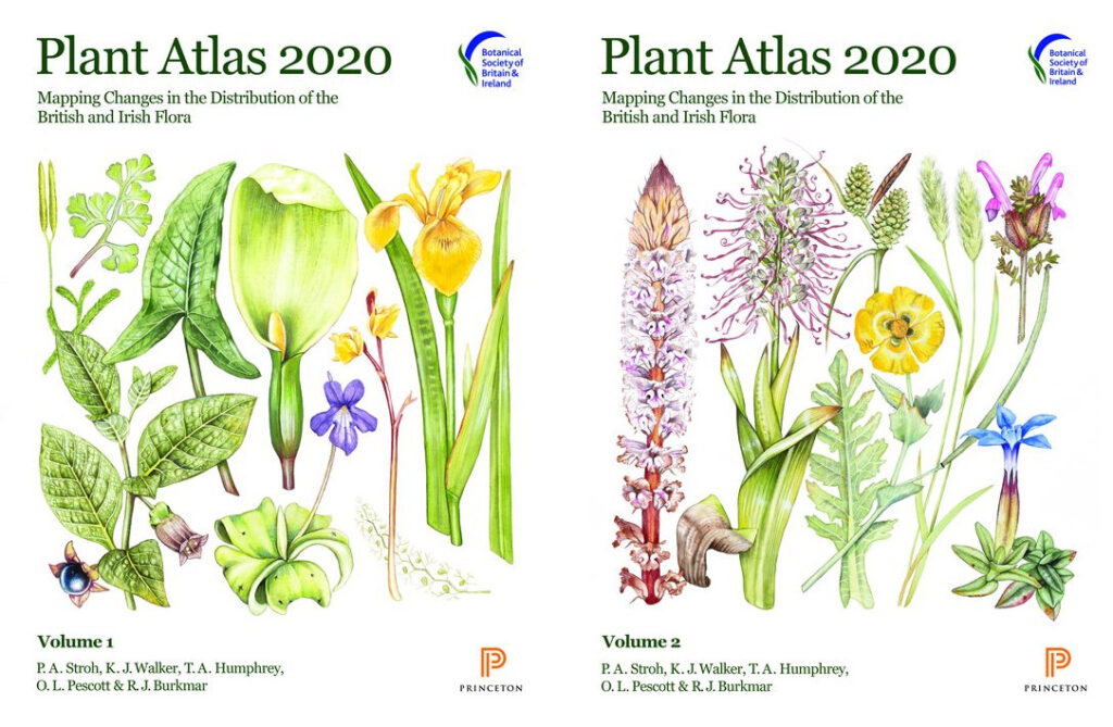
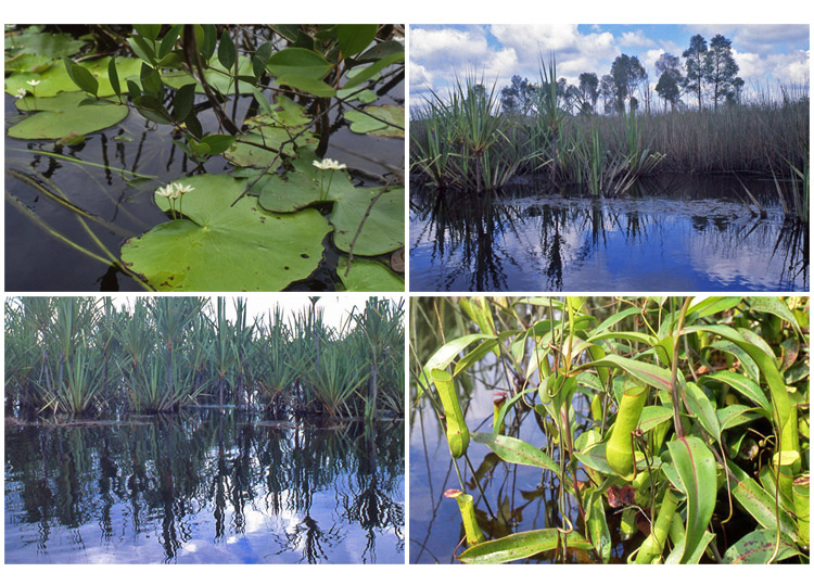
Each species is given a general description, then its altitudinal range, phenology (its sequence of development – vegetative, reproductive, seeding), time trend and a distribution map in 10 km squares over the country.

What of the changes? There’s been some gain – but the main conclusions are continued loss of plant biodiversity. For estimate of changes since the 1950s, plants are placed into one of three classes 

  • native species – of which  53% have declined;
  • archaeophytes, that have been here a few hundred years – of which 62% have declined;
  • neophytes or recent introductions – of which 58% have increased.

This summary is no surprise to those who have surveyed plants in managed ecosystems across the country. 

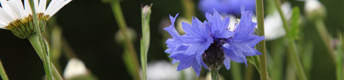
Why have natives and archaeophytes declined – loss of habitat, destruction or modification of habitat through intensified management, fertiliser application, pollution, erosion, run-off, drainage, and overgrazing; loss of small farms. Not all is bad – some species such as cornflower have increased in occurrence due to the sowing of wildflower seed mixes. But the overall position is that Britain continues to lose plant species and many of the losses are in arable and grass farmland.

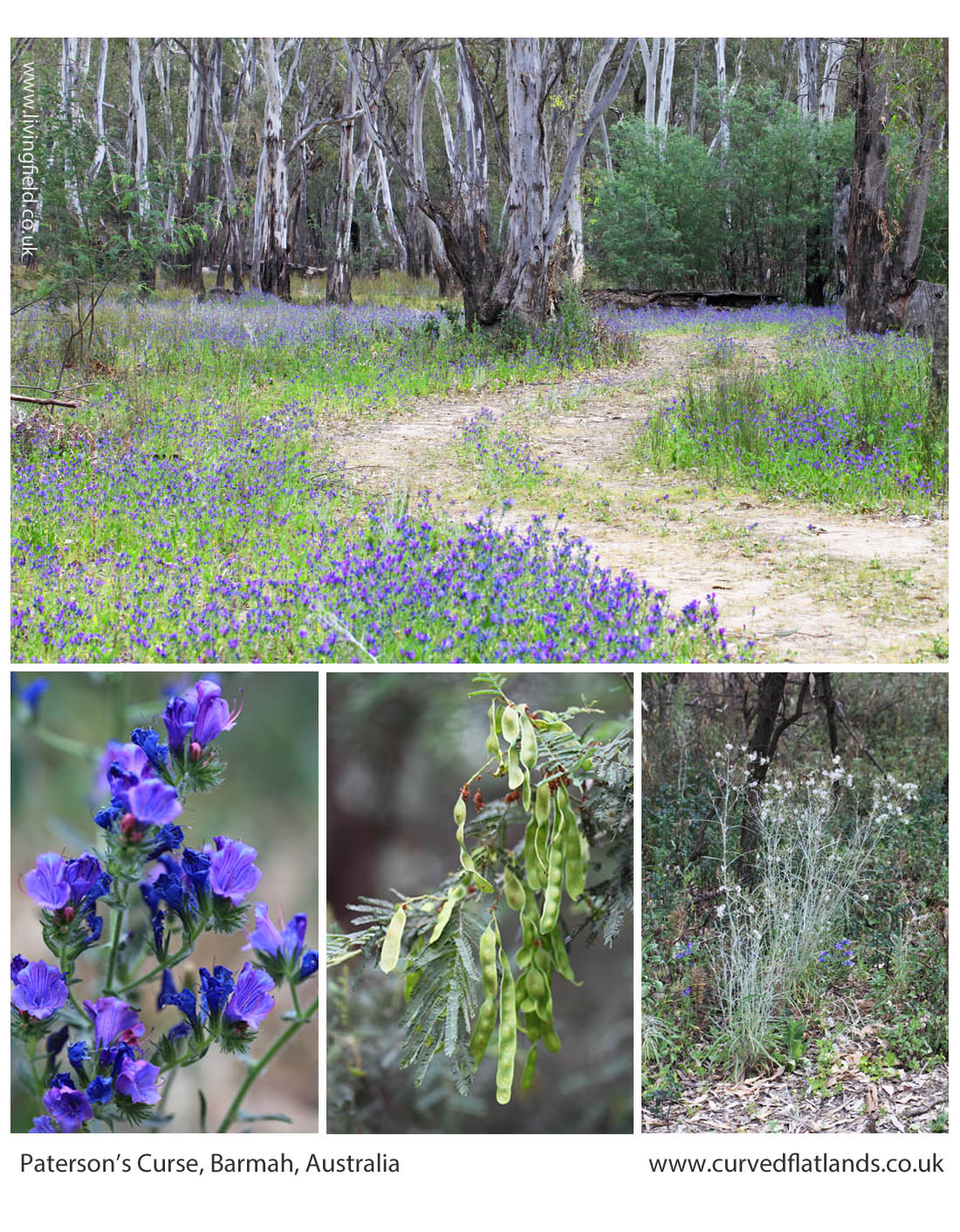
Some of the recent plant introductions are doing the opposite – taking advantage of disturbance. Sitka spruce is one – introduced as a forest plantation tree across the country but now spreading through self seeding. It’s all over the place – on the shores of pristine lochs, in marshland, moving over the moor. 

Climate is having an effect. ‘Winners’ are southern species that can take advantage of the warming. ‘Losers’ are montane species suffering due to reduced snow cover and dryness. 

What can be done? The online launch gave five key actions: 

  • Protect the best sites.
  • Allow more space for nature – reduce the pressure.
  • Ensure plants are taken account of in decisions on land use.
  • Continued research and monitoring
  • Raise the awareness of plants – encourage skills in identifying, understanding and managing.

And it’s true plants are generally overlooked by those who manage the countryside. One of the reasons for starting the Living Field project back in 2001 was to raise awareness of lowland plants and their many contributions  to ecosystem function and their uses to people through the ages. We’ll continue …. but the pressures against plant diversity are not waning. 

We can look back to the BSBI’s efforts before Plant Atlas 2020 …..

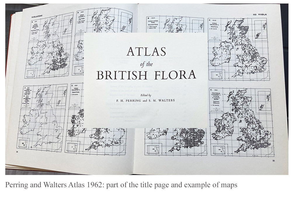
1962 Atlas by Perring and Walters

On joining SCRI, one of the two founder Institutes of the James Hutton, in the 1990s, I found that much of the work was based in crop breeding (potato, soft fruit and barley) and pests (viruses, fungi and  insects). Weeds as pests were given less emphasis and money, but arable plants other than crops were still mostly treated as pests. Nevertheless, the Atlas of the British Flora published by the BSBI in 1962, edited by FH Perring and SM Walters, was in the library, originally at the Scottish Plant Breeding Station, which was then at Pentlandfield, Midlothian, before it moved to become part of SCRI in Dundee. The book was bought in July 1962 and cost £3/10. The image above shows a part of the title superimposed on one of the pages showing the distribution maps for the species.

2002 New Atlas of the British and Irish Flora

Gradually during the 1990s the notion was debated that weeds, or as some of us would prefer ….. arable plants, had attributes that were positive for the farmed ecosystem, notably the provision of plant food for beneficial invertebrates such as detritus-feeders, beetles, spiders and pollinators.

In the late 1990s, the research grouping that was to become Agroecology at the James Hutton, began to win research contracts in vegetation dynamics, geneflow and ecological risk assessment. Over several years, the group sampled crops and wild plants in fields from the south coast of England to Ross and Cromarty In Scotland. 

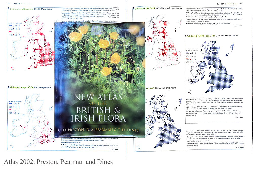
Fortunately for us, the revised version of the 1962 Atlas, named The New Atlas of the British and Irish Flora, edited by CD Preston, DA Pearman and TD Dines, was published in 2002. The cover – in our case very worn from much usage of the book – is shown on a page of maps for several species.

The pages chosen showed distributions of the hemp nettles, of the genus Galeopsis, that occurred widely within cropped fields in the east of Scotland at that time, causing little problem as a weed but providing a base for the invertebrate food web. 

Thanks

The making of these Flora takes a massive effort from the main editors and organisers but also the thousands of volunteer botanists who survey and identify the plants throughout the country. The Living Field has already used the online edition to answer questions from our correspondents. It’s a fantastic resource ….. there to use.

Links

The Botanical Society of British and Ireland (BSBI) web site – https://bsbi.org

BSBI Introductory page to Plant Atlas 2020 – https://bsbi.org/plant-atlas-2020

The 2022 Atlas accessible online – https://plantatlas2020.org

Summary Report of the 2020 Atlas.

Paterson’s Curse

We’d taken a stem back from the field to examine it. It looked close to Viper’s bugloss Echium vulgare, similar flowers and habit (images below), another species of Echium probably. It was growing profusely among what first looked like a field of oat, in Victoria, Australia. Then our  host, Mrs McPherson, who knew the plant well said ‘Paterson’s Curse‘ and it turned out to be one of the most noxious weeds.

Viper’s bugloss near the pond at the Institute’s Balruddery Farm, where it grows as a winter annual, germinating one year, overwintering and flowering the next.

The borage family, to which Viper’s Bugloss belongs, is hardly a weedy problem in the UK. In his book on arable weeds in Britain, written well before the intensification of agriculture after the 1950s, HC Long [1] lists viper’s bugloss, corn gromwell Lithospermum arvense, bugloss Anchusa arvensis and field forget-me-not Myosotis arvensis among the borage family weeds of the 1920s, but none were harmful. Today, only field forget-me-not is common in the arable seedbank [2] but is still not among the top ten troublesome cornfield weeds.

But in Australia …..

In pasture and arable

Paterson’s Curse Echium plantagineum  remains a major invasive species and noxious weed of arable land in southern Australia, notably Victoria and New South Wales. It was not always there. It is from Mediterranean Europe and north Africa, but sometimes cultivated elsewhere as a garden plant for its blue flowers, for which it was taken to Australia.  Then it spread uncontrollably [3].

Here it is in the photographs below, growing in what is most likely a field of ryegrass, along with probably oats that self-seeded after a previous crop. Paterson’s Curse is the blue-purple haze, growing in irregular lines and patches.

The plant is taken very seriously in south Australia as a weed of pasture and arable land. It competes for light, water and nutrient with crops and pasture plants, but is also a poison to some farm animals.  It is a ‘declared plant’ listed in the Biosecurity and Agriculture Management Act 2007, and it is an offence to spread or transport it. Full descriptions are given, by national and state agriculture departments [3], including various means of biological control using invertebrates (e.g. insects).

It’s not all bad, however. Another of its common names, Salvation Jane, hints that it can assist in times of hardship, forming a constituent of pasture or hay that some stock animals can feed on, especially in dry seasons.

In flooded river red gum forest

The plant was also seen growing under the trees in a River Red Gum forest by the Murray River [4]. It was profuse, lining dirt tracks, but also spreading out underneath the shrub layer. There were other weeds with it, notably some of the composite, legume and nightshade families.

Paterson’s Curse lining tracks through river red gum and (lower) a flowering branch and two other understorey plants.

Away from the tracks and under the denser canopies, it was less common, but still the occasional plant was flowering and seeding.

Two years earlier, in the same month, there was no Paterson’s Curse to be seen here. Which raises questions as to how it became so abundant in 2017. Was it in the seedbank but did not germinate two years ago? If the seed was newly arrived in the area, how did it get there in such numbers?

There were extensive floods recently, and it may be that the seed was brought down the river or else the floodwater covered nearby agricultural fields and picked up seed as it receded, depositing seeds in the forest near the river. There are many potential means by which the plants could have spread.

Paterson’s Curse is a classic and costly example of a plant species that is barely an inconvenience in its native home, but finds spectacular opportunity in new territory. A bit like the rabbit and the fox. It’s no wonder Australia is cautious about its biological quarantine.

Do we have weeds as bad as this?

Britain certainly had its share of damaging weeds. Long [1] refers to the Corn Production Acts of the 1920s in which injurious weeds were named, and instructions given that they should be controlled, and if they were not, the landowner could be fined. He cites the counties of Surrey, Kent and Lancashire as having ‘shown very great energy in the matter’ of enforcing the Acts and bringing prosecutions.

The named weeds were ragwort, spear  thistle, creeping thistle, curled dock and broad-leaved dock.  Thirty years later the same weeds were still causing trouble and were named in the 1950s weed acts.

That was before chemical pesticides were routinely used and today the only one of them still spreading out of control is ragwort [5]. But interestingly, ragwort is spreading not in managed agricultural land but along main roads, motorways and roundabouts, and also into rough pasture and along some minor roads leading into wild land. The 1950s weed act still applies, so complaints can still be made about landowners encouraging ragwort to persist and spread  [5].

Today, in Britain, and ragwort excepted, most botanical invasions are outside tilled agriculture and by perennial plants such as rhododendron and himalayan balsam (but that’s another story).

Sources, links

[1] Long, HC. 1929. Weeds of arable land. London: HMSO. Ed: Long wrote his book on arable weeds well before chemical control became the norm after the 1960s in the UK. His account is an essential guide to weeds and their management, mostly by cultivation and choice of crop, in the period before intensification of arable land between 1950 and 1990.

[2] The seeds dropped by plants and buried in the soil form what is called a seedbank. Depending on the species, the seeds can survive for many years and then germinate when they are brought to the surface and conditions are right for them. The seedbank is important for survival is vegetation that suffers periodic destruction – such as burnt grassland or forest and land disturbed for agriculture. If no opportunities arise for germination, the seeds eventually die and the plant can be locally extinct. Most of the borage plant family in Britain can form a seedbank, but conditions in tilled fields have not been favourable to them and with few exceptions, they are rare in farmland.

[3] History, invasiveness, effects as a weed and poison, control and some stunning photographs of Paterson’s Curse’s ability to spread and cover, are available at the following web links: Agriculture Victoria; New South Wales NSW WeedWiseGovt of Austalia Dept Primary Industries and Regional Developmen.

[4] Barmah National Park protects a river red gum forest Eucalyptus camaldulensis by the Murray River in Victoria, Australia. Information at Parks Victoria.

[5] More on Ragwort Senecio jacobaea at The lone ragwort: late bee-haven.

Contact: geoff.squire@hutton.ac.uk

[article in progress  ….

Blue feast

lf_noim_chi_ins_gs

Flower head of chicory (Cichorium intybus) with four insects, the small one perhaps grazing pollen, the others going for the rich centre and trampling the (male) pollen bearing anthers held bifurcating on thin blue-lined tubes and curling inwards like muscle-flexing stick-men

… on an organic farm, East Lothian, 15 August 2014 (Image by Squire).

White lily dark dye

The roots of the white water lily Nymphaea alba, extracted from the mud at the bottom of lakes, were once used to dye tweed ‘black, blue or dark brown’, and mixed with leaves to make a poultice (Scots Herbal).

White water lilly on a loch south of Inverness, taken 14 July 2014 (Squire)

Nymphaea alba is striking plant where it finds a place to expand in shallow lochs in open water between patches of reeds and sedges.  The plants in the photographs above were growing in water at least  one metre deep.  They began flowering in early July.  The small catchment that fed the loch had been mixed crops and grazing until the 1980s when it was turned to sheep grazing and sitka plantation. Apart from atmospheric deposition, the only pollutants were from animal dung and the annual sheep dip. Entry and outflow streams are crystal clear.

The metallic sky and water on this day recalled images of Tasek Bera (or Berak ) an inland expanse of water and swamp in Malaysia. Travel was by dugout and accommodation a small tent by the water’s edge: swimming in the dark water, paddling dugouts and exploring pandans,  pitcher plants and white water lilies. At that time, a  system in balance and now a Ramsar wetland site.

Images of Tasek Bera, Malaysia, scanned from 35 mm colour slides taken 1984 (Squire)

The photographs above taken on a visit in 1984  show (top left clockwise) water lilly, a view to the land surrounding the lake, pitcher plants and pandanus growing in the water, plant species uncertain.

More to follow on Tasek Bera.

Geoff Squire

References

Darwin T. 1996. The Scot’s herbal. Mercat Press, new edition 2008 by Berlinn.

Wetlands International web site for Tasek Bera – for information on the lake, plants and people, click the ‘Library’ tag on the site and next to ‘Current publications’ search for Tasek Bera to browse several sources including downloads.