Mapping the future: land use | climate | food

A Project by SEDA Land and the Huntly Community.

This project – Mapping Land Use, Climate Change and Food – has developed over the last couple of years from an idea into funded reality and now SEDA Land is looking for volunteers to help organise events around Huntly.

AIMS

The Project will work with the community of Huntly [1], Aberdeenshire, to investigate the impact of climate change and alternative food systems on the local area.

SEDA Land writes: “We will investigate the long-term effects of land-use decisions on climate change and the food chain using a variety of tools over the next three years. This will be a collaboration between the community, artists, scientists and local landowners. We will also involve innovative food producers and farmers.”

All the tools proposed in this project are aimed to help the community understand and visualise a possible alternative and productive ecological landscape that serves the climate, the community and which could lead to innovative new forms of employment in the area.

This proposal addresses three of the recommendations from SEDA’s
“A New Vision for Land Use in Scotland 6 Conversations” published in partnership with the SRUC and the James Hutton Institute in August 2021, in particular the healthy food strategy [2].

SEDA Land is part of the Scottish Ecological Design Association (SEDA).

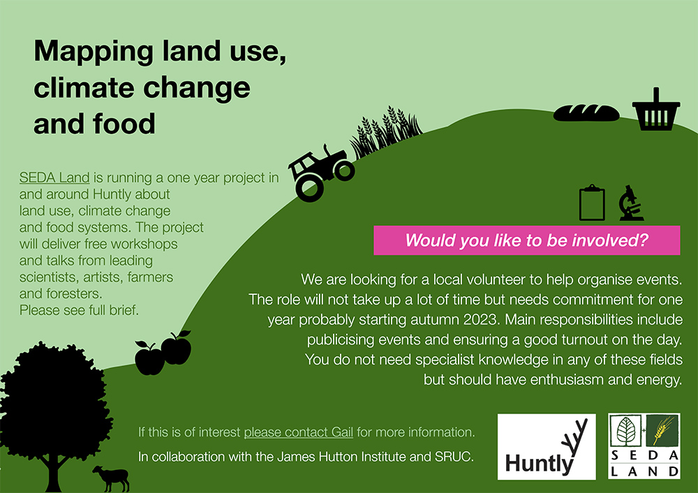
Advertisement for the Land Mapping project

Why Huntly?

Huntly was chosen because it is a good example of a mid-sized (population of 4,460) highland town, where surrounding farmland is predominantly used for grazing. We will be seeking to dispel the stereotypical view of the Highlands as sheep-grazed uplands, and explore the potential for alternative land uses – introducing the local community and local farmers to the scope for growing food on slopes; seasonal food; foraged food and indoor-grown food. We will also demonstrate that alternative farming brings increased biodiversity, carbon storage and other benefits.

SEDA Land already has strong connections with Huntly Development Trust, The Deveron Project (a local arts group) and The Gordon Schools (local primary and secondary schools). The development trust owns 63 acres of community land at Greenmyres, five miles southwest of the town. This should permit any residents who are inspired by our project to start using the land in a regenerative way for themselves. We have also established links with Beldorney Estate where we are able to run workshops and the arts projects.

“I think it is really helpful to use art to get past the usual narratives in which there is a designated ‘bad actor’ – a ‘villain’ to protest against. I think art can be great at showing our common humanity and showing that the ‘villain’ is not a person or group of people, but certain aspects of human nature, and of course, climate change itself”.

Sophie Cooke, artist

Toolbox

These tools are intended to engage people in new ways of thinking about the land, climate change and their food systems.

An interactive computer game – the digital game is being developed by students at Abertay University in Dundee to highlight the complex interrelatedness of climate change, biodiversity, land use and food sourcing . Primarily aimed at 13-45-year-olds, the game will require players to balance the uses and products of land to the best advantage of the community and the planet, measured in outcomes such as carbon capture, food sovereignty and health and well-being. We believe it is easier for people to visualise the palimpsest of issues involved if these can be presented graphically and innovatively.

Biophysical data collection – The community will seek to define its present and future needs with the help of scientists and artists, addressing issues such as resilience and a “just transition”. Data will be collated about land use and food sourcing both locally and globally – covering soil health, vegetation and climate. New information will be gathered about local food sources and waste management.

Field workshops – Professionals (soil scientists, regenerative farming experts, forestry experts, food entrepreneurs etc) will run workshops with the Huntly community, local farmers, foresters and landowners to develop/complement the ecological themes above. Artists will use creativity and storytelling to communicate ideas between the various stakeholder groups.

Artistic pieces – Two community projects are planned to be run by a visual artist and a poet to produce works of art in the landscape around Huntly relating to the aims of the project and using material from the workshops.

Mapping

We intend to use maps of all types to make it easier for people to visualise what effect climate change is expected to have on their local area – including in scenarios such as if there is no change to the current farming practices and in the event of bold and imaginative alternatives being adopted. These will include maps showing existing soil types, water, climate etc. along with maps drawn up with the community using local knowledge and drone footage.

Examples of maps and mapping are given on the Living Field editor’s curvedflatlands web pages [3].
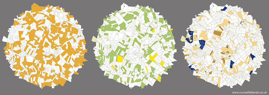
Mapping land use: an area (not Huntly) divided into fields and other land parcels by usage – grass for livestock (left), arable crops such as barley and wheat (centre), and the remaining agriculture and  woodland (right). Data from the James Hutton Institute. Original on curvedflatlands web [3].

The above text and image, apart from the maps, are extracted from the full project description available available as a PDF file [4].

For further info or if you want to be involved, contact Gail Halvorsen by email: land@seda.uk.net.

Sources | links

[1] Among organisations and people involved: Huntly Development Trust and Deveron Projects.

[2] SEDA Land is a part of the Scottish Ecological Design Association. The 2021 report is available as A New Vision for Land Use in Scotland – 6 Conversations downloadable from Past events and reports.

[3] On the curvedflatlands web at Community Mapping – food climate

[4] The following PDF file contains a description of the project, including those contributing.

BSBI Plant Atlas 2020

Mapping changes in the distribution of the British and Irish Flora.

Published by the Botanical Society of Britain and Ireland (BSBI) in 2023

Notes from the Online launch 9 March 2023. Web: plantatlas2020.org

Those of us involved in field survey have long valued the plant atlas produced by the Botanical Society of Britain and Ireland (BSBI). The two previous publications, in 1962 and 2002, have been invaluable, and so will the latest version published earlier this year – Plant Atlas 2020.

It took 20 years of field recording and three years of analysis. Thousands of botanists did the surveys, often under the guidance of the county recorders who know their area intimately. In all, they assembled 30 million records, of 3495 species. 

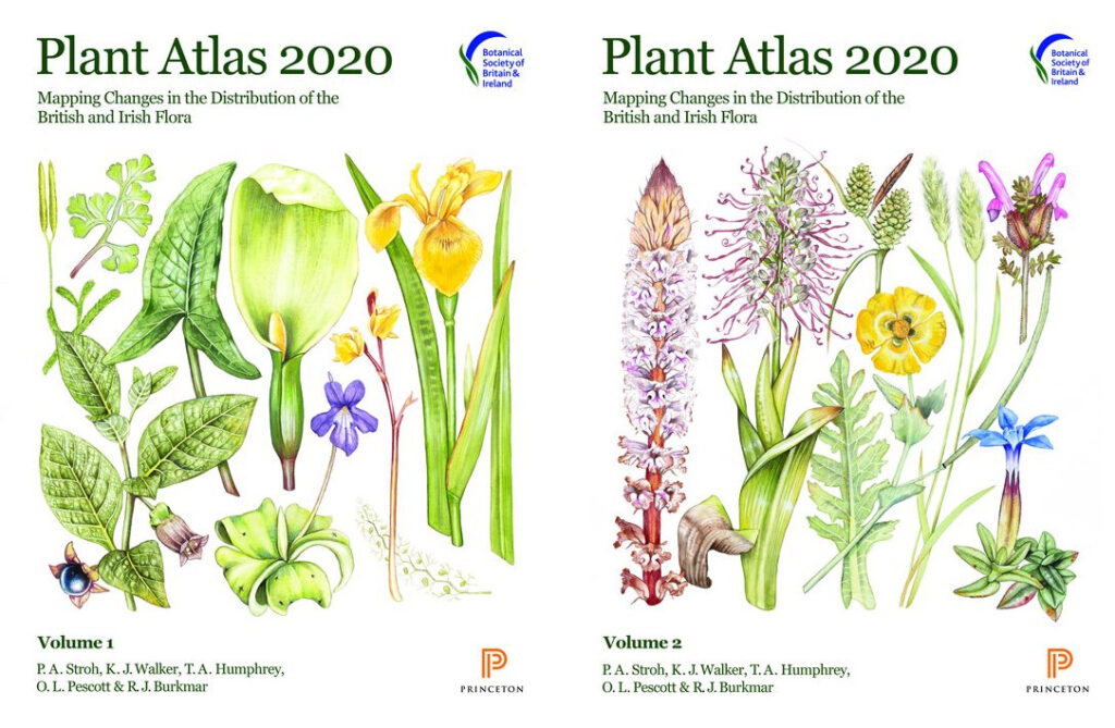
Covers of the two volumes of Plant Atlas 2020, accessible online and available to buy as hard copy.

Each species is given a general description, then its altitudinal range, phenology (its sequence of development – vegetative, reproductive, seeding), time trend and a distribution map in 10 km squares over the country.

What of the changes? There’s been some gain – but the main conclusions are continued loss of plant biodiversity. For estimate of changes since the 1950s, plants are placed into one of three classes 

  • native species – of which  53% have declined;
  • archaeophytes, that have been here a few hundred years – of which 62% have declined;
  • neophytes or recent introductions – of which 58% have increased.

This summary is no surprise to those who have surveyed plants in managed ecosystems across the country. 

Why have natives and archaeophytes declined – loss of habitat, destruction or modification of habitat through intensified management, fertiliser application, pollution, erosion, run-off, drainage, and overgrazing; loss of small farms. Not all is bad – some species such as cornflower have increased in occurrence due to the sowing of wildflower seed mixes. But the overall position is that Britain continues to lose plant species and many of the losses are in arable and grass farmland.

Some of the recent plant introductions are doing the opposite – taking advantage of disturbance. Sitka spruce is one – introduced as a forest plantation tree across the country but now spreading through self seeding. It’s all over the place – on the shores of pristine lochs, in marshland, moving over the moor. 

Climate is having an effect. ‘Winners’ are southern species that can take advantage of the warming. ‘Losers’ are montane species suffering due to reduced snow cover and dryness. 

What can be done? The online launch gave five key actions: 

  • Protect the best sites.
  • Allow more space for nature – reduce the pressure.
  • Ensure plants are taken account of in decisions on land use.
  • Continued research and monitoring
  • Raise the awareness of plants – encourage skills in identifying, understanding and managing.

And it’s true plants are generally overlooked by those who manage the countryside. One of the reasons for starting the Living Field project back in 2001 was to raise awareness of lowland plants and their many contributions  to ecosystem function and their uses to people through the ages. We’ll continue …. but the pressures against plant diversity are not waning. 

We can look back to the BSBI’s efforts before Plant Atlas 2020 …..

1962 Atlas by Perring and Walters

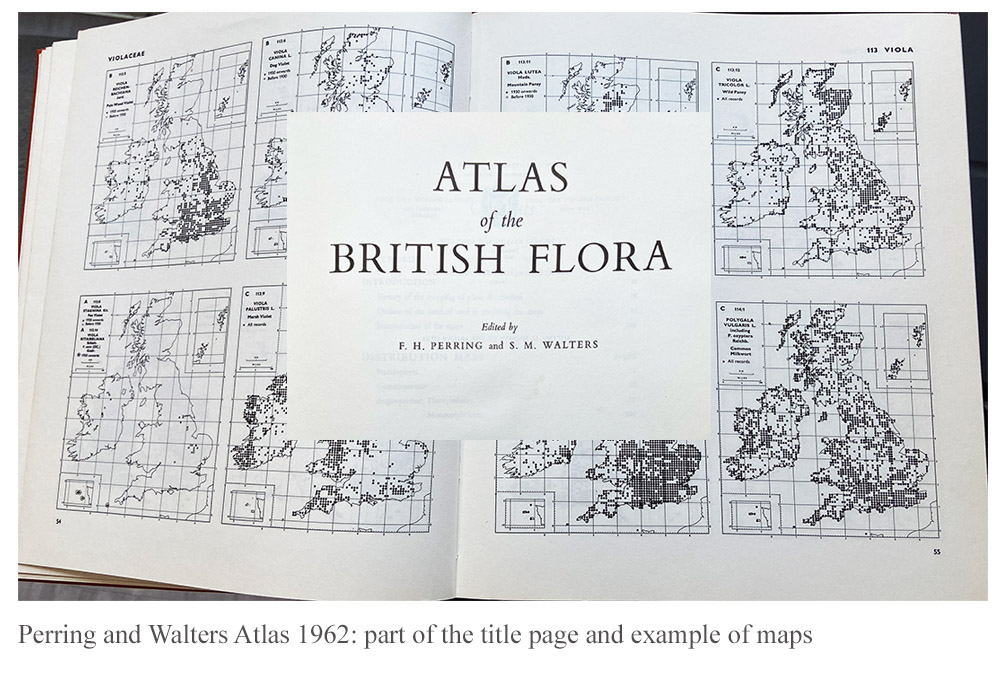
On joining SCRI, one of the two founder Institutes of the James Hutton, in the 1990s, I found that much of the work was based in crop breeding (potato, soft fruit and barley) and pests (viruses, fungi and  insects). Weeds as pests were given less emphasis and money, but arable plants other than crops were still mostly treated as pests. Nevertheless, the Atlas of the British Flora published by the BSBI in 1962, edited by FH Perring and SM Walters, was in the library, originally at the Scottish Plant Breeding Station, which was then at Pentlandfield, Midlothian, before it moved to become part of SCRI in Dundee. The book was bought in July 1962 and cost £3/10. The image above shows a part of the title superimposed on one of the pages showing the distribution maps for the species.

2002 New Atlas of the British and Irish Flora

Gradually during the 1990s the notion was debated that weeds, or as some of us would prefer ….. arable plants, had attributes that were positive for the farmed ecosystem, notably the provision of plant food for beneficial invertebrates such as detritus-feeders, beetles, spiders and pollinators.

In the late 1990s, the research grouping that was to become Agroecology at the James Hutton, began to win research contracts in vegetation dynamics, geneflow and ecological risk assessment. Over several years, the group sampled crops and wild plants in fields from the south coast of England to Ross and Cromarty In Scotland. 

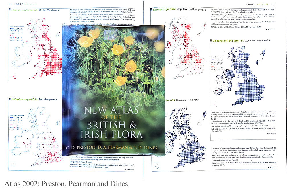
Fortunately for us, the revised version of the 1962 Atlas, named The New Atlas of the British and Irish Flora, edited by CD Preston, DA Pearman and TD Dines, was published in 2002. The cover – in our case very worn from much usage of the book – is shown on a page of maps for several species.

The pages chosen showed distributions of the hemp nettles, of the genus Galeopsis, that occurred widely within cropped fields in the east of Scotland at that time, causing little problem as a weed but providing a base for the invertebrate food web. 

Thanks

The making of these Flora takes a massive effort from the main editors and organisers but also the thousands of volunteer botanists who survey and identify the plants throughout the country. The Living Field has already used the online edition to answer questions from our correspondents. It’s a fantastic resource ….. there to use.

Links

The Botanical Society of British and Ireland (BSBI) web site – https://bsbi.org

BSBI Introductory page to Plant Atlas 2020 – https://bsbi.org/plant-atlas-2020

The 2022 Atlas accessible online – https://plantatlas2020.org

Summary Report of the 2020 Atlas.