Two events are coming up in September 2025 aimed at young people who want to know more about green careers, make contacts in land and food and learn new skills.
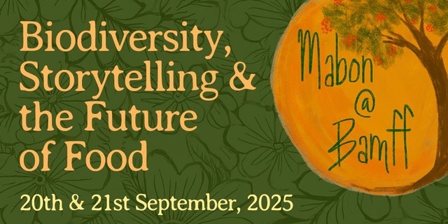
Mabon @ Bamff | 20-21 September | PerthSHire
Mabon is the follow on event to the highly successful Beltane held in 2023.
When: 21 and 21 September 2025 (Sat/Sun). Where: Bamff Estate, Perthshire, a few km NW of Alyth, Strathmore. Who: event run by Rosanna Harvey-Crawford (SEDA Land) aimed at young people (18-40)
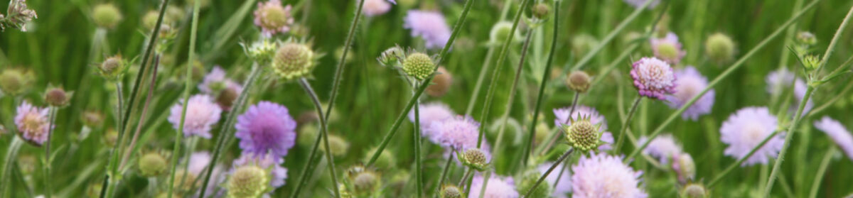
“Do you work in sustainability, conservation, or food systems? Are you interested in learning new skills and connecting with like-minded folks? Join SEDA Land on 20-21 September for an event focused on biodiversity, storytelling and the future of food, held at the beautiful Bamff estate in Perthshire – the site of an ongoing rewilding project.
Mabon @ Bamff includes workshops on tree seed saving, dry stone walling, storytelling, and ecological surveying. You can go on a guided walk of the estate and (hopefully!) see beavers. On Sunday, there will be a panel discussion on the future of food, featuring inspiring speakers working on different aspects of food system transformation. This is a chance to learn, be creative, enjoy being out in nature and feel inspired.“
A careers fair will be run by the Scottish Ecological Design Association (SEDA) at Glasgow University Union on 24 September 2025. Gail Halvorsen from SEDA writes:
“This is shaping up to be a very different careers fair from usual, showcasing both innovative and traditional opportunities in areas including renewable energy, regenerative farming, bioproducts manufacturing, green health and environmental law. It will showcase small and medium-sized enterprises to highlight the full range of green jobs available to graduates. Only people or firms run along ecological lines will be invited.”
SEDA is looking to hear from people who would like to contribute to the fair, for example representing a green industries sector.
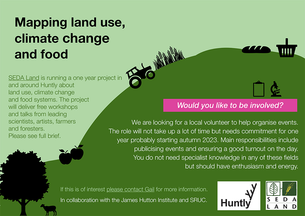
This project – Mapping Land Use, Climate Change and Food – has developed over the last couple of years from an idea into funded reality and now SEDA Land is looking for volunteers to help organise events around Huntly.
AIMS
The Project will work with the community of Huntly [1], Aberdeenshire, to investigate the impact of climate change and alternative food systems on the local area.
SEDA Land writes: “We will investigate the long-term effects of land-use decisions on climate change and the food chain using a variety of tools over the next three years. This will be a collaboration between the community, artists, scientists and local landowners. We will also involve innovative food producers and farmers.”
All the tools proposed in this project are aimed to help the community understand and visualise a possible alternative and productive ecological landscape that serves the climate, the community and which could lead to innovative new forms of employment in the area.
This proposal addresses three of the recommendations from SEDA’s “A New Vision for Land Use in Scotland 6 Conversations” published in partnership with the SRUC and the James Hutton Institute in August 2021, in particular the healthy food strategy [2].
SEDA Land is part of the Scottish Ecological Design Association (SEDA).
Advertisement for the Land Mapping project
Why Huntly?
Huntly was chosen because it is a good example of a mid-sized (population of 4,460) highland town, where surrounding farmland is predominantly used for grazing. We will be seeking to dispel the stereotypical view of the Highlands as sheep-grazed uplands, and explore the potential for alternative land uses – introducing the local community and local farmers to the scope for growing food on slopes; seasonal food; foraged food and indoor-grown food. We will also demonstrate that alternative farming brings increased biodiversity, carbon storage and other benefits.
SEDA Land already has strong connections with Huntly Development Trust, The Deveron Project (a local arts group) and The Gordon Schools (local primary and secondary schools). The development trust owns 63 acres of community land at Greenmyres, five miles southwest of the town. This should permit any residents who are inspired by our project to start using the land in a regenerative way for themselves. We have also established links with Beldorney Estate where we are able to run workshops and the arts projects.
“I think it is really helpful to use art to get past the usual narratives in which there is a designated ‘bad actor’ – a ‘villain’ to protest against. I think art can be great at showing our common humanity and showing that the ‘villain’ is not a person or group of people, but certain aspects of human nature, and of course, climate change itself”.
Sophie Cooke, artist
Toolbox
These tools are intended to engage people in new ways of thinking about the land, climate change and their food systems.
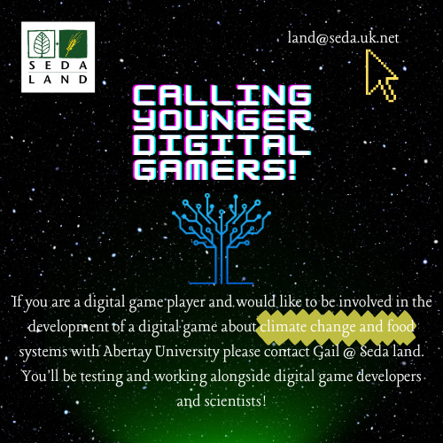
An interactive computer game – the digital game is being developed by students at Abertay University in Dundee to highlight the complex interrelatedness of climate change, biodiversity, land use and food sourcing . Primarily aimed at 13-45-year-olds, the game will require players to balance the uses and products of land to the best advantage of the community and the planet, measured in outcomes such as carbon capture, food sovereignty and health and well-being. We believe it is easier for people to visualise the palimpsest of issues involved if these can be presented graphically and innovatively.
Biophysical data collection – The community will seek to define its present and future needs with the help of scientists and artists, addressing issues such as resilience and a “just transition”. Data will be collated about land use and food sourcing both locally and globally – covering soil health, vegetation and climate. New information will be gathered about local food sources and waste management.
Field workshops – Professionals (soil scientists, regenerative farming experts, forestry experts, food entrepreneurs etc) will run workshops with the Huntly community, local farmers, foresters and landowners to develop/complement the ecological themes above. Artists will use creativity and storytelling to communicate ideas between the various stakeholder groups.
Artistic pieces – Two community projects are planned to be run by a visual artist and a poet to produce works of art in the landscape around Huntly relating to the aims of the project and using material from the workshops.
Mapping
We intend to use maps of all types to make it easier for people to visualise what effect climate change is expected to have on their local area – including in scenarios such as if there is no change to the current farming practices and in the event of bold and imaginative alternatives being adopted. These will include maps showing existing soil types, water, climate etc. along with maps drawn up with the community using local knowledge and drone footage.
Examples of maps and mapping are given on the Living Field editor’s curvedflatlands web pages [3].
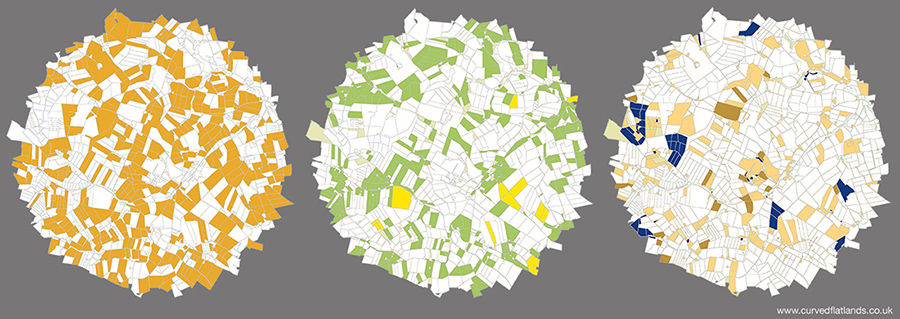
Mapping land use: an area (not Huntly) divided into fields and other land parcels by usage – grass for livestock (left), arable crops such as barley and wheat (centre), and the remaining agriculture and woodland (right). Data from the James Hutton Institute. Original on curvedflatlands web [3].
The above text and image, apart from the maps, are extracted from the full project description available available as a PDF file [4].
For further info or if you want to be involved, contact Gail Halvorsen by email: land@seda.uk.net.
Recently, SEDA Land [1] published its Land Resources pages for all to see and use. They can be found on the SEDA Land web site at https://www.seda.uk.net/seda-land-home-page
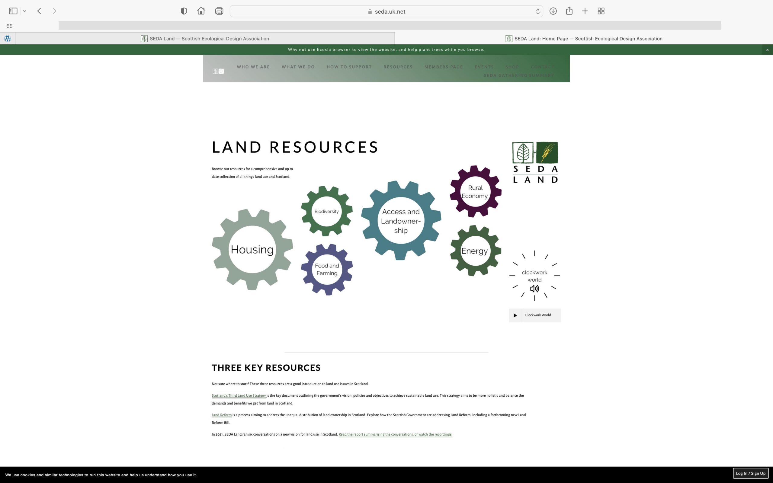
This is a brief introduction to the pages and why they are needed. They were constructed earlier in the year and went online in December 2022 [2]. You can see what the Intro page looks like from the screenshot below.
Land Resources page on the SEDA Land web site
They are designed as a repository and source of information on land-related matters in Scotland. They will be updated as new information becomes available.
Six Cogs
The topic areas are written in the middle of the SIX cogs in the image below – Housing, Biodiversity, Food and Farming, Access and Landownership, Rural Economy and Energy. Most likely the structure is not static but will evolve – funding permitted.
Hidden data
One of the great difficulties facing researchers and investigators who do not belong to an organisation such as university or research institute is that most of the scientific papers produced in the world are not easily accessible.
Universities and Institutes pay large subscriptions each year to the major publishers of science and technology. This sub allows access by their employees to published papers, reports and journals. Others can only get access by paying a fee per paper and if you want to look at tens or hundreds of papers, it mounts up to sums most can’t afford.
It’s not easy therefore for members of the public or researchers working independently to keep up with what’s happening.
But it’s not all hidden. There’s an increasing desire by science to publish open-access papers, where a fee is paid by the researchers on publication and the paper then becomes accessible to anyone. There is also a growing bank of summaries, policy papers and major scientific and technical reports that are available to the web free of charge. The UN and EC organisations for example have been very good at this open-source provision, but so have many organsations in Scotland. In fact, many of the links to reports and data on the Living Field site are to this global bank of open data.
But what’s there to get?
Anyone wanting to research a topic is faced with knowing where to begin. There is so much information and data out there that the problem now is knowing what is open-access and what is best for a first read. There is also misinformation. Some guidance may be needed therefore – pointers to sources that are independent, critical and whose work can be challenged and verified. This is where SEDA Land’s Resources web pages will contribute.
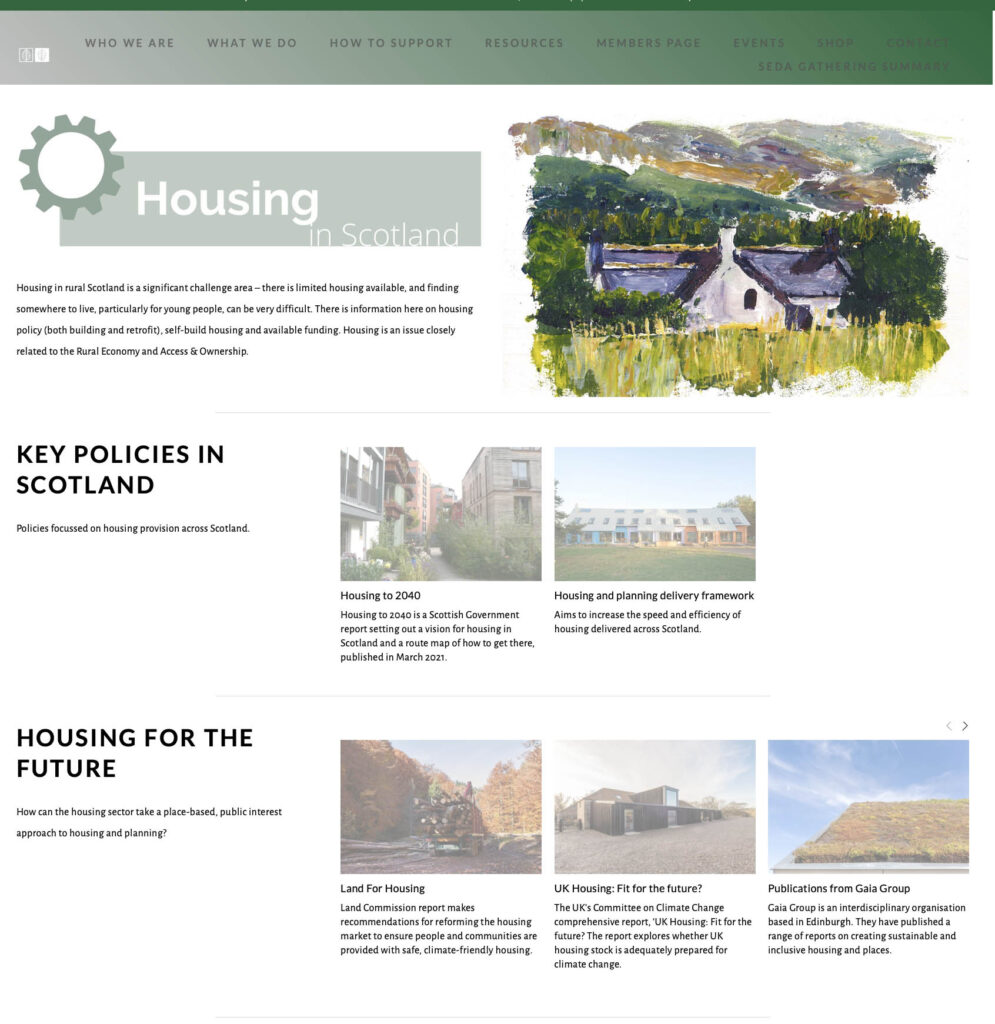
Click the Housing cog on the SEDA resources web and move to this page. It begins with a brief description, Key Policies and some ideas for the Future. Click the image to go to the web site.
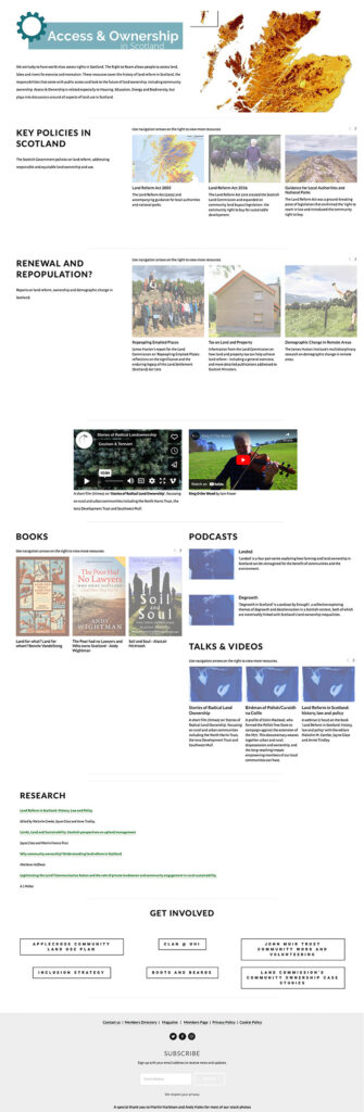
On the SEDA Land web site, clicking a cog leads to a separate web page for that topic. The pages give links to relevant open-access documents and also display artwork, music and poetry. The image above shows the upper part of the page on Housing, that below, the whole page on Access and Ownership.
Page on Access and Ownership at SEDA Land’s Resources web. Click the image to go to the web site.
SEDA Land say this is just the beginning.
Links
[1] SEDA Land is part of the Scottish Ecological Design Association. More on the Living field web at: Land Conversations 2021.
[2] The SEDA Land Resources web pages were constructed by Eleanor Fraser and Rosanna Harvey-Crawford with funding from Patrick and Linda Flockhart.
The Living Field Editor’s curvedflatlands web analyses some of the issues raised in the Land Conversations: First Ideas, Land Conversations 2021, Matrix and decision tree, Carbon Tax. Thanks to the SEDA Land initiators for the invitation in 2020 to assist in scoping the Conversations.