Since its publication on these pages in 2017 the Vegetable Map of Scotland [1] has attracted much interest. There is a growing awareness of the benefits of local, nutritious food – especially if bought from short supply chains that use the least possible carbon.
People want to know where their food comes from, how much is imported and how much grown locally and whether the country can grow more of its food within or near its borders.
These questions are asked especially of vegetables, including pulses and potato, because they are (or should be) mostly eaten very fresh, such as leaf, or else, like carrot and swede, kept not too long on the shelf before being cooked.
With this background of interest, the Vegetable Map was constructed by researchers at the Institute as part of joint interests with Nourish Scotland [2]. The group interrogated EU databases provided by the Scottish Government [3] to locate the fields in which the various vegetables and soft fruits were grown.
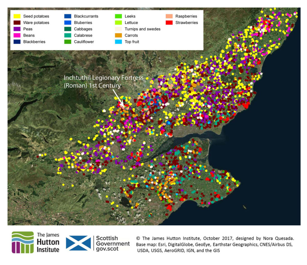
An example of part of the region is shown above. The Map remained available through this web site, then in late 2018, ideas began to form about making the map real – complete with vegetables – and it would be constructed in the Living Field garden [4].
Tayside’s neolithic?
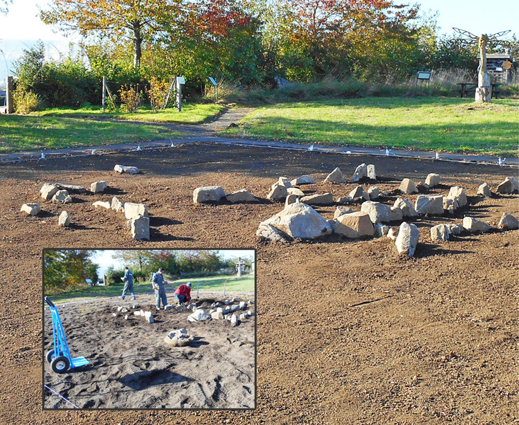
Time went by. Ground was weeded, cleared and cultivated – a rare barrenness in the otherwise plant-rich garden. Then gradually, over the winter, tectonic plates shifted.
People began to wonder about the strange earthworks dotted with rocks that appeared in the plot. Was the garden being visited at night by strange forces or was the Living Field community finally just losing it? Rumours were rife.
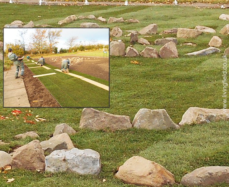
More time went by. Turf was laid in a great rectangle over the whole patch, but people were still unclear of what it was all for …. and what lay underneath.
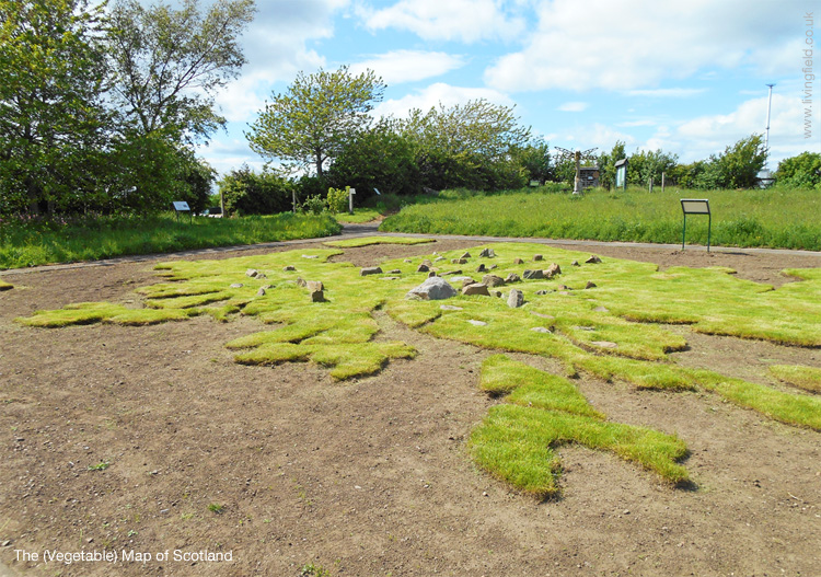
The turf rooted and formed a fine carpet. But what were the rocks? A ritual landscape? Tayside’s answer to the Ring of Brodgar?
Then one day in late spring 2019 an outline was traced and the turf was cut to reveal the unmistakable shape of ….. Scotland ….. its indented coast now clear and the land inside complete with hills and mountains.
All well so far ……. a map of the country covered in grass and rocks …… nothing new there. But then in May, holes were cut in the turf and plants put in the holes: and you’ll guess what plants – Yes, vegetables.
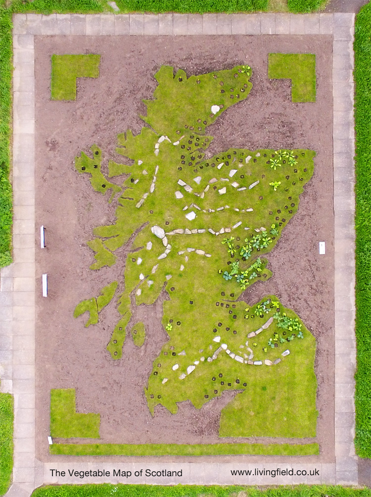
And that is where we are at the beginning of June 2019. The Farm’s drone was flown to photograph the Living Field garden from the air on 5 June. The image of the map appears below.
Different types of vegetable are being planted in the parts of the country where they are typically grown. It is possible to see the early plantings to the right of the image. The brown holes in the turf are where circles have been cut in readiness for later plantings. (The ‘corners’ and lower border are spare turf in case of need.)
Planting will continue well into the summer. There will be some surprises which we shall show later.
For now, you can read more about the history of vegetable growing at the original page [1]. photographs of the construction will follow – link to be provided. And there will be more articles on what can and can’t be grown in the soils and climates of our northern latitudes.
Living Field people will be on hand at Open Farm Sunday 9 June 2019 to explain more about the Vegetable Map of Scotland. See you there!
With apologies to the Outer Hebrides, Orkney and Shetland, presently missing from the map but to be included.
Sources, references, links
[1] The Vegetable Map of Scotland at Can we grow more vegetables? was constructed by Nora Quesada with Graham Begg and Geoff Squire.
[2] Nourish Scotland at nourishscotland.org and Peas please.
[3] The original digital map was produced during work on the distribution of crops as part of the Scottish Government’s Strategic Research Programme.
[4] Gladys Wright had the idea of constructing the Vegetable Map in the Living Field garden and was soon offered enthusiastic help by The Farm. Together, and with other coopted helpers they measured out the grid, made the mountains (like Titans), laid and cut the turf and raised and planted the plants. A great effort by the Living Field community!
[5] Further links to the map on this site: Living Field garden from the air and Veg posters from Open Farm Sunday.
Contact: gladys.wright@hutton.ac.uk, geoff.squire@hutton.ac.uk